2020s Maps of Jackson, Mississippi
Explore 16 historic maps of Jackson from the 2020s. These maps offer a rare glimpse into what life looked like during the 2020s — showing old roads, neighborhoods, homes, and landmarks that have changed or disappeared over time.
Whether you're researching your family's past, planning a metal detecting trip, or studying how Jackson's landscape evolved across the 2020s, these high-resolution maps are a powerful tool for exploring the history of this region.
- Focus on a specific era: All maps on this page are from the 2020s, giving you a focused view of this time period.
- See what’s changed: Compare century-old streets, trails, and buildings to today's modern landscape using overlays and satellite layers.
- Research with precision: Use these maps for genealogy, historical research, land use analysis, or educational projects.
- View, download, or print: Maps are fully viewable online in high resolution, and can be downloaded or printed for your own records.
Start exploring Jackson's history through authentic maps from the 2020s. This is your window into the past.
Jackson, MS maps
(16)- 2020 Map of Pocahontas, 2020 Print
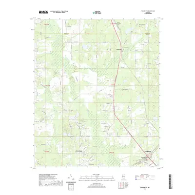 2020 Pocahontas2020 Print · USGSCovers Jackson, including Clinton, Green Crossing, and other nearby areas
 - 2020 Map of Clinton, 2020 Print
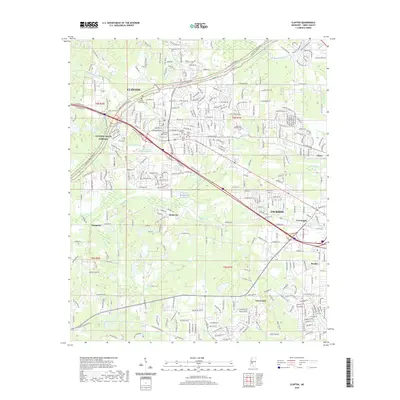 2020 Clinton2020 Print · USGSCovers Jackson, including Clinton, Shadow Lake Estates, and other nearby areas
 - 2020 Map of Jackson SE, 2020 Print
 2020 Jackson SE2020 Print · USGSCovers Jackson, including Pearl, Brandon, and other nearby areas
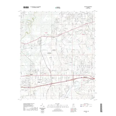
 - 2020 Map of Jackson, 2020 Print
 2020 Jackson2020 Print · USGSCovers Jackson, including Pearl, Flowood, and other nearby areas
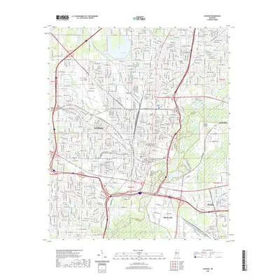
 - 2020 Map of New Byram, 2020 Print
 2020 New Byram2020 Print · USGSCovers Jackson, including Byram, Pine Grove, and other nearby areas
 - 2020 Map of Madison, 2020 Print
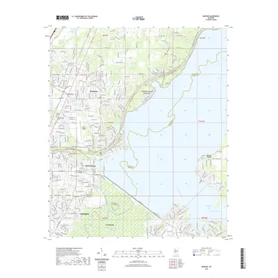 2020 Madison2020 Print · USGSCovers Jackson, including Madison, Ridgeland, and other nearby areas
 - 2020 Map of Florence, 2020 Print
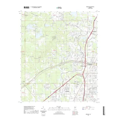
 2020 Florence2020 Print · USGSCovers Jackson, including Pearl, Byram, and other nearby areas
 - 2020 Map of Ridgeland, 2020 Print
 2020 Ridgeland2020 Print · USGSCovers Jackson, including Madison, Ridgeland, and other nearby areas
 - 2024 Map of Florence, 2024 Print
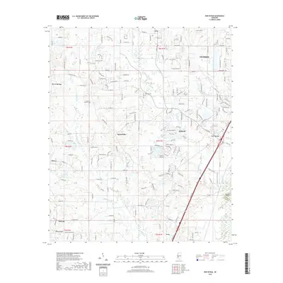
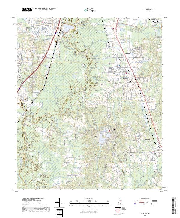 2024 Florence2024 Print · USGSThe Rankin County corridor south of the capital shows its contemporary growth and riverfront heritage in the early twenty-first century. Genealogists and local historians can locate several family burial grounds, including Cleary Cem and Florence Cem, or trace the winding Pearl River past Cooks Ferry and Stewarts Bluff.
 - 2024 Map of Ridgeland, 2024 Print
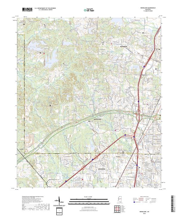 2024 Ridgeland2024 Print · USGSThe northern Jackson suburbs and the Ridgeland area are shown in detail during a period of significant modern expansion. Genealogists and local historians can trace legacy sites like Tougaloo College and numerous burial grounds including New Hope Grove Cem and Mount Olive Cem.
 - 2024 Map of Jackson, 2024 Print
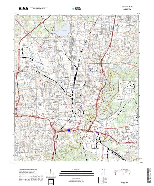 2024 Jackson2024 Print · USGSJackson and its surrounding riverfront communities are captured here in a period of modern urban complexity. Researchers can trace civil rights landmarks like the Medgar and Myrlie Evers Home National Monument and early crossing points such as Whites Ferry.
 - 2024 Map of Jackson SE, 2024 Print
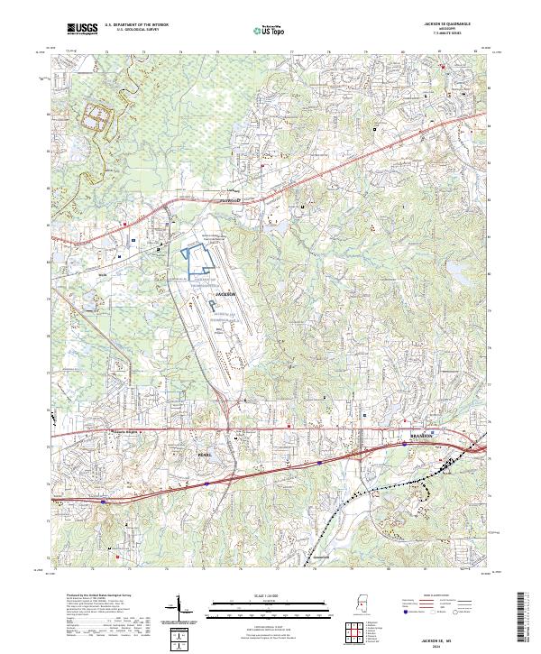 2024 Jackson SE2024 Print · USGSThe Rankin County corridor east of the state capital comes into focus in this recent survey. Local researchers can trace family roots through Pleasant Grove Cem or follow the suburban development surrounding Pearl and Brandon.
 - 2024 Map of Pocahontas, 2024 Print
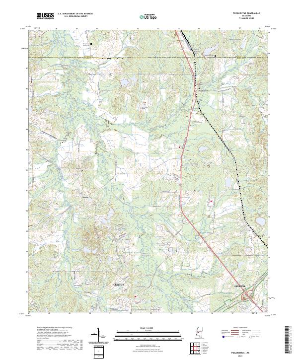 2024 Pocahontas2024 Print · USGSThe northern Hinds County countryside is captured here in the contemporary era, showing the growth of the Jackson metropolitan fringe. Genealogists and local historians can locate many family burial sites, such as Tinnin Cem and Cedar Grove Cem, or trace the path of Bogue Chitto Creek.
 - 2024 Map of Clinton, 2024 Print
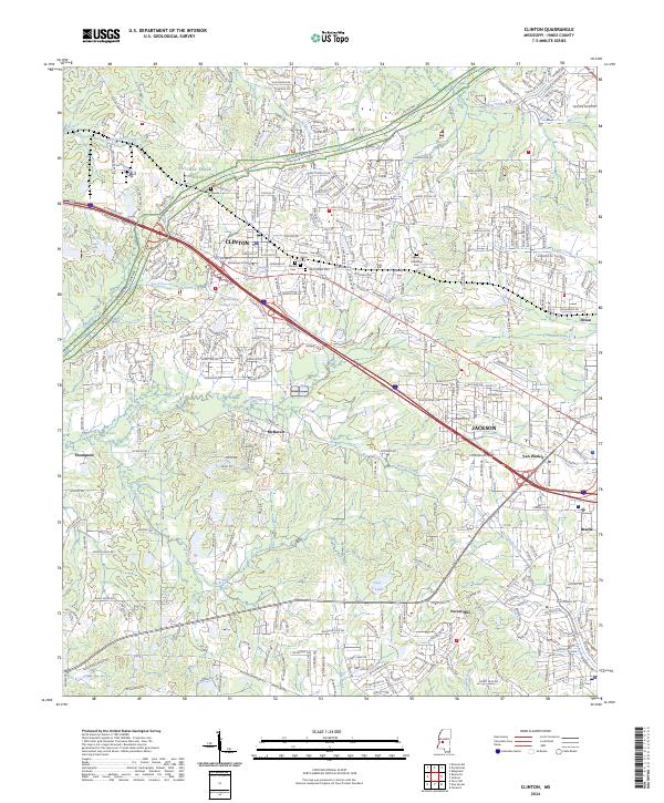 2024 Clinton2024 Print · USGSClinton and the western fringes of Jackson are shown here in the 2020s, documenting a landscape defined by collegiate history and expanding suburbs. Researchers can trace historic cemeteries such as Clinton Cem and Cowles Meade Cem or follow the route of the Natchez Trace Parkway.
 - 2024 Map of New Byram, 2024 Print
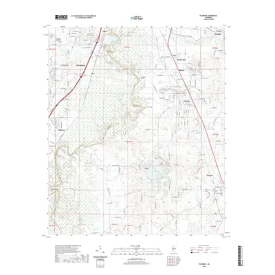
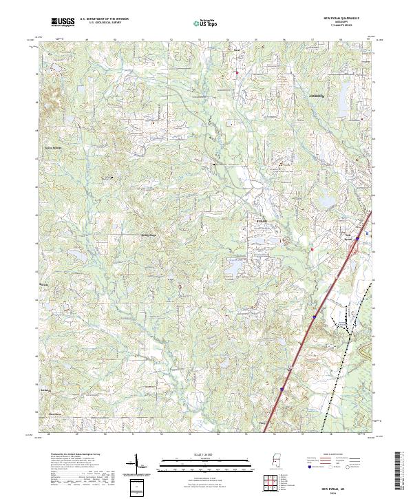 2024 New Byram2024 Print · USGSHinds County, south of the capital, shows significant modern growth and suburban expansion in this contemporary survey. Researchers can trace the evolution of old settlements like Spring Ridge and Siwel or locate family sites near Big Creek Cem.
 - 2024 Map of Madison, 2024 Print
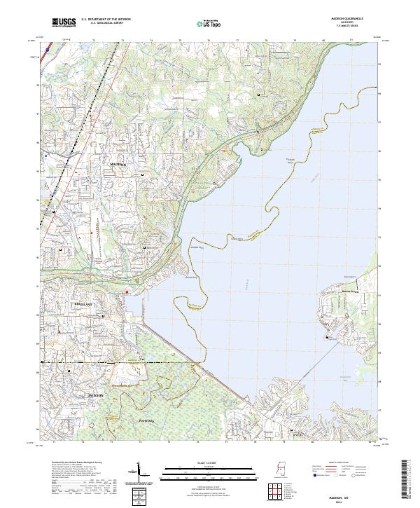 2024 Madison2024 Print · USGSMadison and Ridgeland sit at a crossroads of modern expansion and deep-rooted history along the Pearl River. Researchers can trace ancestral sites at Old Christian Union Cem or locate historical river crossings like Grants Ferry and Collins Ferry.
End of results
Showing maps 1-16 of 16
Top cities near Jackson
- Clinton historical maps
- Madison historical maps
- Pearl historical maps
- Brandon historical maps
- Ridgeland historical maps
- Byram historical maps
See more
Top neighborhoods of Jackson
- Rolling Meadows historical maps
- North Town Plaza historical maps
- Northpointe historical maps
- Hope Springs historical maps
- Lakeover historical maps
- North Colony historical maps
See more
Frequently asked questions
- What are the different types of historical maps available for Jackson?
- What is the oldest map of Jackson?
- Where can I purchase historical maps of Jackson for my home or office?
- Where can I download high-res historical maps of Jackson?
- Are there historical topographic maps available for Jackson?
- Is there historical aerial imagery available for Jackson?
- Where are historical maps of Jackson sourced from?