Old Maps of Raymond, Mississippi for Academic Research
Study the evolution of Raymond with 24 high-resolution historic maps. Whether you're teaching, researching, or modeling changes in land use, these maps provide essential visual documentation of urban, environmental, and geographic change.
- Analyze long-term change: Track patterns in development, transportation, and natural features.
- Ideal for environmental or urban studies: Support academic projects with primary historical map data.
- Use in the classroom or lab: Educators and researchers rely on these maps to bring historical context to life.
These maps are a powerful tool for teaching, research, and visualizing how Raymond has changed over the decades.
Raymond, MS maps
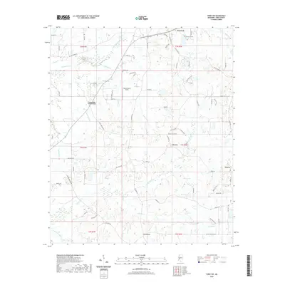
(24)- 1903 Map of Jackson
 1903 Jackson1903 Print · USGSCentral Mississippi at the dawn of the new century shows a landscape transformed by expanding rail lines and river commerce. Genealogists and researchers can trace family roots through early settlements like Pocahontas, Ridgeland, and Clinton or locate the historic Asylum grounds.
 - 1934 Map of Raymond
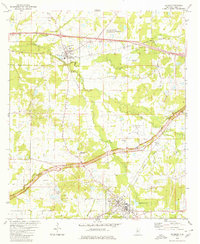
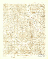 1934 Raymond1934 Print · USGSHinds County during the mid-thirties was a landscape of thriving rural communities and significant educational centers. Genealogists can trace family roots through numerous local landmarks like Gaddis Chapel, McRaven Sta, and Rosenwald County Line Sch.
 - 1937 Map of Raymond
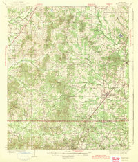
 1937 Raymond1937 Print · USGSHinds County is captured here in the mid-1930s, showing a landscape defined by collegiate centers and a dense network of rural schools. Family historians can trace the locations of Mississippi College, the Old Mens Home, and Gillespie Sch.2 unique versions available
 - 1937 Map of Terry
 1937 Terry1937 Print · USGSHinds County is captured here in the late thirties, showing a rural landscape defined by the Illinois Central Railroad and its farming hubs. Researchers can trace family roots through numerous small-scale landmarks, including Hester Rosenwald Sch, Morgans Store, and Salmon Cem.3 unique versions available
 - 1942 Map of Raymond
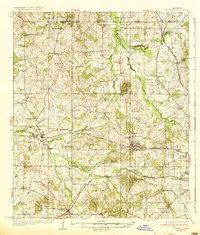
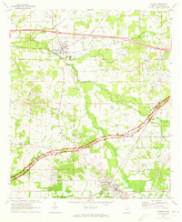
 1942 Raymond1942 Print · USGSHinds County in the early 1940s served as a regional crossroads of education and rail transport during a period of steady rural development. Researchers can locate family landmarks such as New Salem Cem, trace the Illinois Central tracks, and find long-standing institutions like Mississippi College.
 - 1943 Map of Terry
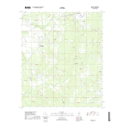
 1943 Terry1943 Print · USGSSouthern Hinds County in the late thirties is a landscape of rural crossroads and rail-connected settlements like Terry. Genealogists and historians can locate numerous country schools and churches such as Taylor Grove Sch, Mt Beulah Ch, and the landmark Morgan Store.2 unique versions available
 - 1955 Map of Jackson
 1955 Jackson1955 Print · USGSThe Lower Mississippi Valley at the middle of the century reveals a landscape of deep river meanders and growing rail hubs. Genealogists and historians can trace the mid-century footprints of Vicksburg National Military Park, old river landings at Port Gibson, and the rail corridors of the Illinois Central Railroad.3 unique versions available
 - 1961 Map of Jackson
 1961 Jackson1961 Print · USGSThe Lower Mississippi Delta and the state capital area are captured here during the post-war era of infrastructure expansion. Researchers can trace the complex river oxbows and rail lines connecting Vicksburg, Yazoo City, and the Illinois Central Railroad network.
 - 1962 Map of Jackson
 1962 Jackson1962 Print · USGSThe Mississippi Delta and the state capital region are mapped here in the early sixties, showing a landscape defined by the great river and the growing city of JACKSON. Genealogists can trace family roots through numerous landmarks like Cedar Hill Cem, rural stops on the Illinois Central RR, and historic sites like Champion Hill.2 unique versions available
 - 1971 Map of Terry NW, 1973 Print
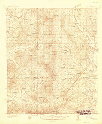
 1971 Terry NW1973 Print · USGSRural Hinds County in the early seventies remained a landscape of scattered crossroads and small churches. Researchers can trace family sites at Salmon Cem, explore the community around Dry Grove, or locate the County Penal Farm.
 - 1971 Map of Raymond, 1973 Print
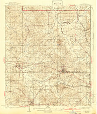
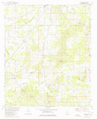
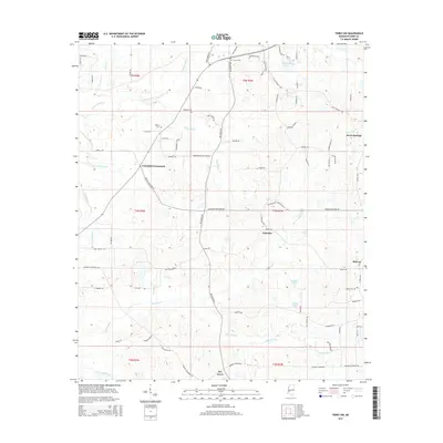
 1971 Raymond1973 Print · USGSHinds County is captured here in the early seventies as the historic Natchez Trace Parkway and Illinois Central rail lines shaped the local economy. Genealogists and researchers can trace family landmarks like Zion Chapel Cem, Hinds Jr College, and the old Carver Sch.
 - 1980 Map of Terry NW
 1980 Terry NW1980 Print · USGSHinds County in the 1980s reveals a landscape of small crossroads settlements and family-named landmarks. Genealogists can trace rural roots through features like Fairchilds Crossroads, the Bedwell Cem, and country churches such as Hamilton Grove Ch and Spring Hill Ch.
 - 1980 Map of Raymond
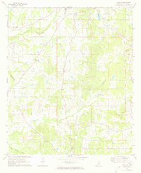
 1980 Raymond1980 Print · USGSThe area around Raymond and Bolton comes into focus in the early eighties, showcasing a mix of educational hubs and oil-rich landscapes. Researchers can trace genealogical sites like Mt Elizabeth Ch, Zion Chapel Cem, and the sprawling Hinds Jr College campus.2 unique versions available
 - 1984 Map of Jackson
 1984 Jackson1984 Print · USGSCentral Mississippi in the mid-eighties shows a landscape defined by the growing suburbs of Jackson and the riverfront legacy of Vicksburg. Researchers can trace the Natchez Trace Parkway or locate local landmarks like Utica College and Mississippi State Hospital.
 - 2012 Map of Terry NW, 2012 Print
 2012 Terry NW2012 Print · USGSCovers Raymond, including Palestine, Dry Grove, and other nearby areas
 - 2012 Map of Raymond, 2012 Print
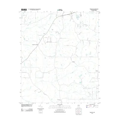
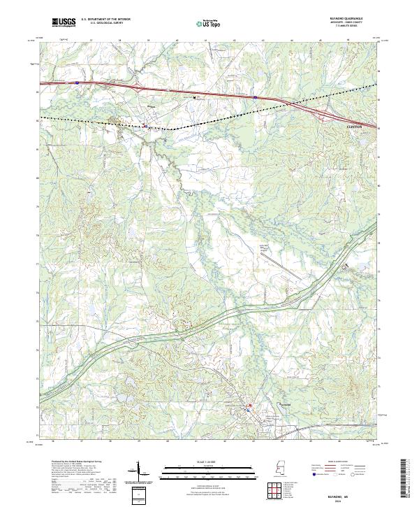
 2012 Raymond2012 Print · USGSCovers Raymond, including Clinton, Bolton, and other nearby areas
 - 2015 Map of Raymond, 2015 Print
 2015 Raymond2015 Print · USGSCovers Raymond, including Clinton, Bolton, and other nearby areas
 - 2015 Map of Terry NW, 2015 Print
 2015 Terry NW2015 Print · USGSCovers Raymond, including Palestine, Dry Grove, and other nearby areas
 - 2018 Map of Raymond, 2018 Print
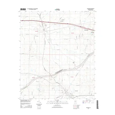
 2018 Raymond2018 Print · USGSCovers Raymond, including Clinton, Bolton, and other nearby areas
 - 2018 Map of Terry NW, 2018 Print
 2018 Terry NW2018 Print · USGSCovers Raymond, including Palestine, Dry Grove, and other nearby areas
 - 2020 Map of Raymond, 2020 Print
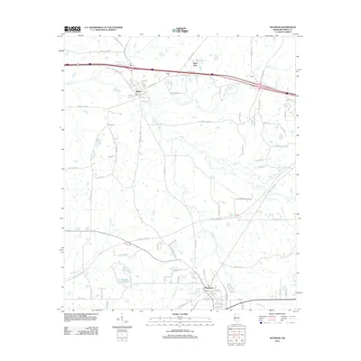
 2020 Raymond2020 Print · USGSCovers Raymond, including Clinton, Bolton, and other nearby areas
 - 2020 Map of Terry NW, 2020 Print
 2020 Terry NW2020 Print · USGSCovers Raymond, including Palestine, Dry Grove, and other nearby areas
 - 2024 Map of Raymond, 2024 Print
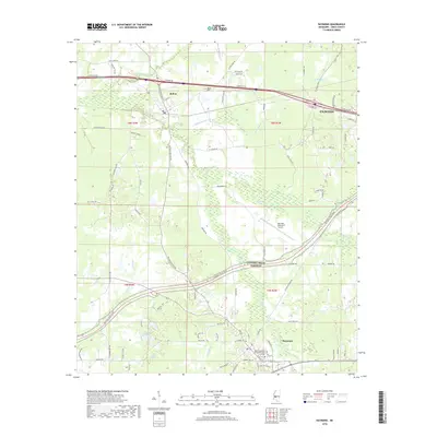
 2024 Raymond2024 Print · USGSHinds County during the 2020s shows a landscape of established educational institutions and historic rural centers. Genealogists and local historians can trace the roads connecting Raymond to Bolton, while locating landmarks like the Hinds County Courthouse Annex and Bolton Cem.
 - 2024 Map of Terry NW, 2024 Print
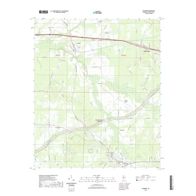
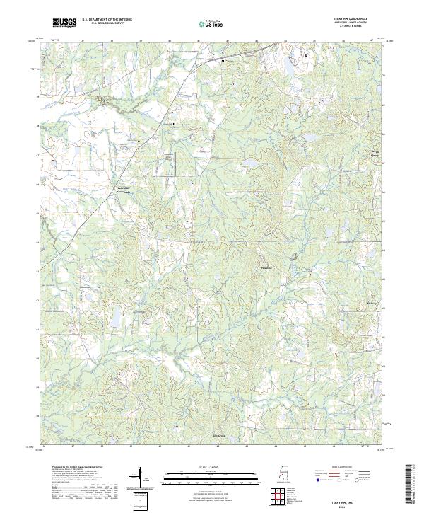 2024 Terry NW2024 Print · USGSHinds County rural life continues to center around historic crossroads and creek bottoms in the mid-2020s. Researchers can trace family ties at Salmon Cem and Carter Cem or locate the small settlements of Fairchilds Crossroads and Dry Grove.
End of results
Showing maps 1-24 of 24
Top cities near Raymond
- Jackson historical maps
- Clinton historical maps
- Madison historical maps
- Ridgeland historical maps
- Byram historical maps
- Richland historical maps
See more
Frequently asked questions
- What are the different types of historical maps available for Raymond?
- What is the oldest map of Raymond?
- Where can I purchase historical maps of Raymond for my home or office?
- Where can I download high-res historical maps of Raymond?
- Are there historical topographic maps available for Raymond?
- Is there historical aerial imagery available for Raymond?
- Where are historical maps of Raymond sourced from?