Old Maps of Leake County, Mississippi for Hiking & Exploration
Hike through history with 106 historic maps of Leake County. Explore old trails, ghost towns, and forgotten backroads — perfect for outdoor adventurers and local explorers.
- Rediscover forgotten places: Map out old mining camps, roads, and footpaths that no longer exist on modern maps.
- Layer with modern tools: Combine with LiDAR or satellite views to plan hikes through historical terrain.
- Made for exploration: Popular among hikers, overlanders, and local history lovers.
Use these maps to find adventure and explore the hidden past of Leake County.
Leake County, MS maps
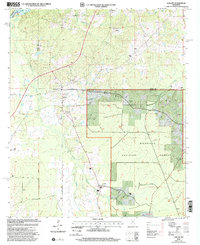
(106)- 1953 Map of Meridian, 1966 Print
 1953 Meridian1966 Print · USGSEast Central Mississippi and the Alabama borderlands are captured here during a period of steady growth and infrastructure expansion. Genealogists and historians can trace rail-town development along the Gulf Mobile & Ohio Railroad and find early settlements like Scooba, Pelahatchie, and De Kalb.2 unique versions available
 - 1957 Map of Meridian
 1957 Meridian1957 Print · USGSEast Central Mississippi and parts of Western Alabama come alive in the mid-1950s, centered on the transit hub of Meridian. Researchers can trace old rail lines like the Illinois Central and find historic sites such as the Choctaw Indian Reservation and Roosevelt State Park.
 - 1961 Map of Carthage, 1962 Print
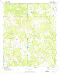
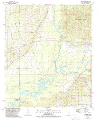
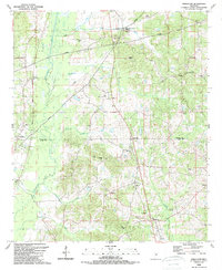
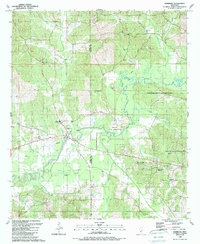
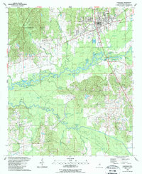
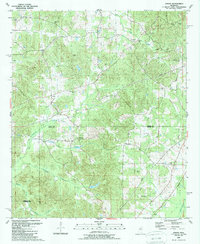
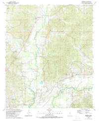
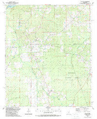
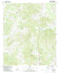
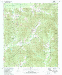
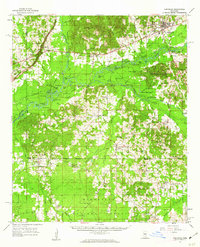 1961 Carthage1962 Print · USGSLeake County and the central Mississippi timberlands are captured here in the early sixties, showing the area as the Bienville National Forest and local rail lines defined the economy. Genealogists can trace family roots through numerous sites like Tribulation Cem, Free Mission Ch, and Ofahoma.3 unique versions available
 - 1962 Map of Edinburg, 1964 Print
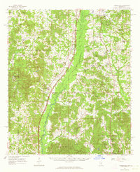
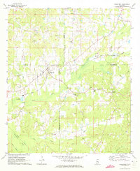
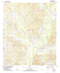
 1962 Edinburg1964 Print · USGSCentral Mississippi's rural river country comes to life in the early sixties, showing the intersection of four counties along the Pearl River. Genealogists can trace family roots through numerous sites like Battleground Cemetery, Coughlin Mound, and the settlement at Edinburg.
 - 1962 Map of Thomastown, 1964 Print
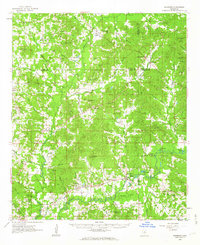
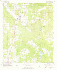
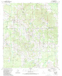
 1962 Thomastown1964 Print · USGSLeake County was a landscape of creek-side settlements and rural parishes in the early sixties. Genealogists can trace family footprints through dozens of local landmarks like Ellington Cem, Greer High Sch, and Cedar Grove Ch.
 - 1965 Map of Meridian
 1965 Meridian1965 Print · USGSEast Mississippi and West Alabama are mapped here in the mid-sixties as the region's modern highway and reservoir systems began to take shape. Researchers can trace rural lineages through local landmarks like Prince Chapel and Tuscahoma Landing, or follow the historic Gulf Mobile & Ohio rail lines.
 - 1972 Map of McAfee, 1973 Print
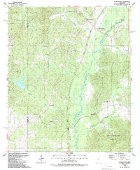
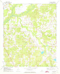 1972 McAfee1973 Print · USGSLeake County in the early seventies is a landscape of rural crossroads and river bottomlands centered on the Pearl River. Researchers can trace old family roots through numerous country landmarks like Harmony Sch Galilee Ch, the Standing Pine Cemetery, and Estesmill.2 unique versions available
 - 1972 Map of Madden, 1973 Print
 1972 Madden1973 Print · USGSAcross the border of Leake and Neshoba counties in the early seventies, this rural landscape reveals a community built around small-town centers and country churches. Genealogists can trace family roots through several landmarks like Leake Academy, Mt Bethany Ch, and the Carolina Cem.
 - 1972 Map of Sebastopol, 1973 Print
 1972 Sebastopol1973 Print · USGSThe intersection of four counties in central Mississippi comes alive in the early seventies, centered on the railroad town of Sebastopol. Genealogists and historians can trace the locations of rural landmarks like Steam Mill, Milldale Cem, and Hays.
 - 1972 Map of Walnut Grove, 1974 Print
 1972 Walnut Grove1974 Print · USGSThe rail and river geography of central Mississippi comes into focus in the early seventies, centered on the community of Walnut Grove. Local historians can trace the Gulf Mobile and Ohio rail line or locate family sites like Lindsey Cem and Damascus Ch.
 - 1984 Map of Carthage
 1984 Carthage1984 Print · USGSLeake and Neshoba counties in the mid-1980s showcase a transition from the Government Hills to the dense Bienville National Forest. Genealogists and researchers can trace the historic Natchez Trace Parkway and local settlements like Plattsburg and Williamsville.
 - 1988 Map of Thomastown, 1989 Print
 1988 Thomastown1989 Print · USGSLeake and Madison counties are captured in the late eighties as the Natchez Trace Parkway bisects this river-carved landscape. Genealogists can locate family landmarks like the Thomastown Christian Cem and rural congregations including Wake Forest Ch and Saint Ann.
 - 1989 Map of Ofahoma
 1989 Ofahoma1989 Print · USGSCentral Mississippi in the late eighties shows a landscape shaped by the Pearl River floodplains and the high Government Hills. Trace the paths of local life through the Natchez Trace Parkway or find family landmarks like Tribulation Ch and Good Hope.
 - 1989 Map of Singleton
 1989 Singleton1989 Print · USGSThe Attala and Leake County line comes alive in the late 1980s, showcasing a rural landscape defined by the Natchez Trace Parkway and the Yockanookany River. Researchers can trace old family burial sites at Delydia Hill Cem and Turnage Cem.
 - 1989 Map of Edinburg
 1989 Edinburg1989 Print · USGSThe Pearl River valley in the late eighties reveals a landscape of Choctaw lands and rural communities along the Leake and Neshoba county line. Genealogists and local historians can trace numerous landmarks including Edinburg High Sch, Mars Hill Ch, and the Bethany Cem.
 - 1989 Map of Carthage
 1989 Carthage1989 Print · USGSCarthage and the surrounding Leake County bottomlands are captured here in the late eighties as the town expanded toward the river. Genealogists and local historians can trace family-named sites like Piggtown, Good Hope, and rural landmarks such as Pilgrim Rest Ch.
 - 1989 Map of Joseph
 1989 Joseph1989 Print · USGSAttala and Leake counties are documented here in the late eighties, just as the modern survey of their rural townships was finalized. Researchers can locate many family-named landmarks and old church sites like Ellington Ch, Zemuly, and Bolatusha Cem.
 - 1989 Map of Renfroe
 1989 Renfroe1989 Print · USGSCentral Leake County in the late eighties is defined by the winding Pearl River and rural crossroads. Genealogists can trace family roots through Mary Bethel Ch, Mt Olive Ch, and the Old Railroad Grade.
 - 1989 Map of Ludlow
 1989 Ludlow1989 Print · USGSIn the late 1980s, the Mississippi timberlands near Ludlow remained a landscape of forest reserves and family burial grounds. Local historians can trace early transportation routes like the Old RR Grade or locate sites like Mt Zion Ch and Pearson Cem.
 - 1989 Map of Conway
 1989 Conway1989 Print · USGSLeake County's rural heartland and Choctaw lands are captured here in the late 1980s. Researchers can trace family roots through numerous country landmarks like Center Hill Ch, the Choctaw Indian Reservation, and Redwater.
 - 1989 Map of Four Corners
 1989 Four Corners1989 Print · USGSThe crossroads at Four Corners and Zama in the late eighties reveal a landscape deeply rooted in the intersection of four Mississippi counties. Genealogists and local historians can trace family roots at New Ebenezer Ch, Sullivan Cem, and the Mars Hill Lookout.
 - 1989 Map of Lena
 1989 Lena1989 Print · USGSCentral Mississippi in the late eighties shows a landscape shaped by timber history and rural faith. Genealogists and historians can trace family ties through Sweetwater Ch and Robinson Cem, or locate the timber-era tracks at Sproles Siding.
 - 1989 Map of Zama
 1989 Zama1989 Print · USGSCentral Mississippi hill country is documented here in the late eighties, centered on the Attala and Leake County line. Researchers can locate several rural community hubs and churches, from Zama and Smyrna to the Patterson Cem and Shield Cem.
 - 1994 Map of Carthage
 1994 Carthage1994 Print · USGSCentral Mississippi in the mid-nineties is a region of dense river bottoms and historic travel ways. Genealogists can trace family names and small-town roots across the Choctaw Indian Reservation or follow the path of the Natchez Trace Parkway past Carthage and Walnut Grove.
 - 2000 Map of Ludlow, 2002 Print
 2000 Ludlow2002 Print · USGSScott and Leake counties meet at Ludlow during the late twentieth century, showing a rural Mississippi landscape defined by timber and traditional crossroads. Researchers can trace family ties at Pearson Cem and Mt Zion Ch or explore the wooded reaches of Bienville National Forest.
Showing maps 1-25 of 106
Top cities of Leake County
Frequently asked questions
- What are the different types of historical maps available for Leake County?
- What is the oldest map of Leake County?
- Where can I purchase historical maps of Leake County for my home or office?
- Where can I download high-res historical maps of Leake County?
- Are there historical topographic maps available for Leake County?
- Is there historical aerial imagery available for Leake County?
- Where are historical maps of Leake County sourced from?