1900s (20th Century) Maps of Rixwood, Mississippi
Explore 9 historic maps of Rixwood from the 1900s (20th Century). These maps offer a rare glimpse into what life looked like during the 1900s — showing old roads, neighborhoods, homes, and landmarks that have changed or disappeared over time.
Whether you're researching your family's past, planning a metal detecting trip, or studying how Rixwood's landscape evolved across the 1900s, these high-resolution maps are a powerful tool for exploring the history of this region.
- Focus on a specific era: All maps on this page are from the 1900s, giving you a focused view of this time period.
- See what’s changed: Compare century-old streets, trails, and buildings to today's modern landscape using overlays and satellite layers.
- Research with precision: Use these maps for genealogy, historical research, land use analysis, or educational projects.
- View, download, or print: Maps are fully viewable online in high resolution, and can be downloaded or printed for your own records.
Start exploring Rixwood's history through authentic maps from the 1900s. This is your window into the past.
Rixwood, MS maps
(9)- 1931 Map of Schlater
 1931 Schlater1931 Print · USGSThe Mississippi Delta's complex network of bayous and winding river bends is captured in the early 1930s. Genealogists can trace hundreds of family and community landmarks, from the Rosenwald Sch to small congregations like Thankful Ch and Harts Chapel.
 - 1934 Map of Schlater
 1934 Schlater1934 Print · USGSThe Mississippi Delta's winding bayous and rail towns are captured here in the early 1930s, showing a landscape of intense riverfront settlement. Genealogists can trace family-named sites across the floodplains, from Schlater and Sunnyside to the Rosenwald Sch and Rock of Ages Ch.2 unique versions available
 - 1939 Map of Schlater, 1941 Print
 1939 Schlater1941 Print · USGSThe Mississippi Delta's intricate network of bayous and agricultural communities is captured here in the late 1930s. Genealogists can trace family roots through numerous local landmarks like Rosenwald Sch, Mile Tabernacle, and Rock of Ages Ch.
 - 1953 Map of Greenwood, 1966 Print
 1953 Greenwood1966 Print · USGSThe Mississippi Delta in the mid-fifties is captured here as a thriving network of river towns, railroads, and oxbow lakes. Researchers can trace the legacy of the Illinois Central Railroad and locate landmarks like the State Penal Farm and Greenville Air Force Base.5 unique versions available
 - 1956 Map of Greenwood
 1956 Greenwood1956 Print · USGSThe Mississippi Delta in the mid-fifties is captured here during a period of significant military and agricultural activity. Researchers can trace the rail lines of the Illinois Central RR, find the Greenville Air Force Base, or locate the State Penal Farm.
 - 1961 Map of Schlater, 1963 Print
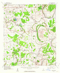 1961 Schlater1963 Print · USGSLeflore County in the early sixties is a landscape of river bends and rail lines before the modern era of consolidation. Genealogists can trace family roots through numerous delta landmarks like Mississippi Vocational College, Shiloh Cem, and Itta Bena.2 unique versions available
 - 1974 Map of Schlater SE, 1975 Print
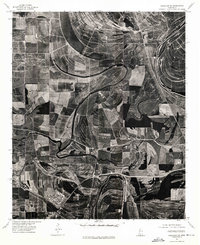 1974 Schlater SE1975 Print · USGSIn the mid-1970s, the Mississippi Delta landscape around Itta Bena was a patchwork of precision-farmed fields and ancient river bends. Researchers can trace the winding Tallahatchie and study the detailed aerial layout of local farmsteads.
 - 1983 Map of Greenwood
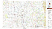 1983 Greenwood1983 Print · USGSThe Mississippi Delta in the early eighties shows a landscape of rail-connected towns and vast river systems. Genealogists and historians can trace family roots in towns like Mound Bayou, Ruleville, and the grounds of Mississippi Valley State University.
 - 1983 Map of Shellmound, 1984 Print
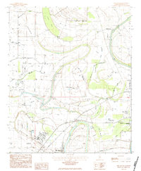 1983 Shellmound1984 Print · USGSLeflore County during the early eighties shows a Delta landscape defined by the Tallahatchie River and industrial agriculture. Genealogists can trace rural communities through local landmarks like Mt Zion Ch, St Pauls Cem, and the campus of Mississippi Valley State University.
End of results
Showing maps 1-9 of 9
Top cities near Rixwood
- Greenwood historical maps
- Ruleville historical maps
- Moorhead historical maps
- Drew historical maps
- Itta Bena historical maps
- Sunflower historical maps
See more
Frequently asked questions
- What are the different types of historical maps available for Rixwood?
- What is the oldest map of Rixwood?
- Where can I purchase historical maps of Rixwood for my home or office?
- Where can I download high-res historical maps of Rixwood?
- Are there historical topographic maps available for Rixwood?
- Is there historical aerial imagery available for Rixwood?
- Where are historical maps of Rixwood sourced from?