Old Maps of Morton, Mississippi for Metal Detecting
Plan your next treasure hunt with 27 historic maps of Morton. Find old homesites, ghost towns, trails, and gathering spots that may be lost to time — perfect for identifying promising metal detecting locations.
- Locate forgotten sites: Uncover places like long-lost settlements, abandoned rail lines, or gathering spots.
- Plan better hunts: Use map overlays combined with LiDAR or satellite views to narrow in on historically rich areas.
- Made for detectorists: Thousands of hobbyists use these maps to discover relics, coins, and hidden history.
Use these historic maps to boost your research and find new opportunities beneath the surface of Morton.
Morton, MS maps
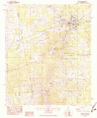
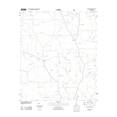
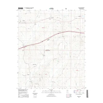
(27)- 1922 Map of Morton
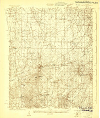 1922 Morton1922 Print · USGSScott County in the early twenties is a landscape of rural schoolhouses and timber operations centered on the Morton rail line. Researchers can locate vanished community landmarks like the Scott County Fair Grounds, Lumber Camp, and several family-named churches.
 - 1924 Map of Morton
 1924 Morton1924 Print · USGSThe rail-and-timber landscape of Scott and Rankin counties is captured here in the early twenties. Researchers can trace rural life through dozens of named landmarks like Peagler Store, Morton, and the Sprous Cemetery.
 - 1951 Map of Morton
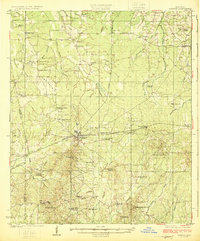
 1951 Morton1951 Print · USGSMid-century Scott and Rankin counties are mapped here just as the modern highway system began to overshadow the rail era. Genealogists can locate family landmarks like Peagler Store and numerous rural sites such as Simmons Grove Ch and Latham Cem.3 unique versions available
 - 1953 Map of Meridian, 1966 Print
 1953 Meridian1966 Print · USGSEast Central Mississippi and the Alabama borderlands are captured here during a period of steady growth and infrastructure expansion. Genealogists and historians can trace rail-town development along the Gulf Mobile & Ohio Railroad and find early settlements like Scooba, Pelahatchie, and De Kalb.2 unique versions available
 - 1957 Map of Meridian
 1957 Meridian1957 Print · USGSEast Central Mississippi and parts of Western Alabama come alive in the mid-1950s, centered on the transit hub of Meridian. Researchers can trace old rail lines like the Illinois Central and find historic sites such as the Choctaw Indian Reservation and Roosevelt State Park.
 - 1965 Map of Meridian
 1965 Meridian1965 Print · USGSEast Mississippi and West Alabama are mapped here in the mid-sixties as the region's modern highway and reservoir systems began to take shape. Researchers can trace rural lineages through local landmarks like Prince Chapel and Tuscahoma Landing, or follow the historic Gulf Mobile & Ohio rail lines.
 - 1982 Map of Forkville
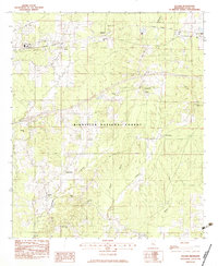
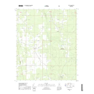
 1982 Forkville1982 Print · USGSThe rural communities of Scott and Rankin Counties are shown here in the early 1980s, centered around Forkville and the Bienville National Forest. Genealogists can trace family roots through numerous sites like Latham Cem, Macedonia Ch, and the Indian Treaty Boundary.
 - 1982 Map of Morton, 1983 Print
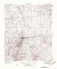
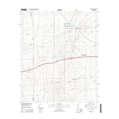
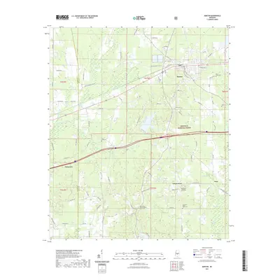
 1982 Morton1983 Print · USGSThe town of Morton and its surrounding timberlands are captured in the early eighties, showing a community defined by its rail access and proximity to the national forest. Trace local roots through a wealth of rural landmarks like Kracker Station, Walker Cem, and the Indian Treaty Boundary.2 unique versions available
 - 1982 Map of Pulaski, 1983 Print
 1982 Pulaski1983 Print · USGSCentral Mississippi timberlands and small rail-side settlements define this landscape in the early eighties. Genealogists can trace family names through landmarks like North Morton Cem, Raworth, and Hunter Town near the Strong River.
 - 1984 Map of Forest
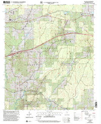
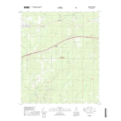
 1984 Forest1984 Print · USGSCentral Mississippi in the mid-eighties centers on the timberlands and rail corridors of the Bienville National Forest. Genealogists and historians can trace old settlements like Conehatta and Hillsboro or follow the Illinois Central Gulf line through Morton and Newton.2 unique versions available
 - 2000 Map of Pulaski, 2002 Print
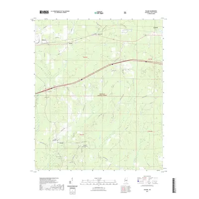
 2000 Pulaski2002 Print · USGSThe woods of Scott County appear at the turn of the millennium, showing a landscape shaped by timber and tradition. Genealogists can trace family landmarks like North Morton Cem, Hunter Town, and the rural community of Pulaski.
 - 2000 Map of Forkville, 2002 Print
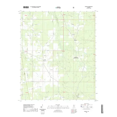
 2000 Forkville2002 Print · USGSCentral Mississippi at the turn of the millennium reveals a landscape of small forest settlements and country churches. Researchers can trace family roots at Latham Cem or locate community hubs like Forkville and Line Prairie Ch.
 - 2012 Map of Forkville, 2012 Print
 2012 Forkville2012 Print · USGSCovers Morton, including Forkville, Branch, and other nearby areas
 - 2012 Map of Pulaski, 2012 Print
 2012 Pulaski2012 Print · USGSCovers Morton, including Forest, Frogtown, and other nearby areas
 - 2012 Map of Morton, 2012 Print
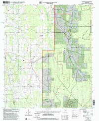
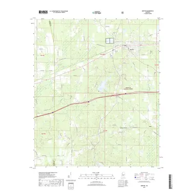
 2012 Morton2012 Print · USGSCovers Morton, including Pelahatchie, Independence, and other nearby areas
 - 2015 Map of Forkville, 2015 Print
 2015 Forkville2015 Print · USGSCovers Morton, including Forkville, Branch, and other nearby areas
 - 2015 Map of Pulaski, 2015 Print
 2015 Pulaski2015 Print · USGSCovers Morton, including Forest, Frogtown, and other nearby areas
 - 2015 Map of Morton, 2015 Print
 2015 Morton2015 Print · USGSCovers Morton, including Pelahatchie, Independence, and other nearby areas
 - 2018 Map of Forkville, 2018 Print
 2018 Forkville2018 Print · USGSCovers Morton, including Forkville, Branch, and other nearby areas
 - 2018 Map of Pulaski, 2018 Print
 2018 Pulaski2018 Print · USGSCovers Morton, including Forest, Frogtown, and other nearby areas
 - 2018 Map of Morton, 2018 Print
 2018 Morton2018 Print · USGSCovers Morton, including Pelahatchie, Independence, and other nearby areas
 - 2021 Map of Forkville, 2021 Print
 2021 Forkville2021 Print · USGSCovers Morton, including Forkville, Branch, and other nearby areas
 - 2021 Map of Morton, 2021 Print
 2021 Morton2021 Print · USGSCovers Morton, including Pelahatchie, Independence, and other nearby areas
 - 2021 Map of Pulaski, 2021 Print
 2021 Pulaski2021 Print · USGSCovers Morton, including Forest, Frogtown, and other nearby areas
 - 2024 Map of Forkville, 2024 Print
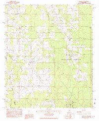
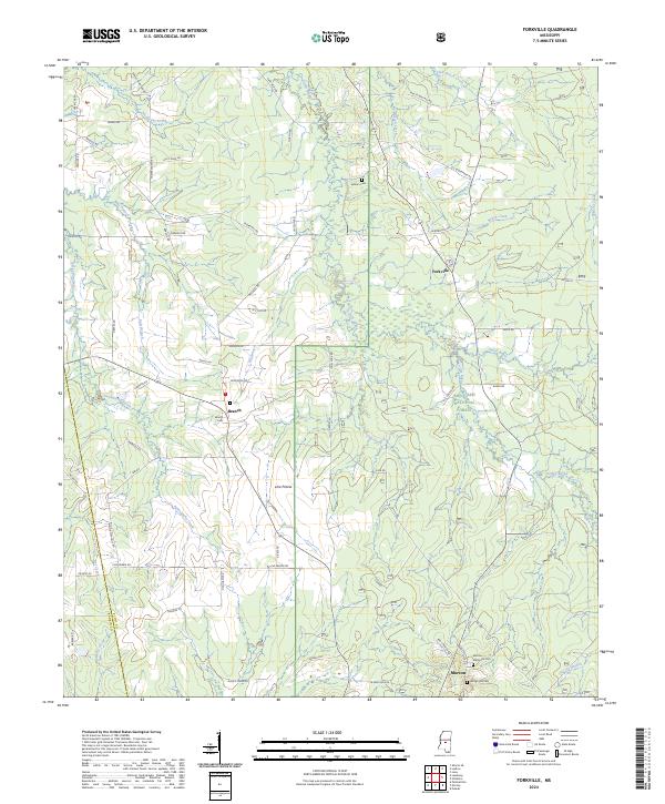 2024 Forkville2024 Print · USGSCentral Mississippi woodlands meet the northern reaches of the Bienville National Forest in this recent survey. Local researchers can trace family landmarks and rural communities from Forkville and Branch down to the Latham Cem.
Showing maps 1-25 of 27
Top cities near Morton
Frequently asked questions
- What are the different types of historical maps available for Morton?
- What is the oldest map of Morton?
- Where can I purchase historical maps of Morton for my home or office?
- Where can I download high-res historical maps of Morton?
- Are there historical topographic maps available for Morton?
- Is there historical aerial imagery available for Morton?
- Where are historical maps of Morton sourced from?