Old Maps of Harworth, Mississippi for Hiking & Exploration
Hike through history with 13 historic maps of Harworth. Explore old trails, ghost towns, and forgotten backroads — perfect for outdoor adventurers and local explorers.
- Rediscover forgotten places: Map out old mining camps, roads, and footpaths that no longer exist on modern maps.
- Layer with modern tools: Combine with LiDAR or satellite views to plan hikes through historical terrain.
- Made for exploration: Popular among hikers, overlanders, and local history lovers.
Use these maps to find adventure and explore the hidden past of Harworth.
Harworth, MS maps
(13)- 1940 Map of Mechanicsburg, 1947 Print
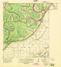 1940 Mechanicsburg1947 Print · USGSThe Yazoo River Delta in the early 1940s reveals a landscape defined by steamboat landings and the edge of the Loess Bluffs. Researchers can trace historic river access points like Enola Ldg and Miller Ldg or locate the early footprints of Satartia and Mechanicsburg.2 unique versions available
 - 1955 Map of Jackson
 1955 Jackson1955 Print · USGSThe Lower Mississippi Valley at the middle of the century reveals a landscape of deep river meanders and growing rail hubs. Genealogists and historians can trace the mid-century footprints of Vicksburg National Military Park, old river landings at Port Gibson, and the rail corridors of the Illinois Central Railroad.3 unique versions available
 - 1961 Map of Jackson
 1961 Jackson1961 Print · USGSThe Lower Mississippi Delta and the state capital area are captured here during the post-war era of infrastructure expansion. Researchers can trace the complex river oxbows and rail lines connecting Vicksburg, Yazoo City, and the Illinois Central Railroad network.
 - 1962 Map of Jackson
 1962 Jackson1962 Print · USGSThe Mississippi Delta and the state capital region are mapped here in the early sixties, showing a landscape defined by the great river and the growing city of JACKSON. Genealogists can trace family roots through numerous landmarks like Cedar Hill Cem, rural stops on the Illinois Central RR, and historic sites like Champion Hill.2 unique versions available
 - 1963 Map of Mechanicsburg, 1965 Print
 1963 Mechanicsburg1965 Print · USGSThe Yazoo Delta and its surrounding bluffs are shown in the early sixties as a landscape of river landings and rural parishes. Researchers can trace family history through Satartia, Mechanicsburg, and numerous rural churches like Germania El Bethel Ch or Lynch Chapel.
 - 1984 Map of Yazoo City
 1984 Yazoo City1984 Print · USGSThe Mississippi Delta and loess bluffs meet in the mid-eighties as the Yazoo River snakes through a dense network of wildlife areas and rail lines. Researchers can trace rural life and drainage history through small communities like Holly Bluff, Mechanicsburg, and Satartia.2 unique versions available
 - 1988 Map of Lucre
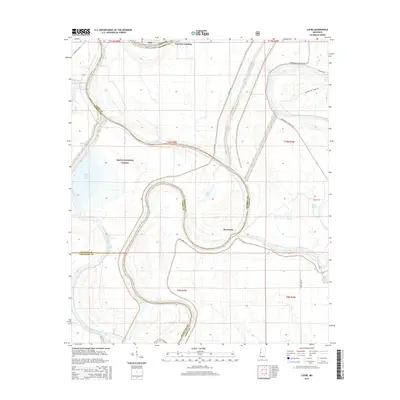
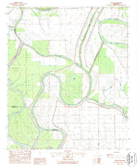 1988 Lucre1988 Print · USGSThe convergence of the Yazoo and Sunflower rivers in the late 1980s reveals a landscape of deep-delta timber and intensive water management. Researchers can trace the boundaries of the Delta National Forest and locate small rural outposts like Lucre and Cypress.
 - 2000 Map of Lucre, 2002 Print
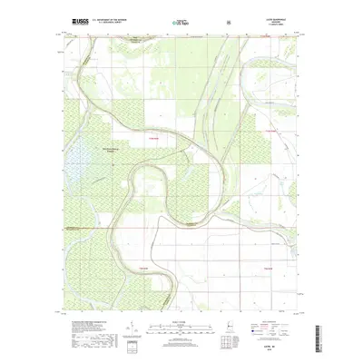
 2000 Lucre2002 Print · USGSThe Mississippi Delta's river-driven landscape is captured here at the turn of the millennium, showing the confluence of three major rivers. Genealogists and historians can trace the intricate levee systems and find local landmarks like Lucre, Lake George, and the South Greentree Reservoir.
 - 2012 Map of Lucre, 2012 Print
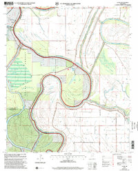
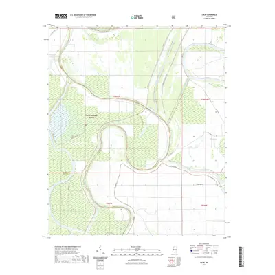
 2012 Lucre2012 Print · USGSCovers Harworth, including Horn Place Landing, Kansas Landing, and other nearby areas
 - 2015 Map of Lucre, 2015 Print
 2015 Lucre2015 Print · USGSCovers Harworth, including Horn Place Landing, Kansas Landing, and other nearby areas
 - 2018 Map of Lucre, 2018 Print
 2018 Lucre2018 Print · USGSCovers Harworth, including Horn Place Landing, Kansas Landing, and other nearby areas
 - 2021 Map of Lucre, 2021 Print
 2021 Lucre2021 Print · USGSCovers Harworth, including Horn Place Landing, Kansas Landing, and other nearby areas
 - 2024 Map of Lucre, 2024 Print
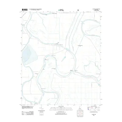
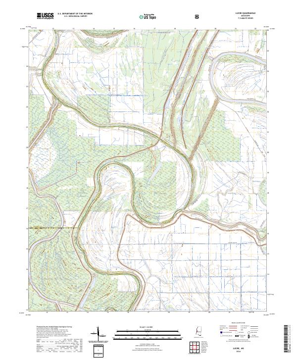 2024 Lucre2024 Print · USGSThe Mississippi Delta bottomlands come alive in this study of the mid-2020s, showing the vast Delta National Forest at the meeting of three counties. You can trace the complex drainage of the Yazoo River alongside major engineering works like the Will M. Whittington Auxiliary Channel.
End of results
Showing maps 1-13 of 13
Top cities near Harworth
Frequently asked questions
- What are the different types of historical maps available for Harworth?
- What is the oldest map of Harworth?
- Where can I purchase historical maps of Harworth for my home or office?
- Where can I download high-res historical maps of Harworth?
- Are there historical topographic maps available for Harworth?
- Is there historical aerial imagery available for Harworth?
- Where are historical maps of Harworth sourced from?