Old Maps of Smith County, Mississippi
Explore 113 old maps of Smith County, spanning from 1935 to today. These high-resolution historic maps reveal how streets, neighborhoods, landmarks, and natural features evolved over time — perfect for genealogy, metal detecting, research, and local history exploration.
What you can do with these maps:
- See how Smith County changed over time: Compare historical maps to modern-day views to trace roads, homesites, rail lines & more.
- View detailed metadata: Each map includes creators, publishers, year, scale, and archive source.
- Overlay maps with satellite & LiDAR: Visualize the past alongside modern tools to explore terrain & human change.
- Trusted historical sources: Maps sourced from the USGS, Library of Congress, and other archives.
- Access maps your way: View online, download high-res files, or order prints for personal or research use.
Start exploring old maps of Smith County to uncover forgotten places, hidden landmarks, and the deep history beneath your feet.
Smith County, MS maps
(113)- 1935 Map of White Oak
 1935 White Oak1935 Print · USGSPrentiss County in the mid-1930s is captured in this Tennessee Valley Authority advance sheet. Genealogists and local historians can trace the rural landscape around White Oak and the Snowdown Sch or follow the path of Glausel Creek.
 - 1953 Map of Hattiesburg, 1965 Print
 1953 Hattiesburg1965 Print · USGSSouth Mississippi and western Alabama are shown here during the mid-twentieth century as the timber and rail industries shaped the region. Genealogists and historians can trace rail lines like the Mississippi Central and locate rural centers such as Magee, Richton, and Mount Vernon.4 unique versions available
 - 1953 Map of Meridian, 1966 Print
 1953 Meridian1966 Print · USGSEast Central Mississippi and the Alabama borderlands are captured here during a period of steady growth and infrastructure expansion. Genealogists and historians can trace rail-town development along the Gulf Mobile & Ohio Railroad and find early settlements like Scooba, Pelahatchie, and De Kalb.2 unique versions available
 - 1957 Map of Meridian
 1957 Meridian1957 Print · USGSEast Central Mississippi and parts of Western Alabama come alive in the mid-1950s, centered on the transit hub of Meridian. Researchers can trace old rail lines like the Illinois Central and find historic sites such as the Choctaw Indian Reservation and Roosevelt State Park.
 - 1958 Map of Hattiesburg
 1958 Hattiesburg1958 Print · USGSSoutheastern Mississippi's timber and rail networks are at their peak during the late fifties, centered on the growing hubs of Hattiesburg and Laurel. Researchers can trace old family landmarks like Sims Chapel, the Busbey Game Refuge, and the vanished stops along the Mississippi Central railroad.2 unique versions available
 - 1965 Map of Meridian
 1965 Meridian1965 Print · USGSEast Mississippi and West Alabama are mapped here in the mid-sixties as the region's modern highway and reservoir systems began to take shape. Researchers can trace rural lineages through local landmarks like Prince Chapel and Tuscahoma Landing, or follow the historic Gulf Mobile & Ohio rail lines.
 - 1968 Map of Clear Springs, 1970 Print
 1968 Clear Springs1970 Print · USGSCentral Mississippi's piney woods come alive in the late sixties, showing where the borders of four counties meet within the Bienville National Forest. Genealogists and historians can trace the rural communities around Clear Springs, Mt Calvary Ch, and the Burnett Cem.
 - 1968 Map of Pineville, 1970 Print
 1968 Pineville1970 Print · USGSThe Pineville area of Mississippi's Bienville National Forest is captured here in the late sixties as a landscape of timber and rural community. Researchers can trace the Old Railroad Grade or locate family landmarks like Noblin Cem, Mt Carmel Ch, and Oak Ridge Ch.2 unique versions available
 - 1968 Map of Homewood, 1970 Print
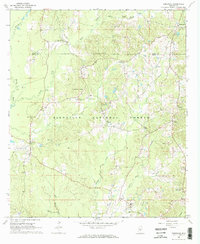 1968 Homewood1970 Print · USGSIn the pine-heavy borderlands of Scott and Smith counties during the late sixties, rural life centered on small timber and mining outposts. Researchers can trace family history through sites like Burns Sch and Zion Cem or locate industrial Bentonite Pits near Lorena.2 unique versions available
 - 1968 Map of White Oak, 1970 Print
 1968 White Oak1970 Print · USGSSmith and Simpson counties meet along the Strong River in the late sixties as the timber and oil industries shaped the land. Genealogists can locate family landmarks like Miley Cem and Merchant Cem or trace the Old Indian Treaty Boundary.3 unique versions available
 - 1968 Map of Polkville, 1970 Print
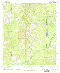 1968 Polkville1970 Print · USGSCentral Mississippi's timber and farm country comes into focus in the late 1960s, centered on the community of Polkville. Researchers can trace early land divisions along the Old Indian Treaty Boundary and locate family landmarks like Haile Cem and Piney Grove Ch.3 unique versions available
 - 1968 Map of Raleigh, 1970 Print
 1968 Raleigh1970 Print · USGSRaleigh and the surrounding Smith County countryside are captured here in the late sixties, just as the regional landscape was being shaped by forestry and oil. Researchers can find numerous family landmarks and rural institutions, from St Paul Ch and Crossroads Ch to the Bentonite Pit.
 - 1968 Map of Louin, 1970 Print
 1968 Louin1970 Print · USGSThe Jasper County interior comes into focus during the late sixties, showcasing the intersection of timberlands and rail-dependent settlements. Researchers can trace family roots through numerous sites like Triumph Ch, Bethany Cem, and the rail stop at Louin.2 unique versions available
 - 1968 Map of Louin SW, 1970 Print
 1968 Louin SW1970 Print · USGSSmith County, Mississippi, is shown here in the late sixties as a landscape of timberland and rural homesteads. Genealogists and historians can locate remote landmarks like Sylvan Grove Cem, Wadell Cave, and the community at Sylvarena.
 - 1974 Map of Soso, 1978 Print
 1974 Soso1978 Print · USGSThe borderlands of Smith, Jasper, and Jones Counties are captured in the mid-1970s as the regional oil and gas industry matured. Trace old family sites and rural landmarks like Gitano, Knights Mill Cem, and Knight Cem Ch along the Illinois Central Gulf line.
 - 1974 Map of Bay Springs, 1978 Print
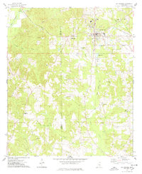 1974 Bay Springs1978 Print · USGSMississippi's Pine Belt is captured in the mid-seventies, showing the growth of Bay Springs alongside the Bay Springs Oil and Gas Field. Genealogists and historians can locate numerous rural landmarks like Mt Nebo Ch, Sylva-Bay Academy, and the Taylorsville Lookout Tower.
 - 1975 Map of Cohay, 1978 Print
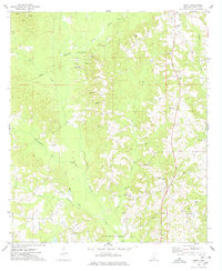 1975 Cohay1978 Print · USGSDeep in Smith County during the mid-seventies, this area is defined by the Raleigh Oil Field and scattered timber tracts. Researchers can trace old family sites near Dry Ridge Ch, the Cohay settlement, and the Railroad Grade.
 - 1975 Map of Taylorsville, 1978 Print
 1975 Taylorsville1978 Print · USGSTaylorsville and the surrounding Smith County countryside are captured here in the mid-seventies, just as the local oil and gas industry was well-established. Researchers can trace the Old Indian Treaty Boundary and locate family landmarks like Oakohay Cem or the Smith County Training Center.
 - 1975 Map of Mize, 1978 Print
 1975 Mize1978 Print · USGSThe Piney Woods region of Smith and Covington counties comes into focus in the mid-1970s, showing a landscape defined by timber, oil, and the Illinois Central Gulf line. Researchers can trace family history through several burial sites like Sullivan Cem or locate early landmarks like the Mize Lookout Tower and the historic Indian Treaty Boundary.
 - 1975 Map of Magee North, 1978 Print
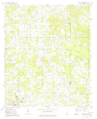 1975 Magee North1978 Print · USGSMagee and the Simpson County countryside are shown here in the mid-1970s, organized around the ICG railroad and the Indian Treaty Boundary. Genealogists can trace family landmarks like Kennedy Springs Ch, Gregory Cem, and Shady Grove Cem.2 unique versions available
 - 1975 Map of Magee South, 1978 Print
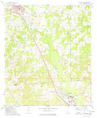 1975 Magee South1978 Print · USGSSettlement along the Illinois Central Gulf rail line in Simpson County is captured here in the mid-seventies. Genealogists and historians can trace family sites at Ware Cem and McNair Cem or locate the historic Old Indian Treaty Boundary.
 - 1975 Map of Center Ridge, 1978 Print
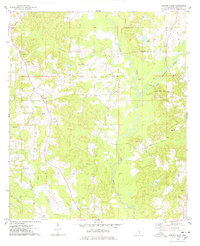 1975 Center Ridge1978 Print · USGSSmith County in the mid-seventies reveals a landscape defined by small rural congregations and growing energy extraction. Researchers can locate family landmarks like Ditch Cem and Liberty Ch or trace the early footprint of the Tallahala Creek Oil and Gas Field.
 - 1984 Map of Hattiesburg
 1984 Hattiesburg1984 Print · USGSSouth Mississippi’s Pine Belt is seen here in the mid-eighties, showing the region as a hub of timber production and petroleum extraction. Trace the rail lines of the Illinois Central Gulf RR through old settlements like Richton or the energy developments at the Heidelberg Oil Field.2 unique versions available
 - 1984 Map of Forest
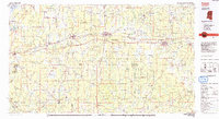 1984 Forest1984 Print · USGSCentral Mississippi in the mid-eighties centers on the timberlands and rail corridors of the Bienville National Forest. Genealogists and historians can trace old settlements like Conehatta and Hillsboro or follow the Illinois Central Gulf line through Morton and Newton.2 unique versions available
 - 1984 Map of Laurel
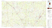 1984 Laurel1984 Print · USGSCentral Mississippi in the mid-eighties shows a landscape of timberlands and river valleys anchored by the growth of Laurel. Genealogists can trace family names near Oak Grove Ch, rural School sites, and settlements along the Illinois Central Gulf RR.
Showing maps 1-25 of 113
Top cities of Smith County
- Taylorsville historical maps
- Raleigh historical maps
- Mize historical maps
- Polkville historical maps
- Sylvarena historical maps
Frequently asked questions
- What are the different types of historical maps available for Smith County?
- What is the oldest map of Smith County?
- Where can I purchase historical maps of Smith County for my home or office?
- Where can I download high-res historical maps of Smith County?
- Are there historical topographic maps available for Smith County?
- Is there historical aerial imagery available for Smith County?
- Where are historical maps of Smith County sourced from?