1960s Maps of Sunflower County, Mississippi
Explore 22 historic maps of Sunflower County from the 1960s. These maps offer a rare glimpse into what life looked like during the 1960s — showing old roads, neighborhoods, homes, and landmarks that have changed or disappeared over time.
Whether you're researching your family's past, planning a metal detecting trip, or studying how Sunflower County's landscape evolved across the 1960s, these high-resolution maps are a powerful tool for exploring the history of this region.
- Focus on a specific era: All maps on this page are from the 1960s, giving you a focused view of this time period.
- See what’s changed: Compare century-old streets, trails, and buildings to today's modern landscape using overlays and satellite layers.
- Research with precision: Use these maps for genealogy, historical research, land use analysis, or educational projects.
- View, download, or print: Maps are fully viewable online in high resolution, and can be downloaded or printed for your own records.
Start exploring Sunflower County's history through authentic maps from the 1960s. This is your window into the past.
Sunflower County, MS maps
(22)- 1961 Map of Mossy Lake, 1962 Print
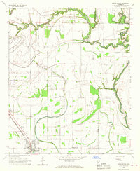
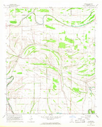
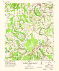 1961 Mossy Lake1962 Print · USGSLeflore County's intricate Delta wetlands and river bends are captured here in the early sixties, showing a landscape of scattered settlements and rural churches. Researchers can trace the Columbus and Greenville rail line through Itta Bena or locate local landmarks like McIntyre Cem and the Indian Mound.3 unique versions available
 - 1961 Map of Schlater, 1963 Print
 1961 Schlater1963 Print · USGSLeflore County in the early sixties is a landscape of river bends and rail lines before the modern era of consolidation. Genealogists can trace family roots through numerous delta landmarks like Mississippi Vocational College, Shiloh Cem, and Itta Bena.2 unique versions available
 - 1962 Map of Sumner, 1965 Print
 1962 Sumner1965 Print · USGSThe Mississippi Delta in the early sixties remains a landscape of bayous and rails, centered on the Tallahatchie River and its cut-offs. Genealogists can trace family roots through numerous local landmarks like Parchman, Glendora, and the Frierson Chapel.2 unique versions available
 - 1965 Map of Inverness, 1966 Print
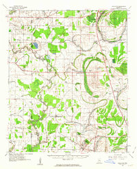
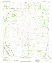
 1965 Inverness1966 Print · USGSThe rail-and-bayou landscape of Sunflower County in the mid-1960s centers on the towns of Inverness and Isola. Genealogists and local historians can locate many rural landmarks like Hickory Grove Cem, Bowles, and the St Lawrence Ch.
 - 1965 Map of Indianola, 1966 Print
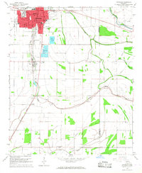
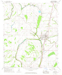
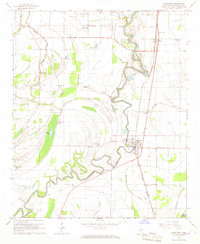
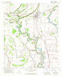
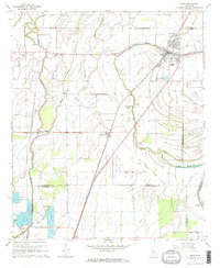
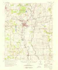
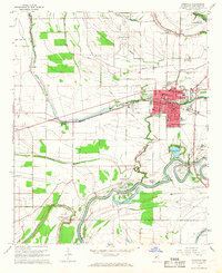 1965 Indianola1966 Print · USGSSunflower County's fertile delta landscape is captured here in the mid-sixties as the town of Indianola expanded near the Big Sunflower River. Genealogists and local historians can trace rural landmarks from the Indian Mound to several country churches like Mt Moriah Ch and Saints Rest Ch.
 - 1965 Map of Kinlock, 1966 Print
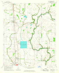
 1965 Kinlock1966 Print · USGSThe Mississippi Delta's river-driven landscape is captured here in the mid-sixties, centering on the curves of the Big Sunflower River. Genealogists and historians can trace family-named estates like Waco Plantation and local landmarks like Big Morning Star Ch.
 - 1966 Map of Merigold, 1967 Print
 1966 Merigold1967 Print · USGSThe Bolivar County plantation lands of the mid-1960s are captured here along the Illinois Central rail line. Genealogists and local historians can trace family landmarks like Jerusalem Ch, Smith Cem, and the prominent Indian Mound.
 - 1966 Map of Cleveland, 1967 Print
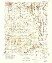
 1966 Cleveland1967 Print · USGSCleveland and the Bolivar County delta appear here in the mid-sixties, dominated by the campus of Delta State College and the Illinois Central rail lines. Genealogists can locate family landmarks such as Chrisman Cem, Delta Heights Memorial Gardens, and the rural New Salem Ch.2 unique versions available
 - 1966 Map of Drew, 1967 Print
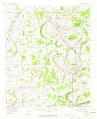
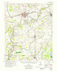
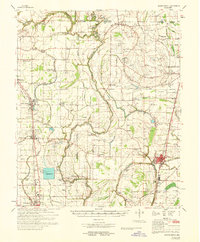
 1966 Drew1967 Print · USGSThe heart of Sunflower County in the mid-1960s is centered on the railroad town of Drew and its surrounding Delta bayous. Researchers can trace the footprints of old schools and churches like Hunter High Sch, Turner Chapel, and James Sch alongside the Illinois Central tracks.2 unique versions available
 - 1966 Map of Sunflower, 1967 Print
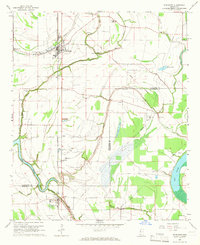
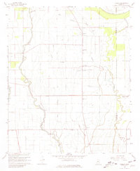
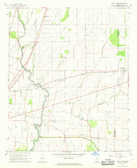
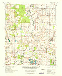
 1966 Sunflower1967 Print · USGSSunflower County during the mid-1960s shows a landscape deeply tied to the Big Sunflower River and the Illinois Central railroad. Researchers can trace rural church communities like McKinney Chapel and old settlements at Blaine and Pentecost.
 - 1966 Map of Ruleville, 1967 Print
 1966 Ruleville1967 Print · USGSMid-century Sunflower County life is centered here along the Big Sunflower River and the busy Illinois Central rail line. Genealogists and local historians can trace rural roots through the many local landmarks, including Hillhouse Cem, the settlement of Dockery, and Walker Chapel.2 unique versions available
 - 1966 Map of Baltzer, 1967 Print
 1966 Baltzer1967 Print · USGSThe Mississippi Delta in the mid-sixties reveals a landscape centered on the State Penal Farm and its numbered camps. Genealogists and historians can trace old community hubs like Lombardy, Fitzhugh, and Goldfield Plantation along the Illinois Central tracks.
 - 1966 Map of Mound Bayou, 1967 Print
 1966 Mound Bayou1967 Print · USGSMississippi Delta life in the mid-sixties centers on the historic town of Mound Bayou and the Illinois Central tracks. Trace a landscape of country churches and cemeteries like Bradford Chapel, Wander Home Ch, and New Hope Cem.2 unique versions available
 - 1967 Map of Baird
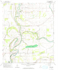
 1967 Baird1967 Print · USGSThe Mississippi Delta's rail-and-river economy is on full display in the late 1960s, centered on the crossing of major lines at Indianola. Locate ancestral sites like Woodburn Plantation or country churches including Union Star Ch and Indian Bayou Ch.
 - 1967 Map of Tribbett, 1968 Print
 1967 Tribbett1968 Print · USGSThe Mississippi Delta's agricultural heartland is captured here in the late sixties, showing a landscape defined by its bayous and sloughs. Genealogists and local historians can trace family-named landmarks and rural congregations like Mt Zion Ch, Bourbon, and the Indian Mounds near Sixmile Bayou.2 unique versions available
 - 1967 Map of Boyer, 1968 Print
 1967 Boyer1968 Print · USGSThe rural Mississippi Delta comes into focus in the late sixties, showing a landscape defined by bayous and scattered tenant farming communities. Genealogists can locate family landmarks such as Mt Zion Center Ch, Shackelford Lake, and Mt Calvary Cem.2 unique versions available
 - 1967 Map of Shaw, 1968 Print
 1967 Shaw1968 Print · USGSThe Mississippi Delta's agricultural heartland is captured here in the late sixties, centered on the railroad town of Shaw. Genealogists and historians can trace the Old Indian Treaty Boundary and locate rural landmarks like Strangers Rest Cem and Choctaw.2 unique versions available
 - 1967 Map of Holly Ridge, 1968 Print
 1967 Holly Ridge1968 Print · USGSThe Mississippi Delta in the late sixties reveals a landscape of winding bayous and railroad-adjacent settlements. Genealogists can locate family landmarks like Jones Cem, Old Whitestone Ch, and the rural community of Rexburg.2 unique versions available
 - 1968 Map of Cleveland
 1968 Cleveland1968 Print · USGSBolivar and Sunflower counties are captured here in the late sixties, showing the intricate water and rail networks of the Mississippi Delta. Genealogists and local researchers can locate numerous community landmarks, including True Light Ch, Hillhouse Cem, and the small siding at O'Reilly.
 - 1968 Map of Mound Bayou
 1968 Mound Bayou1968 Print · USGSThe Mississippi Delta's historic settlements and expansive agricultural lands are detailed here during the late sixties. Researchers can trace family roots through dozens of local landmarks like Mound Bayou, Indian Mounds, and the State Penal Farm.
 - 1969 Map of Tralake
 1969 Tralake1969 Print · USGSWashington and Sunflower Counties in the late sixties reveal a landscape of deep-rooted agriculture and small rail-stop communities. Genealogists can trace family landmarks and rural congregations at Greenlawn Memorial Gardens, St Johns Chapel, and the settlement of Bourbon.
 - 1969 Map of Choctaw
 1969 Choctaw1969 Print · USGSBolivar County at the end of the 1960s reveals a Delta landscape shaped by complex bayou drainage and a dense network of country churches. Researchers can trace family sites near Stringtown and Meltonia or locate landmarks like the Gospel Temple and Indian Mound 26.
End of results
Showing maps 1-22 of 22
Top cities of Sunflower County
- Indianola historical maps
- Ruleville historical maps
- Moorhead historical maps
- Drew historical maps
- Inverness historical maps
- Sunflower historical maps
See more
Frequently asked questions
- What are the different types of historical maps available for Sunflower County?
- What is the oldest map of Sunflower County?
- Where can I purchase historical maps of Sunflower County for my home or office?
- Where can I download high-res historical maps of Sunflower County?
- Are there historical topographic maps available for Sunflower County?
- Is there historical aerial imagery available for Sunflower County?
- Where are historical maps of Sunflower County sourced from?