Old Maps of Sunflower County, Mississippi for Genealogy
Trace your family roots with 155 historic maps of Sunflower County. These high-res maps reveal old neighborhoods, homesites, landmarks, and streets — helping you uncover where your ancestors lived and how the area evolved over time.
- Explore historic neighborhoods: Identify where your relatives may have lived in the 1800s or 1900s.
- Compare maps over time: Trace the changes in streets, buildings, and landmarks for multi-generational research.
- Perfect for genealogy & ancestry research: Used by family historians and researchers to map out lineage and migration.
These maps are an incredible resource for exploring your personal connection to Sunflower County's past.
Sunflower County, MS maps
(155)- 1931 Map of Schlater
 1931 Schlater1931 Print · USGSThe Mississippi Delta's complex network of bayous and winding river bends is captured in the early 1930s. Genealogists can trace hundreds of family and community landmarks, from the Rosenwald Sch to small congregations like Thankful Ch and Harts Chapel.
 - 1931 Map of Sumner
 1931 Sumner1931 Print · USGSTallahatchie County in the early thirties is captured here as a landscape of cotton fields and bayous connected by the Yazoo and Mississippi Valley Railroad. Researchers can locate community centers like Glendora and Sumner, or trace family ties to the Brooks-Rosenwald Sch and Indian Mounds.4 unique versions available
 - 1931 Map of Drew
 1931 Drew1931 Print · USGSSunflower County's agricultural and social landscape is meticulously detailed in the early 1930s, centering on the communities of Mound Bayou and Drew. Researchers can trace the layout of the State Penitentiary Reservation and numerous country churches like Beautiful Star Ch and Shady Grove Ch.
 - 1934 Map of Cleveland
 1934 Cleveland1934 Print · USGSThe Mississippi Delta in the early thirties was a bustling landscape of rail-connected plantation towns and rural schools. Genealogists can trace family roots through numerous sites like Boyer Cem, the Doddsville Industrial Institute, and the historic Dockery community.2 unique versions available
 - 1934 Map of Schlater
 1934 Schlater1934 Print · USGSThe Mississippi Delta's winding bayous and rail towns are captured here in the early 1930s, showing a landscape of intense riverfront settlement. Genealogists can trace family-named sites across the floodplains, from Schlater and Sunnyside to the Rosenwald Sch and Rock of Ages Ch.2 unique versions available
 - 1935 Map of Sumner
 1935 Sumner1935 Print · USGSThe Mississippi Delta's intricate river bends and rail towns are captured here in the mid-1930s. Family historians can trace numerous rural sites like Brooks Rosenwald Sch, the State Reservation at Parchman, and the town of Glendora.2 unique versions available
 - 1935 Map of Mound Bayou
 1935 Mound Bayou1935 Print · USGSThe Mississippi Delta's agricultural and social landscape is captured here in the mid-1930s as local communities thrived along the rail lines. Genealogists can locate family landmarks like Pilgrims Rest Ch or trace the extensive camp system of the State Reservation.2 unique versions available
 - 1939 Map of Schlater, 1941 Print
 1939 Schlater1941 Print · USGSThe Mississippi Delta's intricate network of bayous and agricultural communities is captured here in the late 1930s. Genealogists can trace family roots through numerous local landmarks like Rosenwald Sch, Mile Tabernacle, and Rock of Ages Ch.
 - 1939 Map of Sumner, 1943 Print
 1939 Sumner1943 Print · USGSTallahatchie County in the late thirties is a landscape of winding river bends and Delta rail towns like Sumner and Glendora. Genealogists and historians can trace numerous rural landmarks, including the Brooks Rosenwald Sch and the ancient Indian Mounds.
 - 1939 Map of Tralake, 1964 Print
 1939 Tralake1964 Print · USGSWashington County in the late 1930s shows a landscape of intensive Delta farming and rail-side commerce. Researchers can trace family roots through numerous local churches like St Marys Ch and St James Ch or locate forgotten stops like Aldridge and Burdett.
 - 1939 Map of Choctaw, 1965 Print
 1939 Choctaw1965 Print · USGSBolivar County and Washington County are captured here at the end of the 1930s, showing a Delta landscape transformed by drainage canals and rail. You can trace early twentieth-century settlement patterns through landmarks like Mt Olive Ch, the Illinois Central Railroad corridor, and the community at Shaw.
 - 1940 Map of Baird, 1942 Print
 1940 Baird1942 Print · USGSThe Mississippi Delta's intricate river and rail economy is on full display during the early 1940s. Genealogists and historians can trace family roots through specific landmarks like Price School, Heard Ferry, and the many small settlements like Baird and Inverness.
 - 1940 Map of Cleveland, 1946 Print
 1940 Cleveland1946 Print · USGSBolivar and Sunflower counties are seen here in the early 1940s, as the delta landscape was being transformed by major flood control projects. Genealogists can trace family roots through numerous local landmarks like Boyer Cem, Hannahs Bridge, and the Doddsville Industrial Institute.
 - 1953 Map of Greenwood, 1966 Print
 1953 Greenwood1966 Print · USGSThe Mississippi Delta in the mid-fifties is captured here as a thriving network of river towns, railroads, and oxbow lakes. Researchers can trace the legacy of the Illinois Central Railroad and locate landmarks like the State Penal Farm and Greenville Air Force Base.5 unique versions available
 - 1956 Map of Greenwood
 1956 Greenwood1956 Print · USGSThe Mississippi Delta in the mid-fifties is captured here during a period of significant military and agricultural activity. Researchers can trace the rail lines of the Illinois Central RR, find the Greenville Air Force Base, or locate the State Penal Farm.
 - 1961 Map of Mossy Lake, 1962 Print
 1961 Mossy Lake1962 Print · USGSLeflore County's intricate Delta wetlands and river bends are captured here in the early sixties, showing a landscape of scattered settlements and rural churches. Researchers can trace the Columbus and Greenville rail line through Itta Bena or locate local landmarks like McIntyre Cem and the Indian Mound.3 unique versions available
 - 1961 Map of Schlater, 1963 Print
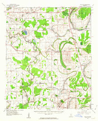 1961 Schlater1963 Print · USGSLeflore County in the early sixties is a landscape of river bends and rail lines before the modern era of consolidation. Genealogists can trace family roots through numerous delta landmarks like Mississippi Vocational College, Shiloh Cem, and Itta Bena.2 unique versions available
 - 1962 Map of Sumner, 1965 Print
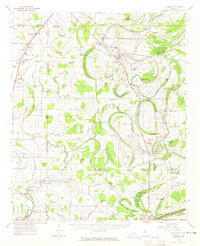 1962 Sumner1965 Print · USGSThe Mississippi Delta in the early sixties remains a landscape of bayous and rails, centered on the Tallahatchie River and its cut-offs. Genealogists can trace family roots through numerous local landmarks like Parchman, Glendora, and the Frierson Chapel.2 unique versions available
 - 1965 Map of Inverness, 1966 Print
 1965 Inverness1966 Print · USGSThe rail-and-bayou landscape of Sunflower County in the mid-1960s centers on the towns of Inverness and Isola. Genealogists and local historians can locate many rural landmarks like Hickory Grove Cem, Bowles, and the St Lawrence Ch.
 - 1965 Map of Indianola, 1966 Print
 1965 Indianola1966 Print · USGSSunflower County's fertile delta landscape is captured here in the mid-sixties as the town of Indianola expanded near the Big Sunflower River. Genealogists and local historians can trace rural landmarks from the Indian Mound to several country churches like Mt Moriah Ch and Saints Rest Ch.
 - 1965 Map of Kinlock, 1966 Print
 1965 Kinlock1966 Print · USGSThe Mississippi Delta's river-driven landscape is captured here in the mid-sixties, centering on the curves of the Big Sunflower River. Genealogists and historians can trace family-named estates like Waco Plantation and local landmarks like Big Morning Star Ch.
 - 1966 Map of Merigold, 1967 Print
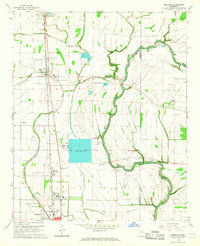 1966 Merigold1967 Print · USGSThe Bolivar County plantation lands of the mid-1960s are captured here along the Illinois Central rail line. Genealogists and local historians can trace family landmarks like Jerusalem Ch, Smith Cem, and the prominent Indian Mound.
 - 1966 Map of Cleveland, 1967 Print
 1966 Cleveland1967 Print · USGSCleveland and the Bolivar County delta appear here in the mid-sixties, dominated by the campus of Delta State College and the Illinois Central rail lines. Genealogists can locate family landmarks such as Chrisman Cem, Delta Heights Memorial Gardens, and the rural New Salem Ch.2 unique versions available
 - 1966 Map of Drew, 1967 Print
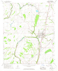 1966 Drew1967 Print · USGSThe heart of Sunflower County in the mid-1960s is centered on the railroad town of Drew and its surrounding Delta bayous. Researchers can trace the footprints of old schools and churches like Hunter High Sch, Turner Chapel, and James Sch alongside the Illinois Central tracks.2 unique versions available
 - 1966 Map of Sunflower, 1967 Print
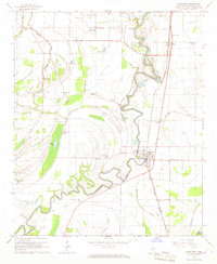 1966 Sunflower1967 Print · USGSSunflower County during the mid-1960s shows a landscape deeply tied to the Big Sunflower River and the Illinois Central railroad. Researchers can trace rural church communities like McKinney Chapel and old settlements at Blaine and Pentecost.
Showing maps 1-25 of 155
Top cities of Sunflower County
- Indianola historical maps
- Ruleville historical maps
- Moorhead historical maps
- Drew historical maps
- Inverness historical maps
- Sunflower historical maps
See more
Frequently asked questions
- What are the different types of historical maps available for Sunflower County?
- What is the oldest map of Sunflower County?
- Where can I purchase historical maps of Sunflower County for my home or office?
- Where can I download high-res historical maps of Sunflower County?
- Are there historical topographic maps available for Sunflower County?
- Is there historical aerial imagery available for Sunflower County?
- Where are historical maps of Sunflower County sourced from?