1950s Maps of Tallahatchie County, Mississippi
Explore 13 historic maps of Tallahatchie County from the 1950s. These maps offer a rare glimpse into what life looked like during the 1950s — showing old roads, neighborhoods, homes, and landmarks that have changed or disappeared over time.
Whether you're researching your family's past, planning a metal detecting trip, or studying how Tallahatchie County's landscape evolved across the 1950s, these high-resolution maps are a powerful tool for exploring the history of this region.
- Focus on a specific era: All maps on this page are from the 1950s, giving you a focused view of this time period.
- See what’s changed: Compare century-old streets, trails, and buildings to today's modern landscape using overlays and satellite layers.
- Research with precision: Use these maps for genealogy, historical research, land use analysis, or educational projects.
- View, download, or print: Maps are fully viewable online in high resolution, and can be downloaded or printed for your own records.
Start exploring Tallahatchie County's history through authentic maps from the 1950s. This is your window into the past.
Tallahatchie County, MS maps
(13)- 1950 Map of Helena
 1950 Helena1950 Print · USGSMid-century Phillips County and the surrounding Delta region are shown at a peak of rail and river commerce. Genealogists and historians can trace family locations through numerous rural communities like Old Austin, Cotton Plant, and West Helena, or follow the routes of the Missouri Pacific RR across Grand Prairie.2 unique versions available
 - 1953 Map of Greenwood, 1966 Print
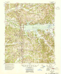
 1953 Greenwood1966 Print · USGSThe Mississippi Delta in the mid-fifties is captured here as a thriving network of river towns, railroads, and oxbow lakes. Researchers can trace the legacy of the Illinois Central Railroad and locate landmarks like the State Penal Farm and Greenville Air Force Base.5 unique versions available
 - 1953 Map of West Point, 1973 Print
 1953 West Point1973 Print · USGSNorth-Central Mississippi and the Alabama borderlands are captured here during the mid-twentieth century as new reservoirs and national forests transformed the landscape. Researchers can trace the path of the Mississippi & Skuna Valley railroad or locate old landings along the Tombigbee River and Schooner Creek.3 unique versions available
 - 1954 Map of Grenada
 1954 Grenada1954 Print · USGSGrenada and the surrounding hills are captured here just as the river valley was transformed by the reservoir. Genealogists can locate family sites like Preston Sch & Ch, Barksdale Cem, and the railroad community of Dubard.2 unique versions available
 - 1954 Map of Oakland
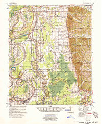
 1954 Oakland1954 Print · USGSThe Enid Lake area and the Yocona River valley are captured in the mid-1950s as flood control projects reshaped the Mississippi landscape. Researchers can trace rural lineages through dozens of sites like Mount Pisgah Ch & Cem and Spring Hill Sch & Cem.3 unique versions available
 - 1955 Map of Helena, 1967 Print
 1955 Helena1967 Print · USGSThe Arkansas Delta and Mississippi floodplains are captured here in the mid-fifties, during a period of expanding flood control and rail commerce. Researchers can trace the extensive Chicago Rock Island and Pacific RR lines and locate sites like the Arkansas State College Experimental Rice Farm or Friars Point.2 unique versions available
 - 1956 Map of Greenwood
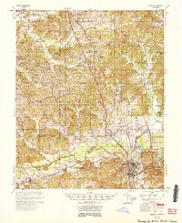
 1956 Greenwood1956 Print · USGSThe Mississippi Delta in the mid-fifties is captured here during a period of significant military and agricultural activity. Researchers can trace the rail lines of the Illinois Central RR, find the Greenville Air Force Base, or locate the State Penal Farm.
 - 1956 Map of Tupelo, 1967 Print
 1956 Tupelo1967 Print · USGSNortheast Mississippi and parts of Tennessee and Alabama are shown here during the mid-fifties, a time of major reservoir construction and forestry management. Researchers can trace the St Louis-San Francisco RR through Tupelo or locate historic sites like Tishomingo State Park and the University.2 unique versions available
 - 1957 Map of Philipp
 1957 Philipp1957 Print · USGSThe Tallahatchie River basin in the mid-fifties is a landscape of river cut-offs and rural crossroads settlements. Genealogists can trace family roots at St. Paul Sch Ch & Cem, Philipp, and the Needmore Cem along the Illinois Central line.3 unique versions available
 - 1957 Map of Greenwood
 1957 Greenwood1957 Print · USGSThe Mississippi Delta in the late fifties shows a landscape of river-bend settlements and extensive rail networks. Genealogists can trace family roots at Little Zion Ch & Cem, Money, and the many rural churches like Lanes Chapel or Evergreen Ch.3 unique versions available
 - 1958 Map of Tupelo
 1958 Tupelo1958 Print · USGSNortheast Mississippi and neighboring Alabama and Tennessee appear here during the late fifties as a region defined by new reservoirs and historic rail lines. Genealogists can trace family locations near Sardis Lake, Woodall Mountain, and the St Louis-San Francisco Ry.
 - 1958 Map of West Point
 1958 West Point1958 Print · USGSNortheastern Mississippi and western Alabama are shown in the late 1950s, highlighting a region defined by its river-and-rail economy. Researchers can trace family roots through numerous settlements like Artesia and Vardaman or explore the corridor of the Tombigbee River.
 - 1959 Map of Helena
 1959 Helena1959 Print · USGSThe Arkansas and Mississippi Delta regions are captured here in the late fifties, showing a landscape defined by the Mississippi River and the Grand Prairie. Genealogists and researchers can trace the rail networks of the Illinois Central RR and locate community landmarks like Helena and the White River National Wildlife Refuge.
End of results
Showing maps 1-13 of 13
Top cities of Tallahatchie County
- Charleston historical maps
- Tutwiler historical maps
- Webb historical maps
- Sumner historical maps
- Glendora historical maps
Frequently asked questions
- What are the different types of historical maps available for Tallahatchie County?
- What is the oldest map of Tallahatchie County?
- Where can I purchase historical maps of Tallahatchie County for my home or office?
- Where can I download high-res historical maps of Tallahatchie County?
- Are there historical topographic maps available for Tallahatchie County?
- Is there historical aerial imagery available for Tallahatchie County?
- Where are historical maps of Tallahatchie County sourced from?