1980s Maps of Tate County, Mississippi
Explore 14 historic maps of Tate County from the 1980s. These maps offer a rare glimpse into what life looked like during the 1980s — showing old roads, neighborhoods, homes, and landmarks that have changed or disappeared over time.
Whether you're researching your family's past, planning a metal detecting trip, or studying how Tate County's landscape evolved across the 1980s, these high-resolution maps are a powerful tool for exploring the history of this region.
- Focus on a specific era: All maps on this page are from the 1980s, giving you a focused view of this time period.
- See what’s changed: Compare century-old streets, trails, and buildings to today's modern landscape using overlays and satellite layers.
- Research with precision: Use these maps for genealogy, historical research, land use analysis, or educational projects.
- View, download, or print: Maps are fully viewable online in high resolution, and can be downloaded or printed for your own records.
Start exploring Tate County's history through authentic maps from the 1980s. This is your window into the past.
Tate County, MS maps
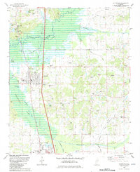
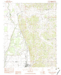
(14)- 1982 Map of Senatobia
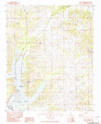
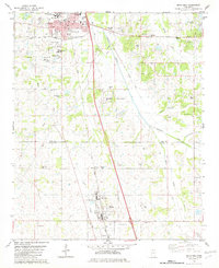 1982 Senatobia1982 Print · USGSNorthwest Mississippi in the early 1980s shows a landscape of growing towns and deep-rooted community landmarks. Genealogists and historians can trace family locations near Bethesda Cem, Oldham Cem, and the Illinois Central Gulf rail line.
 - 1982 Map of Looxahoma
 1982 Looxahoma1982 Print · USGSLooxahoma and the Tate-Panola county line are captured here in the late seventies and early eighties. Genealogists and local historians can trace family sites like Looxahoma Cem, Mt Moriah Ch, and the high-point Glenville Lookout Tower.
 - 1982 Map of Banks
 1982 Banks1982 Print · USGSDe Soto County in the early eighties shows the striking transition from the Mississippi Delta lowlands to the rolling hill country. Genealogists and researchers can trace local settlements like Banks and Eudora, or locate landmarks such as Lake O' The Hills and Trinity.2 unique versions available
 - 1982 Map of Coldwater
 1982 Coldwater1982 Print · USGSNorthwest Mississippi at the start of the eighties shows a landscape of growing towns and significant water management. Genealogists and local researchers can trace family lines through numerous rural sites like Scotland Cem, Faith Chapel Deans Cem, and the area surrounding Northwest Mississippi Junior College.
 - 1982 Map of Frees Corners
 1982 Frees Corners1982 Print · USGSDeSoto County's reservoir landscape is captured here in the early 1980s, centered on the northern reaches of the Arkabutla Lake. Local historians can trace rural settlements like Frees Corners, Pleasant Hill, and the outlying edges of Hernando.2 unique versions available
 - 1982 Map of Independence
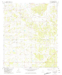
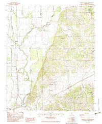
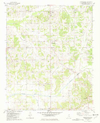 1982 Independence1982 Print · USGSTate County in the early eighties was a landscape of small crossroads settlements and rural family churches. Genealogists and local historians can trace legacy sites like Thyatira, Sandridge Cem, and the historic Independence Ch of Christ.
 - 1982 Map of Hernando
 1982 Hernando1982 Print · USGSNorthern Mississippi's landscape in the early eighties centers on the growth of Hernando and the surrounding rural communities. Genealogists and researchers can trace local landmarks and waterways from Bright to Love, including the shores of Arkabutla Lake.2 unique versions available
 - 1982 Map of Lewisburg, 1983 Print
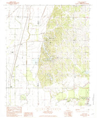
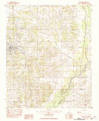
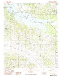
 1982 Lewisburg1983 Print · USGSDe Soto and Tate counties appear here in the early eighties as a landscape of rural crossroads and river valleys. Genealogists can trace family footprints near Lewisburg, the water-powered legacy of Ingrams Mill, and the small settlement of Alphaba.
 - 1983 Map of Crenshaw North
 1983 Crenshaw North1983 Print · USGSIn the early 1980s, the Mississippi Delta's rail and river networks remained central to life in Tate and Panola counties. Genealogists can trace family footprints around Strayhorn, Sarah, and Crenshaw, or locate rural landmarks like Harmony Cem and Spring Hill Ch.
 - 1983 Map of Arkabutla West
 1983 Arkabutla West1983 Print · USGSNorthwest Mississippi in the early eighties shows a landscape of river-bottom bayous and upland churches as the Coldwater River flows through Tate and Tunica counties. Researchers can locate the Illinois Central Gulf rail line, Mid-South College, and family landmarks like St Maryland Ch and Arkabutla Cem.
 - 1983 Map of Arkabutla East
 1983 Arkabutla East1983 Print · USGSTate and De Soto Counties are shown in the early eighties as the waters of Arkabutla Lake defined the local landscape. Researchers can find numerous rural landmarks and family-history sites like St Peter Ch, Sweet Grove Ch, and the settlement of Arkabutla.
 - 1983 Map of Longtown
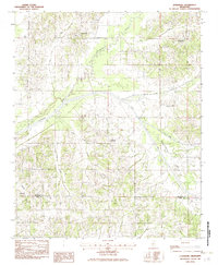
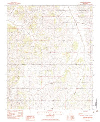 1983 Longtown1983 Print · USGSThe rural border of Panola and Tate counties comes into focus during the early eighties, showing a landscape defined by small farming communities. Researchers can trace family roots through landmarks like Longtown, Salem Cem, and Hopewell Ch.
 - 1984 Map of Tupelo
 1984 Tupelo1984 Print · USGSNorth Mississippi in the 1980s is defined by its massive river basin reservoirs and the growing regional hubs of Tupelo and Oxford. Researchers can trace the legacy of the Pontotoc Ridge, find the University of Mississippi, and map early Interstate corridors near Sardis Lake.3 unique versions available
 - 1984 Map of Helena, 1985 Print
 1984 Helena1985 Print · USGSThe Delta landscape of Arkansas and Mississippi comes to life in this mid-eighties survey of river bends and ridge settlements. Researchers can trace the rail-and-river economy through Missouri Pacific lines and local landmarks like Whiskey Island or Marianna.
End of results
Showing maps 1-14 of 14
Top cities of Tate County
Frequently asked questions
- What are the different types of historical maps available for Tate County?
- What is the oldest map of Tate County?
- Where can I purchase historical maps of Tate County for my home or office?
- Where can I download high-res historical maps of Tate County?
- Are there historical topographic maps available for Tate County?
- Is there historical aerial imagery available for Tate County?
- Where are historical maps of Tate County sourced from?