Old Maps of Tate County, Mississippi for Metal Detecting
Plan your next treasure hunt with 112 historic maps of Tate County. Find old homesites, ghost towns, trails, and gathering spots that may be lost to time — perfect for identifying promising metal detecting locations.
- Locate forgotten sites: Uncover places like long-lost settlements, abandoned rail lines, or gathering spots.
- Plan better hunts: Use map overlays combined with LiDAR or satellite views to narrow in on historically rich areas.
- Made for detectorists: Thousands of hobbyists use these maps to discover relics, coins, and hidden history.
Use these historic maps to boost your research and find new opportunities beneath the surface of Tate County.
Tate County, MS maps
(112)- 1932 Map of Horn Lake
 1932 Horn Lake1932 Print · USGSNorthwest Mississippi and the river border come alive in the 1930s as the rail lines and river landings shaped local life. Genealogists can trace family footprints at Howards Store, Bynums Chapel, and Sunrise Sch and Ch near the banks of Horn Lake.3 unique versions available
 - 1932 Map of Crenshaw, 1964 Print
 1932 Crenshaw1964 Print · USGSNorthwest Mississippi in the early thirties reveals a complex network of Delta bayous and hill-country settlements. Genealogists can trace family roots through dozens of rural landmarks, from Cottonville Store to Brooks Chapel and the Longtown Sch.
 - 1935 Map of Crenshaw
 1935 Crenshaw1935 Print · USGSNorthwest Mississippi in the mid-thirties was a landscape of intricate bayous and thriving rural communities tied to the rail and river. Genealogists can trace family roots through numerous local landmarks like Cottonville Store, New Salem Ch, and Spring Hill Sch.2 unique versions available
 - 1935 Map of Horn Lake
 1935 Horn Lake1935 Print · USGSThe Mississippi Delta and Tennessee borderlands meet here in the mid-1930s, showing a landscape of bluff-top farms and river-bottom bayous. Genealogists can trace family roots through dozens of local landmarks like Morning Star Ch, Eudora, and Sunrise Sch.2 unique versions available
 - 1944 Map of Senatobia, 1946 Print
 1944 Senatobia1946 Print · USGSNorthwest Mississippi at the end of the war reveals a landscape of rural school-churches and new reservoirs. Genealogists can trace family roots at the Wright Fam Cem, Lashures Sch & Cem, or the Bethlehem African Ch near the Illinois Central line.3 unique versions available
 - 1944 Map of Hernando, 1946 Print
 1944 Hernando1946 Print · USGSDeSoto County communities and the rising waters of the Arkabutla Reservoir are documented here in the mid-1940s. Genealogists can locate family landmarks like Betts Sch Ch & Cemetery, the Drain Family Cem, and old schools in Cockrum or Lewisburg.3 unique versions available
 - 1944 Map of Tyro, 1964 Print
 1944 Tyro1964 Print · USGSMississippi's hill country met a changing river landscape in the mid-1940s as the Sardis Reservoir took shape. Genealogists can trace hundreds of family landmarks, from Harmontown to local institutions like St Josephs Ch & Sch and Lammey Fam Cem.
 - 1948 Map of Helena
 1948 Helena1948 Print · USGSEastern Arkansas and the Mississippi Delta are captured here just after the war, showing a landscape defined by its great rivers and rail lines. Genealogists can trace family locations near Bemis Plantation, Helena, and smaller rail stops like Wheatley and Moro.
 - 1948 Map of Byhalia
 1948 Byhalia1948 Print · USGSMarshall County in the late 1940s is captured here as a thriving network of small settlements and rail-side towns. Genealogists and historians can trace family locations through numerous rural landmarks like Shelby Ch & Cem, Red Banks, and the Marshall Inst Ch.3 unique versions available
 - 1950 Map of Helena
 1950 Helena1950 Print · USGSMid-century Phillips County and the surrounding Delta region are shown at a peak of rail and river commerce. Genealogists and historians can trace family locations through numerous rural communities like Old Austin, Cotton Plant, and West Helena, or follow the routes of the Missouri Pacific RR across Grand Prairie.2 unique versions available
 - 1955 Map of Helena, 1967 Print
 1955 Helena1967 Print · USGSThe Arkansas Delta and Mississippi floodplains are captured here in the mid-fifties, during a period of expanding flood control and rail commerce. Researchers can trace the extensive Chicago Rock Island and Pacific RR lines and locate sites like the Arkansas State College Experimental Rice Farm or Friars Point.2 unique versions available
 - 1956 Map of Tupelo, 1967 Print
 1956 Tupelo1967 Print · USGSNortheast Mississippi and parts of Tennessee and Alabama are shown here during the mid-fifties, a time of major reservoir construction and forestry management. Researchers can trace the St Louis-San Francisco RR through Tupelo or locate historic sites like Tishomingo State Park and the University.2 unique versions available
 - 1958 Map of Tupelo
 1958 Tupelo1958 Print · USGSNortheast Mississippi and neighboring Alabama and Tennessee appear here during the late fifties as a region defined by new reservoirs and historic rail lines. Genealogists can trace family locations near Sardis Lake, Woodall Mountain, and the St Louis-San Francisco Ry.
 - 1959 Map of Helena
 1959 Helena1959 Print · USGSThe Arkansas and Mississippi Delta regions are captured here in the late fifties, showing a landscape defined by the Mississippi River and the Grand Prairie. Genealogists and researchers can trace the rail networks of the Illinois Central RR and locate community landmarks like Helena and the White River National Wildlife Refuge.
 - 1960 Map of Helena
 1960 Helena1960 Print · USGSThe Arkansas and Mississippi Delta regions meet along the great river bends during a period of significant agricultural and rail expansion. Genealogists and historians can trace the paths of the Missouri Pacific railroad through Clarendon or locate landings along the Mississippi River and White River.
 - 1961 Map of Horn Lake, 1978 Print
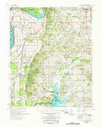 1961 Horn Lake1978 Print · USGSDeSoto County and the Mississippi River bottoms are captured here in the early sixties as rural life centered on the river and rail lines. Genealogists can locate family landmarks like Howard Plantation, Lakeside Cem, and numerous country churches like New Hope Ch.
 - 1963 Map of Crenshaw, 1965 Print
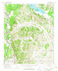 1963 Crenshaw1965 Print · USGSNorthwest Mississippi in the early sixties reveals a landscape of delta lowlands and upland reservoirs where the Illinois Central rail line connects small rural hubs. Genealogists can locate family landmarks like Brooks Chapel, Kelley's Crossing, and the small community of Strayhorn.
 - 1971 Map of Byhalia, 1973 Print
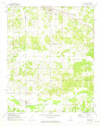 1971 Byhalia1973 Print · USGSByhalia and its rural surrounds in the early 1970s show a landscape of railroad-driven growth and traditional southern church communities. Local researchers can pinpoint family burial sites at Watkins Cem or trace the old rail corridor of the St Louis - San Francisco through Coal Oil Corner.
 - 1971 Map of Wyatte, 1973 Print
 1971 Wyatte1973 Print · USGSThe Marshall and Tate County borderlands come to life in the early 1970s, showcasing a network of rural settlements and crossroad communities. Trace family history through Wyatte, Chulahoma, and local landmarks like Jamieson Chapel or Grubb Hill Cem.2 unique versions available
 - 1971 Map of Tyro, 1973 Print
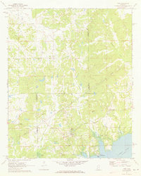 1971 Tyro1973 Print · USGSThe rural borderlands of Lafayette, Tate, and Marshall counties are captured here in the early 1970s before modern development altered these small communities. Researchers can trace family sites at Mt Patient Cem, Langstons Cem, and rural hubs like Harmontown and Tyro.2 unique versions available
 - 1975 Map of Senatobia SW, 1976 Print
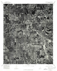 1975 Senatobia SW1976 Print · USGSPanola County agricultural life and small-town footprints are captured in this mid-seventies aerial survey. Genealogists and researchers can trace property lines and land use between the settlements of Senatobia, Como, and New Town.
 - 1975 Map of Senatobia NW, 1976 Print
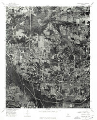 1975 Senatobia NW1976 Print · USGSNorthern Tate County comes into focus in the mid-1970s as a landscape of river bottoms and expanding towns. Trace the winding Coldwater River and early residential growth in Coldwater and Senatobia.
 - 1982 Map of Senatobia
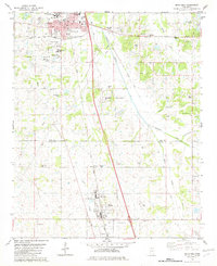 1982 Senatobia1982 Print · USGSNorthwest Mississippi in the early 1980s shows a landscape of growing towns and deep-rooted community landmarks. Genealogists and historians can trace family locations near Bethesda Cem, Oldham Cem, and the Illinois Central Gulf rail line.
 - 1982 Map of Looxahoma
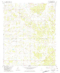 1982 Looxahoma1982 Print · USGSLooxahoma and the Tate-Panola county line are captured here in the late seventies and early eighties. Genealogists and local historians can trace family sites like Looxahoma Cem, Mt Moriah Ch, and the high-point Glenville Lookout Tower.
 - 1982 Map of Banks
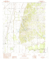 1982 Banks1982 Print · USGSDe Soto County in the early eighties shows the striking transition from the Mississippi Delta lowlands to the rolling hill country. Genealogists and researchers can trace local settlements like Banks and Eudora, or locate landmarks such as Lake O' The Hills and Trinity.2 unique versions available
Showing maps 1-25 of 112
Top cities of Tate County
Frequently asked questions
- What are the different types of historical maps available for Tate County?
- What is the oldest map of Tate County?
- Where can I purchase historical maps of Tate County for my home or office?
- Where can I download high-res historical maps of Tate County?
- Are there historical topographic maps available for Tate County?
- Is there historical aerial imagery available for Tate County?
- Where are historical maps of Tate County sourced from?