1960s Maps of Cletonia, Mississippi
Explore 2 historic maps of Cletonia from the 1960s. These maps offer a rare glimpse into what life looked like during the 1960s — showing old roads, neighborhoods, homes, and landmarks that have changed or disappeared over time.
Whether you're researching your family's past, planning a metal detecting trip, or studying how Cletonia's landscape evolved across the 1960s, these high-resolution maps are a powerful tool for exploring the history of this region.
- Focus on a specific era: All maps on this page are from the 1960s, giving you a focused view of this time period.
- See what’s changed: Compare century-old streets, trails, and buildings to today's modern landscape using overlays and satellite layers.
- Research with precision: Use these maps for genealogy, historical research, land use analysis, or educational projects.
- View, download, or print: Maps are fully viewable online in high resolution, and can be downloaded or printed for your own records.
Start exploring Cletonia's history through authentic maps from the 1960s. This is your window into the past.
Cletonia, MS maps
(2)- 1968 Map of Hollandale, 1969 Print
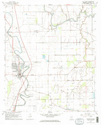 1968 Hollandale1969 Print · USGSThe Mississippi Delta landscape of the late sixties centers on the railroad town of Hollandale and its winding bayous. Researchers can trace family history through local sites like Simmons Sch and family-named cemeteries such as Magruder Cem.2 unique versions available
 - 1969 Map of Swan Lake
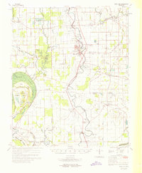 1969 Swan Lake1969 Print · USGSThe Mississippi Delta in the late sixties reveals a landscape of productive cotton fields and vital wetlands along Deer Creek. Genealogists can trace family names at Bellamy Cem, visit Simmons Sch, or locate the historic siding at Panther Burn.
End of results
Showing maps 1-2 of 2
Top cities near Cletonia
Frequently asked questions
- What are the different types of historical maps available for Cletonia?
- What is the oldest map of Cletonia?
- Where can I purchase historical maps of Cletonia for my home or office?
- Where can I download high-res historical maps of Cletonia?
- Are there historical topographic maps available for Cletonia?
- Is there historical aerial imagery available for Cletonia?
- Where are historical maps of Cletonia sourced from?