Old Maps of Ingrams, Mississippi for Genealogy
Trace your family roots with 12 historic maps of Ingrams. These high-res maps reveal old neighborhoods, homesites, landmarks, and streets — helping you uncover where your ancestors lived and how the area evolved over time.
- Explore historic neighborhoods: Identify where your relatives may have lived in the 1800s or 1900s.
- Compare maps over time: Trace the changes in streets, buildings, and landmarks for multi-generational research.
- Perfect for genealogy & ancestry research: Used by family historians and researchers to map out lineage and migration.
These maps are an incredible resource for exploring your personal connection to Ingrams's past.
Ingrams, MS maps
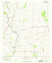
(12)- 1939 Map of Tralake, 1964 Print
 1939 Tralake1964 Print · USGSWashington County in the late 1930s shows a landscape of intensive Delta farming and rail-side commerce. Researchers can trace family roots through numerous local churches like St Marys Ch and St James Ch or locate forgotten stops like Aldridge and Burdett.
 - 1953 Map of Greenwood, 1966 Print
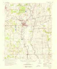
 1953 Greenwood1966 Print · USGSThe Mississippi Delta in the mid-fifties is captured here as a thriving network of river towns, railroads, and oxbow lakes. Researchers can trace the legacy of the Illinois Central Railroad and locate landmarks like the State Penal Farm and Greenville Air Force Base.5 unique versions available
 - 1956 Map of Greenwood
 1956 Greenwood1956 Print · USGSThe Mississippi Delta in the mid-fifties is captured here during a period of significant military and agricultural activity. Researchers can trace the rail lines of the Illinois Central RR, find the Greenville Air Force Base, or locate the State Penal Farm.
 - 1967 Map of Holly Ridge, 1968 Print
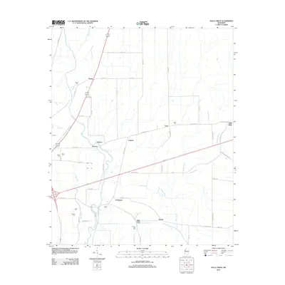
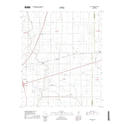
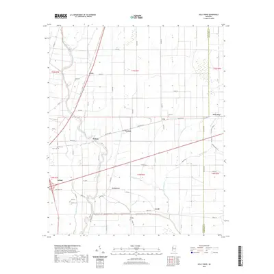
 1967 Holly Ridge1968 Print · USGSThe Mississippi Delta in the late sixties reveals a landscape of winding bayous and railroad-adjacent settlements. Genealogists can locate family landmarks like Jones Cem, Old Whitestone Ch, and the rural community of Rexburg.2 unique versions available
 - 1969 Map of Tralake
 1969 Tralake1969 Print · USGSWashington and Sunflower Counties in the late sixties reveal a landscape of deep-rooted agriculture and small rail-stop communities. Genealogists can trace family landmarks and rural congregations at Greenlawn Memorial Gardens, St Johns Chapel, and the settlement of Bourbon.
 - 1984 Map of Indianola, 1985 Print
 1984 Indianola1985 Print · USGSThe Mississippi Delta of the mid-1980s reveals a landscape of fertile bottomlands shaped by the Sunflower River and Yazoo River. Researchers can trace the rail-and-river economy through landmarks like Saints College, the Leflore Cemetery, and the Columbus and Greenville Railway.
 - 1994 Map of Indianola
 1994 Indianola1994 Print · USGSThe Mississippi Delta's rich agricultural heartland is documented here in the mid-1990s, showing a landscape defined by meandering rivers and rail lines. Genealogists and historians can trace family roots in rural settlements like Nitta Yuma and Midnight or locate the sprawling Yazoo National Wildlife Refuge.
 - 2012 Map of Holly Ridge, 2012 Print
 2012 Holly Ridge2012 Print · USGSCovers Ingrams, including Holly Ridge, Long, and other nearby areas
 - 2015 Map of Holly Ridge, 2015 Print
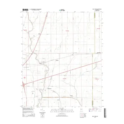 2015 Holly Ridge2015 Print · USGSCovers Ingrams, including Holly Ridge, Long, and other nearby areas
 - 2018 Map of Holly Ridge, 2018 Print
 2018 Holly Ridge2018 Print · USGSCovers Ingrams, including Holly Ridge, Long, and other nearby areas
 - 2020 Map of Holly Ridge, 2020 Print
 2020 Holly Ridge2020 Print · USGSCovers Ingrams, including Holly Ridge, Long, and other nearby areas
 - 2024 Map of Holly Ridge, 2024 Print
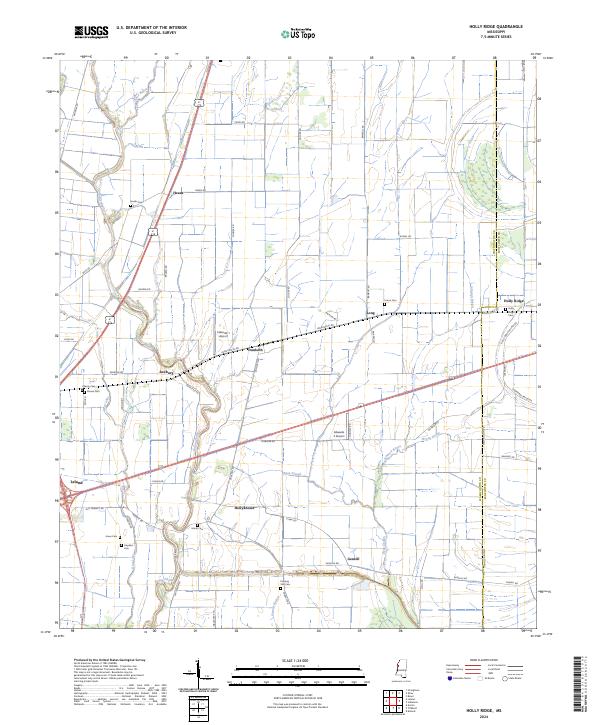 2024 Holly Ridge2024 Print · USGSThe Mississippi Delta near the Washington and Sunflower county line is shown here in the 2020s, dominated by wide-reaching agricultural plains and Bayou drainage. Genealogists can locate numerous local burial sites including Evening Star Cem and Union Cem, alongside established settlements like Dunleith and Holly Ridge.
End of results
Showing maps 1-12 of 12
Top cities near Ingrams
- Greenville historical maps
- Indianola historical maps
- Leland historical maps
- Shaw historical maps
- Metcalfe historical maps
- Benoit historical maps
See more
Frequently asked questions
- What are the different types of historical maps available for Ingrams?
- What is the oldest map of Ingrams?
- Where can I purchase historical maps of Ingrams for my home or office?
- Where can I download high-res historical maps of Ingrams?
- Are there historical topographic maps available for Ingrams?
- Is there historical aerial imagery available for Ingrams?
- Where are historical maps of Ingrams sourced from?