2000s (21st Century) Maps of Bruce Junction, Mississippi
Explore 6 historic maps of Bruce Junction from the 2000s (21st Century). These maps offer a rare glimpse into what life looked like during the 2000s — showing old roads, neighborhoods, homes, and landmarks that have changed or disappeared over time.
Whether you're researching your family's past, planning a metal detecting trip, or studying how Bruce Junction's landscape evolved across the 2000s, these high-resolution maps are a powerful tool for exploring the history of this region.
- Focus on a specific era: All maps on this page are from the 2000s, giving you a focused view of this time period.
- See what’s changed: Compare century-old streets, trails, and buildings to today's modern landscape using overlays and satellite layers.
- Research with precision: Use these maps for genealogy, historical research, land use analysis, or educational projects.
- View, download, or print: Maps are fully viewable online in high resolution, and can be downloaded or printed for your own records.
Start exploring Bruce Junction's history through authentic maps from the 2000s. This is your window into the past.
Bruce Junction, MS maps
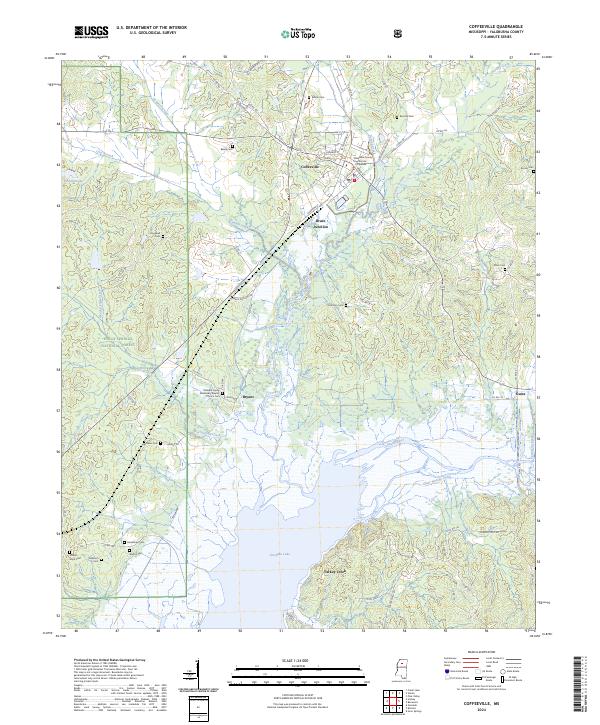
(6)- 2000 Map of Coffeeville, 2003 Print
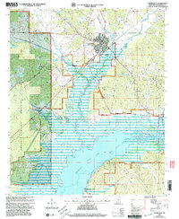 2000 Coffeeville2003 Print · USGSYalobusha County enters the twenty-first century with a landscape defined by the expansive Grenada Lake and the timbered reaches of the Holly Springs National Forest. Researchers can locate several family-named burial grounds and rural landmarks like the Yalobusha Lookout Tower, Bruce Junction, and Hopewell Ch.
 - 2012 Map of Coffeeville, 2012 Print
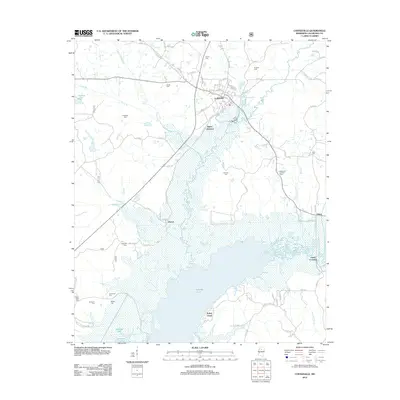 2012 Coffeeville2012 Print · USGSCovers Bruce Junction, including Coffeeville, Gums Crossing, and other nearby areas
 - 2015 Map of Coffeeville, 2015 Print
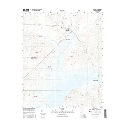 2015 Coffeeville2015 Print · USGSCovers Bruce Junction, including Coffeeville, Gums Crossing, and other nearby areas
 - 2018 Map of Coffeeville, 2018 Print
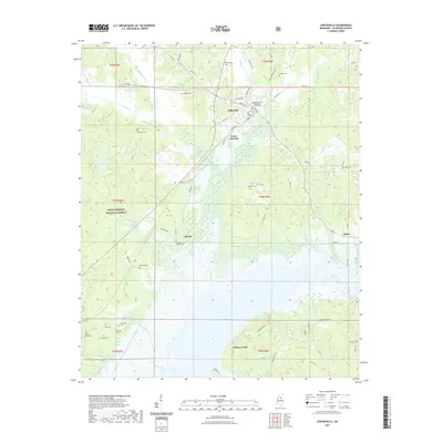
 2018 Coffeeville2018 Print · USGSCovers Bruce Junction, including Coffeeville, Gums Crossing, and other nearby areas
 - 2021 Map of Coffeeville, 2021 Print
 2021 Coffeeville2021 Print · USGSCovers Bruce Junction, including Coffeeville, Gums Crossing, and other nearby areas
 - 2024 Map of Coffeeville, 2024 Print
 2024 Coffeeville2024 Print · USGSCoffeeville and the surrounding Yalobusha County countryside appear in contemporary detail as the landscape meets the northern waters of the reservoir. Researchers can trace family history through numerous rural landmarks like Mount Myra Cem, Brooms Cem, and the Pleasant Grove Missionary Baptist Church.
End of results
Showing maps 1-6 of 6
Top cities near Bruce Junction
- Grenada historical maps
- Water Valley historical maps
- Coffeeville historical maps
- Oakland historical maps
Frequently asked questions
- What are the different types of historical maps available for Bruce Junction?
- What is the oldest map of Bruce Junction?
- Where can I purchase historical maps of Bruce Junction for my home or office?
- Where can I download high-res historical maps of Bruce Junction?
- Are there historical topographic maps available for Bruce Junction?
- Is there historical aerial imagery available for Bruce Junction?
- Where are historical maps of Bruce Junction sourced from?