1970s Maps of Buchanan County, Missouri
Explore 5 historic maps of Buchanan County from the 1970s. These maps offer a rare glimpse into what life looked like during the 1970s — showing old roads, neighborhoods, homes, and landmarks that have changed or disappeared over time.
Whether you're researching your family's past, planning a metal detecting trip, or studying how Buchanan County's landscape evolved across the 1970s, these high-resolution maps are a powerful tool for exploring the history of this region.
- Focus on a specific era: All maps on this page are from the 1970s, giving you a focused view of this time period.
- See what’s changed: Compare century-old streets, trails, and buildings to today's modern landscape using overlays and satellite layers.
- Research with precision: Use these maps for genealogy, historical research, land use analysis, or educational projects.
- View, download, or print: Maps are fully viewable online in high resolution, and can be downloaded or printed for your own records.
Start exploring Buchanan County's history through authentic maps from the 1970s. This is your window into the past.
Buchanan County, MO maps
(5)- 1971 Map of St. Joseph South, 1973 Print
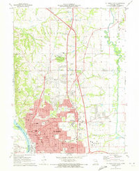
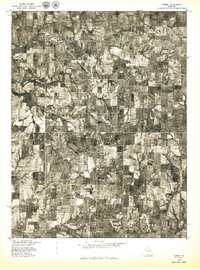
 1971 St. Joseph South1973 Print · USGSSouthern Buchanan County comes into focus in the early 1970s as the rail-and-river economy of St. Joseph meets the rural Missouri countryside. Genealogists and local historians can trace family roots at Old Sparta Cem and Mt Pleasant Cem, or locate landmarks like the Shackelford Landing Strip.3 unique versions available
 - 1971 Map of St. Joseph North, 1973 Print
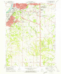
 1971 St. Joseph North1973 Print · USGSSt. Joseph and the surrounding Missouri River bluffs are shown in great detail during a period of significant suburban expansion in the early 1970s. Researchers can trace historic cemeteries like Mt Mora Cem and locate local landmarks such as Missouri Western College and Country Club Village.4 unique versions available
 - 1971 Map of Hemple, 1973 Print
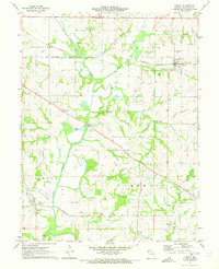
 1971 Hemple1973 Print · USGSClinton and Buchanan counties are captured here in the early 1970s, showcasing a landscape of established farmsteads and rural townships. Researchers can trace family roots at Mt Zion Ch, Keller Cem, and along the Burlington Northern line.
 - 1971 Map of Agency, 1973 Print
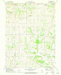
 1971 Agency1973 Print · USGSBuchanan County's agricultural and rail heartland is captured here in the early seventies as three major railroads crossed the fertile Platte River valley. Researchers can pinpoint historic family plots like Blakely Cem and trace the paths of the Burlington Northern through Easton.
 - 1978 Map of Gower
 1978 Gower1978 Print · USGSGower and the surrounding Missouri farmlands are captured in the late seventies, showing the region's agricultural layout and rural road network. Researchers can trace land boundaries near Grayson or follow the meandering course of Castile Creek and the Little Platte.
End of results
Showing maps 1-5 of 5
Top cities of Buchanan County
- Saint Joseph historical maps
- Agency historical maps
- Rushville historical maps
- De Kalb historical maps
- Faucett historical maps
- Easton historical maps
See more
Frequently asked questions
- What are the different types of historical maps available for Buchanan County?
- What is the oldest map of Buchanan County?
- Where can I purchase historical maps of Buchanan County for my home or office?
- Where can I download high-res historical maps of Buchanan County?
- Are there historical topographic maps available for Buchanan County?
- Is there historical aerial imagery available for Buchanan County?
- Where are historical maps of Buchanan County sourced from?