Old Maps of Agency, Missouri
Explore 19 old maps of Agency, spanning from 1925 to today. These high-resolution historic maps reveal how streets, neighborhoods, landmarks, and natural features evolved over time — perfect for genealogy, metal detecting, research, and local history exploration.
What you can do with these maps:
- See how Agency changed over time: Compare historical maps to modern-day views to trace roads, homesites, rail lines & more.
- View detailed metadata: Each map includes creators, publishers, year, scale, and archive source.
- Overlay maps with satellite & LiDAR: Visualize the past alongside modern tools to explore terrain & human change.
- Trusted historical sources: Maps sourced from the USGS, Library of Congress, and other archives.
- Access maps your way: View online, download high-res files, or order prints for personal or research use.
Start exploring old maps of Agency to uncover forgotten places, hidden landmarks, and the deep history beneath your feet.
Agency, MO maps
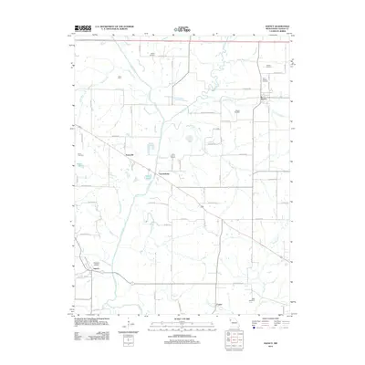
(19)- 1925 Map of Gower
 1925 Gower1925 Print · USGSClinton and Buchanan Counties at the mid-twenties are mapped here as a network of rail-side towns and small farm districts. Genealogists can locate dozens of rural landmarks like Matheys Mill, Blinkley Cem, and the many namesake schoolhouses such as Mc Gruhey School.3 unique versions available
 - 1927 Map of Dearborn
 1927 Dearborn1927 Print · USGSNorthwest Missouri thrived as a rail and river hub during the mid-twenties, where the industrial Stockyards of Saint Joseph gave way to a landscape of oxbow lakes. Genealogists can trace family roots through a dense network of rural landmarks, including New Market, De Kalb, and nearly two dozen local schools like Sleepy Hollow School.3 unique versions available
 - 1950 Map of Kansas City
 1950 Kansas City1950 Print · USGSMid-century Kansas and Missouri are captured here during a period of industrial growth and shifting transportation. Genealogists and historians can trace rail lines like the Wabash RR or locate ancestral homes near the Potawatomi Indian Reservation and Horton.
 - 1954 Map of Kansas City
 1954 Kansas City1954 Print · USGSThe Missouri-Kansas borderlands flourished in the post-war era as river commerce and rail networks converged at the Missouri River. Genealogists and historians can trace the foundations of Kansas City and smaller rural hubs like Hiawatha or Sabetha.
 - 1956 Map of Kansas City, 1967 Print
 1956 Kansas City1967 Print · USGSThe Kansas-Missouri border region thrived during the mid-fifties, centered on the growing metropolitan cores and the busy river valleys. Researchers can trace the layout of significant government sites like Fort Leavenworth and the Lake City Army Ammunition Plant.4 unique versions available
 - 1960 Map of Kansas City
 1960 Kansas City1960 Print · USGSMid-century Kansas and Missouri meet at the river forks, showing a sprawling rail-and-river economy during the 1950s growth era. Genealogists and researchers can trace tribal lands like the Kickapoo Indian Reservation or follow the early interstate corridors through Saint Joseph and Independence.3 unique versions available
 - 1971 Map of St. Joseph South, 1973 Print
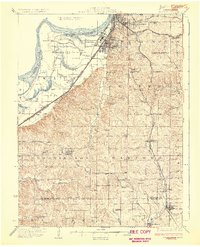
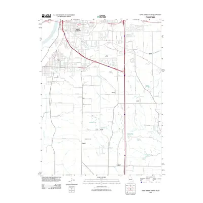
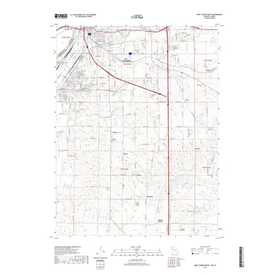
 1971 St. Joseph South1973 Print · USGSSouthern Buchanan County comes into focus in the early 1970s as the rail-and-river economy of St. Joseph meets the rural Missouri countryside. Genealogists and local historians can trace family roots at Old Sparta Cem and Mt Pleasant Cem, or locate landmarks like the Shackelford Landing Strip.3 unique versions available
 - 1971 Map of Agency, 1973 Print
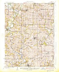
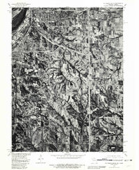
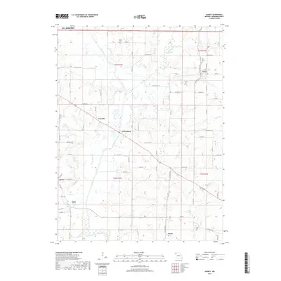
 1971 Agency1973 Print · USGSBuchanan County's agricultural and rail heartland is captured here in the early seventies as three major railroads crossed the fertile Platte River valley. Researchers can pinpoint historic family plots like Blakely Cem and trace the paths of the Burlington Northern through Easton.
 - 1980 Map of St. Joseph South, 1981 Print
 1980 St. Joseph South1981 Print · USGSThe southern fringes of St Joseph and the surrounding Buchanan County farmlands are seen here in the early eighties. Genealogists and local historians can trace the rural landscape around Saxton and Willow Brook or follow the path of Contrary Creek.
 - 1986 Map of Saint Joseph
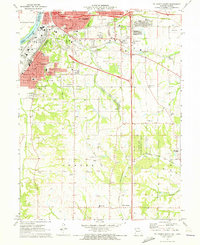
 1986 Saint Joseph1986 Print · USGSNorthwest Missouri thrived as a regional transportation and educational hub during the mid-eighties, centered on the historic river city of Saint Joseph. Researchers can locate specific local landmarks like Burlington Cemetery, Pigeon Hill Church, and the winding Pony Express Trail.2 unique versions available
 - 2009 Map of Saint Joseph South, 2009 Print
 2009 Saint Joseph South2009 Print · USGSCovers Agency, including Saint Joseph, Elwood, and other nearby areas
 - 2012 Map of Agency, 2012 Print
 2012 Agency2012 Print · USGSCovers Agency, including Saint Joseph, Easton, and other nearby areas
 - 2012 Map of Saint Joseph South, 2012 Print
 2012 Saint Joseph South2012 Print · USGSCovers Agency, including Saint Joseph, Elwood, and other nearby areas
 - 2014 Map of Agency, 2014 Print
 2014 Agency2014 Print · USGSCovers Agency, including Saint Joseph, Easton, and other nearby areas
 - 2015 Map of Saint Joseph South, 2015 Print
 2015 Saint Joseph South2015 Print · USGSCovers Agency, including Saint Joseph, Elwood, and other nearby areas
 - 2017 Map of Agency, 2017 Print
 2017 Agency2017 Print · USGSCovers Agency, including Saint Joseph, Easton, and other nearby areas
 - 2017 Map of Saint Joseph South, 2017 Print
 2017 Saint Joseph South2017 Print · USGSCovers Agency, including Saint Joseph, Elwood, and other nearby areas
 - 2021 Map of Saint Joseph South, 2021 Print
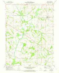
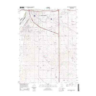
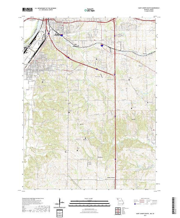 2021 Saint Joseph South2021 Print · USGSSouthern St. Joseph and the surrounding Missouri River lowlands are captured here in the early twenty-first century. Genealogists and local historians can trace legacy sites like Old Sparta Cem, Pleasant Ridge Cem, and the small community of Willow Brook.
 - 2021 Map of Agency, 2021 Print
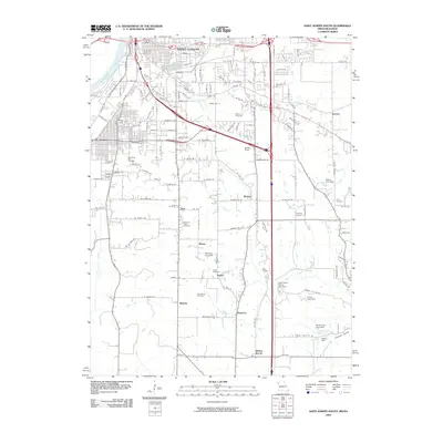
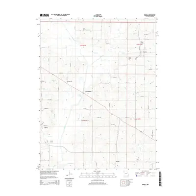
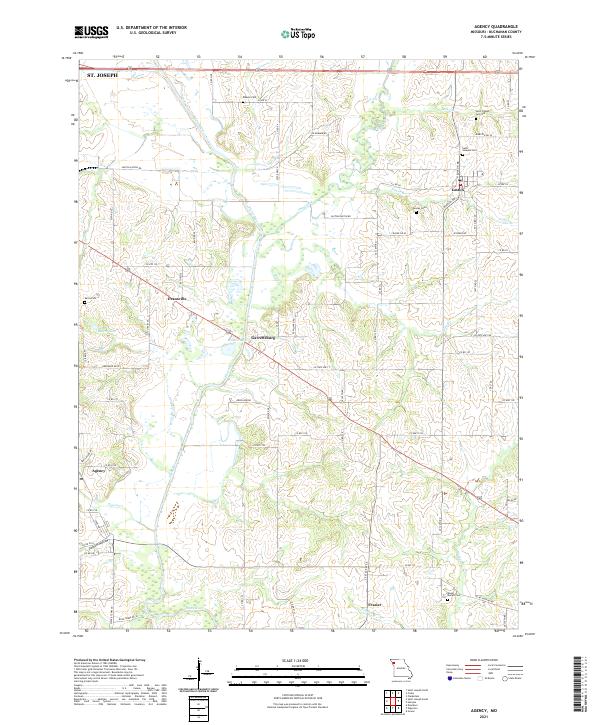 2021 Agency2021 Print · USGSBuchanan County's rural landscape is documented here in the early twenty-first century as the Platte River winds past small farming communities. Researchers can trace family history through several burial sites like Saint Joseph Cem Old and explore the locations of Agency, Easton, and Garrettsburg.
End of results
Showing maps 1-19 of 19
Top cities near Agency
- Saint Joseph historical maps
- Smithville historical maps
- Gower historical maps
- Wathena historical maps
- Elwood historical maps
- Edgerton historical maps
See more
Frequently asked questions
- What are the different types of historical maps available for Agency?
- What is the oldest map of Agency?
- Where can I purchase historical maps of Agency for my home or office?
- Where can I download high-res historical maps of Agency?
- Are there historical topographic maps available for Agency?
- Is there historical aerial imagery available for Agency?
- Where are historical maps of Agency sourced from?