Old Maps of Ash Hill, Missouri for Academic Research
Study the evolution of Ash Hill with 11 high-resolution historic maps. Whether you're teaching, researching, or modeling changes in land use, these maps provide essential visual documentation of urban, environmental, and geographic change.
- Analyze long-term change: Track patterns in development, transportation, and natural features.
- Ideal for environmental or urban studies: Support academic projects with primary historical map data.
- Use in the classroom or lab: Educators and researchers rely on these maps to bring historical context to life.
These maps are a powerful tool for teaching, research, and visualizing how Ash Hill has changed over the decades.
Ash Hill, MO maps
(11)- 1934 Map of Puxico
 1934 Puxico1934 Print · USGSThe Missouri Bootheel comes into focus during the 1930s as drainage projects and rail lines reshape the swampy lowlands. Genealogists can locate dozens of country schools like Wilkerson Sch and Zoll Sch, or trace the tracks of the St Louis San Francisco through Puxico.2 unique versions available
 - 1939 Map of Puxico, 1942 Print
 1939 Puxico1942 Print · USGSSoutheast Missouri's bootheel region comes to life in the late 1930s, showing a landscape defined by extensive drainage projects and burgeoning rail towns. Trace the locations of rural schoolhouses like Edmundson Sch and lost junctions along the St Louis - San Francisco Ry.
 - 1957 Map of Poplar Bluff, 1968 Print
 1957 Poplar Bluff1968 Print · USGSThe Missouri-Arkansas border region is captured here as the timber and rail industries shaped the Ozark foothills. Genealogists and historians can trace the Missouri Pacific Railroad through river towns like Pocahontas, Greenville, and Van Buren.3 unique versions available
 - 1959 Map of Poplar Bluff
 1959 Poplar Bluff1959 Print · USGSThe Missouri Ozarks and Arkansas borderlands meet in this late 1950s study of the region's diverse terrain and rail-fed towns. Researchers can trace the path of the Missouri Pacific Railroad through Poplar Bluff or locate smaller settlements like Birch Tree and Myrtle.
 - 1960 Map of Poplar Bluff
 1960 Poplar Bluff1960 Print · USGSSoutheast Missouri and Northeast Arkansas are captured here during the post-war era, showing the transition from the Ozark highlands to the Delta. Genealogists and historians can trace rail corridors like the St. Louis Southwestern RR and remote settlements such as Birch Tree and Warm Springs.
 - 1962 Map of Fisk, 1963 Print
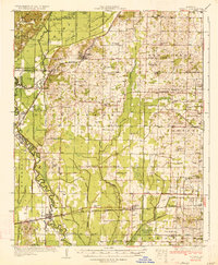
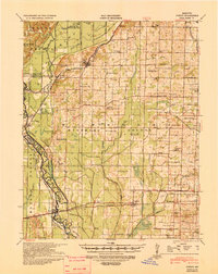
 1962 Fisk1963 Print · USGSFisk and the surrounding river bottomlands are captured here in the early sixties, as the local economy relied on the railroad and a vast network of drainage canals. Researchers can trace the Missouri Pacific rail corridor through Ash Hill and Ives, or locate rural landmarks like Owens Cem and Hobbe Chapel.2 unique versions available
 - 1983 Map of Poplar Bluff
 1983 Poplar Bluff1983 Print · USGSSoutheast Missouri in the early 1980s reveals a landscape defined by the Ozark foothills and the complex drainage systems of the Bootheel. Researchers can trace the rail corridors of the Missouri Pacific RR through Poplar Bluff or locate rural sites like Wilhelmina Church and Lone Hill Lookout.
 - 2011 Map of Fisk, 2011 Print
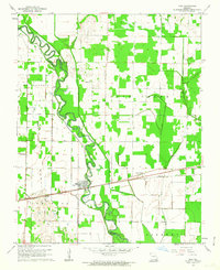
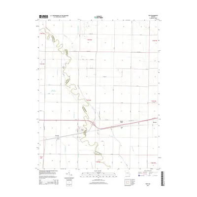
 2011 Fisk2011 Print · USGSCovers Ash Hill, including Fisk, Green Oaks, and other nearby areas
 - 2015 Map of Fisk, 2015 Print
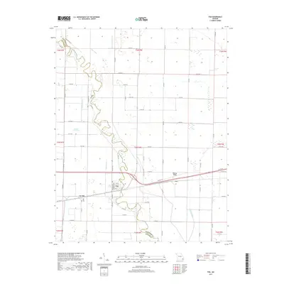
 2015 Fisk2015 Print · USGSCovers Ash Hill, including Fisk, Green Oaks, and other nearby areas
 - 2017 Map of Fisk, 2017 Print
 2017 Fisk2017 Print · USGSCovers Ash Hill, including Fisk, Green Oaks, and other nearby areas
 - 2021 Map of Fisk, 2021 Print
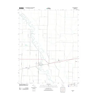
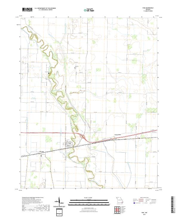 2021 Fisk2021 Print · USGSThe winding Saint Francis River and its reclaimed wetlands define the Butler and Stoddard county line in the early 2020s. Genealogists can trace family sites at Ash Hills Cem and Owens Cem or explore the settlements of Fisk and Ives.
End of results
Showing maps 1-11 of 11
Top cities near Ash Hill
- Poplar Bluff historical maps
- Malden historical maps
- Puxico historical maps
- Qulin historical maps
- Fisk historical maps
- Dudley historical maps
Frequently asked questions
- What are the different types of historical maps available for Ash Hill?
- What is the oldest map of Ash Hill?
- Where can I purchase historical maps of Ash Hill for my home or office?
- Where can I download high-res historical maps of Ash Hill?
- Are there historical topographic maps available for Ash Hill?
- Is there historical aerial imagery available for Ash Hill?
- Where are historical maps of Ash Hill sourced from?