Old Maps of Cape Girardeau County, Missouri
Explore 65 old maps of Cape Girardeau County, spanning from 1918 to today. These high-resolution historic maps reveal how streets, neighborhoods, landmarks, and natural features evolved over time — perfect for genealogy, metal detecting, research, and local history exploration.
What you can do with these maps:
- See how Cape Girardeau County changed over time: Compare historical maps to modern-day views to trace roads, homesites, rail lines & more.
- View detailed metadata: Each map includes creators, publishers, year, scale, and archive source.
- Overlay maps with satellite & LiDAR: Visualize the past alongside modern tools to explore terrain & human change.
- Trusted historical sources: Maps sourced from the USGS, Library of Congress, and other archives.
- Access maps your way: View online, download high-res files, or order prints for personal or research use.
Start exploring old maps of Cape Girardeau County to uncover forgotten places, hidden landmarks, and the deep history beneath your feet.
Cape Girardeau County, MO maps
(65)- 1918 Map of Altenburg
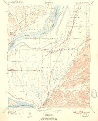
 1918 Altenburg1918 Print · USGSCovers Cape Girardeau County, including Grand Tower, Altenburg, and other nearby areas
 - 1920 Map of Jonesboro
 1920 Jonesboro1920 Print · USGSCovers Cape Girardeau County, including Cape Girardeau, Anna, and other nearby areas
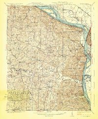
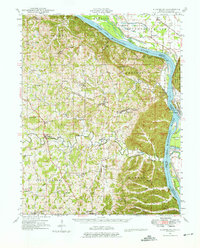
 - 1922 Map of Cape Girardeau, 1954 Print
 1922 Cape Girardeau1954 Print · USGSCovers Cape Girardeau County, including Cape Girardeau, Jackson, and other nearby areas3 unique versions available
 - 1923 Map of Jonesboro
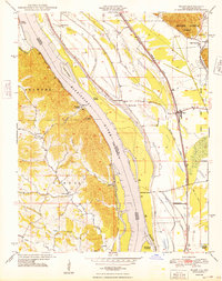
 1923 Jonesboro1923 Print · USGSCovers Cape Girardeau County, including Cape Girardeau, Anna, and other nearby areas2 unique versions available
 - 1923 Map of Perryville, 1960 Print
 1923 Perryville1960 Print · USGSCovers Cape Girardeau County, including Perryville, Sedgewickville, and other nearby areas2 unique versions available
 - 1924 Map of Cape Girardeau
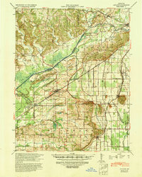
 1924 Cape Girardeau1924 Print · USGSCovers Cape Girardeau County, including Cape Girardeau, Jackson, and other nearby areas2 unique versions available
 - 1924 Map of Perryville
 1924 Perryville1924 Print · USGSCovers Cape Girardeau County, including Perryville, Sedgewickville, and other nearby areas2 unique versions available
 - 1924 Map of Alto Pass
 1924 Alto Pass1924 Print · USGSCovers Cape Girardeau County, including Carbondale, Murphysboro, and other nearby areas2 unique versions available
 - 1925 Map of Altenburg
 1925 Altenburg1925 Print · USGSCovers Cape Girardeau County, including Grand Tower, Altenburg, and other nearby areas3 unique versions available
 - 1933 Map of Marble Hill, 1964 Print
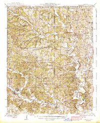
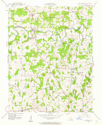
 1933 Marble Hill1964 Print · USGSCovers Cape Girardeau County, including Marble Hill, Mayfield, and other nearby areas3 unique versions available
 - 1934 Map of Thebes
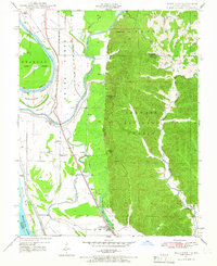
 1934 Thebes1934 Print · USGSCovers Cape Girardeau County, including Scott City, Tamms, and other nearby areas4 unique versions available
 - 1934 Map of Morley
 1934 Morley1934 Print · USGSCovers Cape Girardeau County, including Cape Girardeau, Scott City, and other nearby areas3 unique versions available
 - 1934 Map of Advance
 1934 Advance1934 Print · USGSCovers Cape Girardeau County, including Advance, Bell City, and other nearby areas3 unique versions available
 - 1937 Map of Marble Hill
 1937 Marble Hill1937 Print · USGSCovers Cape Girardeau County, including Marble Hill, Mayfield, and other nearby areas2 unique versions available
 - 1939 Map of Morley, 1942 Print
 1939 Morley1942 Print · USGSCovers Cape Girardeau County, including Cape Girardeau, Scott City, and other nearby areas2 unique versions available
 - 1939 Map of Advance, 1942 Print
 1939 Advance1942 Print · USGSCovers Cape Girardeau County, including Advance, Bell City, and other nearby areas
 - 1939 Map of Thebes, 1946 Print
 1939 Thebes1946 Print · USGSCovers Cape Girardeau County, including Scott City, Tamms, and other nearby areas
 - 1947 Map of Jonesboro, 1954 Print
 1947 Jonesboro1954 Print · USGSCovers Cape Girardeau County, including Cape Girardeau, Anna, and other nearby areas3 unique versions available
 - 1947 Map of Alto Pass, 1954 Print
 1947 Alto Pass1954 Print · USGSCovers Cape Girardeau County, including Carbondale, Murphysboro, and other nearby areas2 unique versions available
 - 1947 Map of Mc Clure, 1954 Print
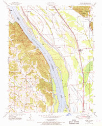
 1947 Mc Clure1954 Print · USGSCovers Cape Girardeau County, including Cape Girardeau, McClure, and other nearby areas3 unique versions available
 - 1947 Map of Oak Ridge, 1964 Print
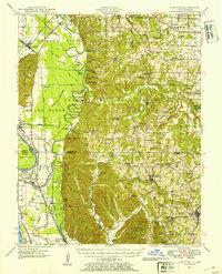
 1947 Oak Ridge1964 Print · USGSCovers Cape Girardeau County, including Oak Ridge, Pocahontas, and other nearby areas2 unique versions available
 - 1947 Map of Wolf Lake, 1966 Print
 1947 Wolf Lake1966 Print · USGSCovers Cape Girardeau County, including Grand Tower, Wolf Lake, and other nearby areas3 unique versions available
 - 1947 Map of Ware, 1969 Print
 1947 Ware1969 Print · USGSCovers Cape Girardeau County, including Ware, Egypt Mills, and other nearby areas3 unique versions available
 - 1947 Map of Altenburg, 1976 Print
 1947 Altenburg1976 Print · USGSCovers Cape Girardeau County, including Grand Tower, Altenburg, and other nearby areas
 - 1948 Map of Ware
 1948 Ware1948 Print · USGSCovers Cape Girardeau County, including Ware, Egypt Mills, and other nearby areas2 unique versions available
Showing maps 1-25 of 65
Top cities of Cape Girardeau County
- Cape Girardeau historical maps
- Jackson historical maps
- Delta historical maps
- Gordonville historical maps
- Oak Ridge historical maps
- Pocahontas historical maps
See more
Frequently asked questions
- What are the different types of historical maps available for Cape Girardeau County?
- What is the oldest map of Cape Girardeau County?
- Where can I purchase historical maps of Cape Girardeau County for my home or office?
- Where can I download high-res historical maps of Cape Girardeau County?
- Are there historical topographic maps available for Cape Girardeau County?
- Is there historical aerial imagery available for Cape Girardeau County?
- Where are historical maps of Cape Girardeau County sourced from?