Old Maps of Fremont, Missouri for Academic Research
Study the evolution of Fremont with 12 high-resolution historic maps. Whether you're teaching, researching, or modeling changes in land use, these maps provide essential visual documentation of urban, environmental, and geographic change.
- Analyze long-term change: Track patterns in development, transportation, and natural features.
- Ideal for environmental or urban studies: Support academic projects with primary historical map data.
- Use in the classroom or lab: Educators and researchers rely on these maps to bring historical context to life.
These maps are a powerful tool for teaching, research, and visualizing how Fremont has changed over the decades.
Fremont, MO maps
(12)- 1944 Map of Van Buren, 1960 Print
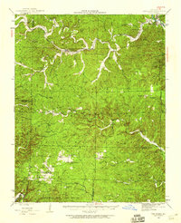 1944 Van Buren1960 Print · USGSThe Ozark hill country of Carter and Shannon counties appears here in the mid-1940s. Researchers can trace the St Louis San Francisco rail line or locate rural sites like Pleasant Site Cem, Chicopee, and the Bristoll Sch.2 unique versions available
 - 1946 Map of Van Buren
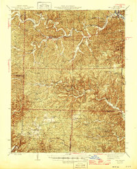 1946 Van Buren1946 Print · USGSThe Ozark foothills of Carter County are shown here in the 1940s, dominated by the winding Current River and the sprawling Clark National Forest. Genealogists and hikers can trace the footprints of rural communities at Wilderness, Bristol Church, and Rinnard School.2 unique versions available
 - 1957 Map of Poplar Bluff, 1968 Print
 1957 Poplar Bluff1968 Print · USGSThe Missouri-Arkansas border region is captured here as the timber and rail industries shaped the Ozark foothills. Genealogists and historians can trace the Missouri Pacific Railroad through river towns like Pocahontas, Greenville, and Van Buren.3 unique versions available
 - 1959 Map of Poplar Bluff
 1959 Poplar Bluff1959 Print · USGSThe Missouri Ozarks and Arkansas borderlands meet in this late 1950s study of the region's diverse terrain and rail-fed towns. Researchers can trace the path of the Missouri Pacific Railroad through Poplar Bluff or locate smaller settlements like Birch Tree and Myrtle.
 - 1960 Map of Poplar Bluff
 1960 Poplar Bluff1960 Print · USGSSoutheast Missouri and Northeast Arkansas are captured here during the post-war era, showing the transition from the Ozark highlands to the Delta. Genealogists and historians can trace rail corridors like the St. Louis Southwestern RR and remote settlements such as Birch Tree and Warm Springs.
 - 1968 Map of Fremont, 1969 Print
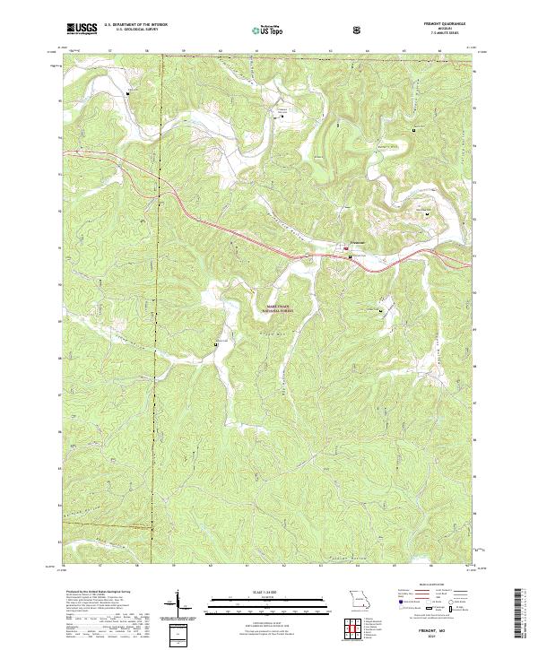
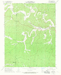 1968 Fremont1969 Print · USGSFremont and the surrounding Ozark woodlands appear here in the late sixties as the forest reclaimed former industrial grounds. Researchers can find the Site of Old Midco Iron Works, the Fremont Lookout Tower, and several family cemeteries like Evaline Cem.2 unique versions available
 - 1984 Map of West Plains
 1984 West Plains1984 Print · USGSThe Missouri Ozarks are mapped here in the mid-1980s, centered on the regional hub of West Plains and the river corridors of the Eleven Point River. Trace the old rail lines and timber towns of Willow Springs, Mountain View, and Birch Tree through the Mark Twain National Forest.2 unique versions available
 - 1997 Map of Fremont, 1999 Print
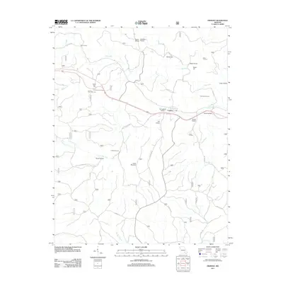
 1997 Fremont1999 Print · USGSThe Ozark forest lands of Carter and Shannon counties appear here in the late nineties, documenting the industrial remains of the charcoal iron era. Researchers can locate numerous family burial grounds like New Hope Cemetery and trace the path of the Old Tram Road near the Site of Old Midco Iron Works.
 - 2011 Map of Fremont, 2011 Print
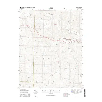
 2011 Fremont2011 Print · USGSCovers Fremont, including Carter County, Shannon County, and other nearby areas
 - 2015 Map of Fremont, 2015 Print
 2015 Fremont2015 Print · USGSCovers Fremont, including Carter County, Shannon County, and other nearby areas
 - 2017 Map of Fremont, 2017 Print
 2017 Fremont2017 Print · USGSCovers Fremont, including Carter County, Shannon County, and other nearby areas
 - 2021 Map of Fremont, 2021 Print
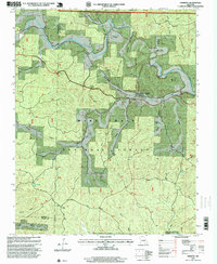
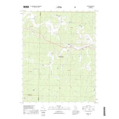
 2021 Fremont2021 Print · USGSFremont and the surrounding Ozark woodlands appear in detail during the early 2020s, revealing a landscape of remote cemeteries and historic transport paths. Researchers can trace family sites like Evaline Cem and Snider Cem or locate the route of the OLD TRAM.
End of results
Showing maps 1-12 of 12
Top cities near Fremont
Frequently asked questions
- What are the different types of historical maps available for Fremont?
- What is the oldest map of Fremont?
- Where can I purchase historical maps of Fremont for my home or office?
- Where can I download high-res historical maps of Fremont?
- Are there historical topographic maps available for Fremont?
- Is there historical aerial imagery available for Fremont?
- Where are historical maps of Fremont sourced from?