Loading...
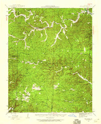
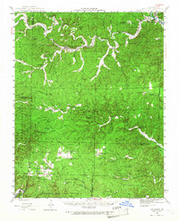
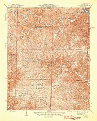
Loading map...1944 Map of Van Buren
USGS Topo · Published 1960About this map
The Current River snakes through the northeast corner of this territory, where the St Louis San Francisco railroad connects the riverside settlement of Chicopee to the village of Fremont. Much of the landscape is defined by the dense topography of the Ozarks, illustrated here during the mid-1940s before modern developments reshaped the local road network. The map reveals a rural economy centered on small, dispersed communities and mountain lookouts like Fremont Lookout and Eagle Lookout.
Find a feature on this map
60 named features on this map. Tap any name to fly to it.
Don’t see what you’re looking for? This feature index may not catch every label — zoom into the map to look around manually.
Map Details
Date Portrayed1944
Date Published1960
PublisherU.S. Geological Survey
Map TypeTopographic
Scale1:62,500
Physical Dimensions16.9 x 20.8 inches
Editions of this 1944 Van Buren Map
2 editions found
Historical Maps of Van Buren Through Time
Featured Locations
Source Details
SourceU.S. Geological Survey
CopyrightPublic Domain