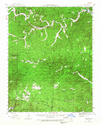
1944 Map of Van Buren
USGS Topo · Published 1968About this map
Chicopee and Fremont serve as the primary rail-and-river hubs along the winding Current River during this mid-century survey. The St Louis - San Francisco railroad cuts through the north, supporting the local timber and freight economy between Retort Hill and the river banks. This Ozark landscape is defined by its deep hollows and unique water features, including Big Spring and the Spout Spr Cave, while the southern reaches are dominated by the Wilderness State Game Refuge.
Find a feature on this map
72 named features on this map. Tap any name to fly to it.
Don’t see what you’re looking for? This feature index may not catch every label — zoom into the map to look around manually.
Map Details
Editions of this 1944 Van Buren Map
2 editions found
Other maps of this area

1915 · Eminence
USGS Topo · 1:62,500

1917 · Eminence
USGS Topo · 1:62,500

1928 · Cardareva
USGS Topo · 1:62,500

1931 · Bandyville
USGS Topo · 1:48,000

1939 · Doniphan
USGS Topo · 1:62,500

1941 · Gatewood
USGS Topo · 1:62,500

1943 · Ellington
USGS Topo · 1:62,500

1944 · Van Buren
USGS Topo · 1:62,500

1944 · Couch
USGS Topo · 1:62,500

1944 · Birch Tree
USGS Topo · 1:62,500