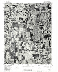
1900s (20th Century) Maps of Cass County, Missouri
Explore 31 historic maps of Cass County from the 1900s (20th Century). These maps offer a rare glimpse into what life looked like during the 1900s — showing old roads, neighborhoods, homes, and landmarks that have changed or disappeared over time.
Whether you're researching your family's past, planning a metal detecting trip, or studying how Cass County's landscape evolved across the 1900s, these high-resolution maps are a powerful tool for exploring the history of this region.
- Focus on a specific era: All maps on this page are from the 1900s, giving you a focused view of this time period.
- See what’s changed: Compare century-old streets, trails, and buildings to today's modern landscape using overlays and satellite layers.
- Research with precision: Use these maps for genealogy, historical research, land use analysis, or educational projects.
- View, download, or print: Maps are fully viewable online in high resolution, and can be downloaded or printed for your own records.
Start exploring Cass County's history through authentic maps from the 1900s. This is your window into the past.
Cass County, MO maps
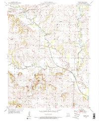
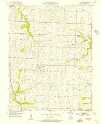
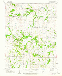
(31)- 1947 Map of Lawrence, 1954 Print
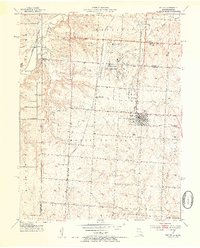
 1947 Lawrence1954 Print · USGSEastern Kansas and western Missouri thrive in the late 1940s, showing a landscape defined by major river valleys and a dense railway network. Genealogists can trace family settlements from Lawrence to Greenwood and locate landmarks like Olathe Navy and Lake Lotawana.
 - 1950 Map of Lawrence
 1950 Lawrence1950 Print · USGSMid-century Kansas and Missouri come alive in this map of the river-valley corridors just as the interstate era was beginning. Researchers can trace the legacy of major rail lines like the Union Pacific RR and locate ancestral roots in towns from Lawrence to Harrisonville.
 - 1953 Map of Belton, 1954 Print
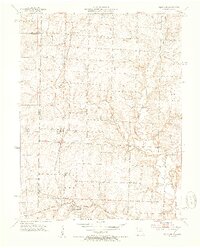
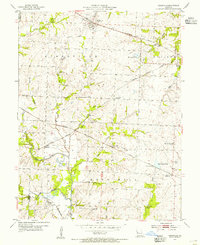
 1953 Belton1954 Print · USGSThe Missouri-Kansas borderlands in the early fifties show a landscape of rural schoolhouses and burgeoning military infrastructure. Trace family roots at Belton Cem or explore the mid-century operations of Knoche Oil Field and Lamar Airport.5 unique versions available
 - 1953 Map of Freeman, 1954 Print
 1953 Freeman1954 Print · USGSThe Missouri-Kansas borderlands in the early fifties are captured here as a landscape of rural schoolhouses and rail-side settlements. Genealogists can trace family roots through local landmarks like Dodge Point Sch, Shiloh Chapel, and the Freeman Cem.4 unique versions available
 - 1953 Map of West Line, 1954 Print
 1953 West Line1954 Print · USGSAlong the Kansas-Missouri border in the early fifties, this area shows a landscape of small rail-side towns and rural school districts. Researchers can find many family landmarks, from Glenwild Cem and Corinth Cem to the tracks of the Kansas City Southern.4 unique versions available
 - 1953 Map of Creighton, 1955 Print
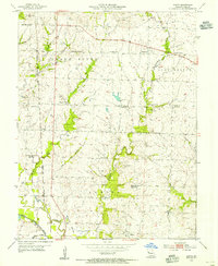
 1953 Creighton1955 Print · USGSCreighton and Urich sat at a busy county-line junction in the early fifties, before the landscape was altered by modern river management. Genealogists can trace rural roots at Smoky Row Sch, Cove Creek Ch, and family burial grounds like Parker Cem.
 - 1953 Map of Everett, 1955 Print
 1953 Everett1955 Print · USGSRural Missouri in the early fifties is defined here by its winding river bottoms and a vanishing generation of country schools. Local historians can trace family roots through landmarks like Burford Cem, Everett, and the Zion Sch (Abandoned).2 unique versions available
 - 1954 Map of Harrisonville, 1955 Print
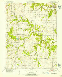
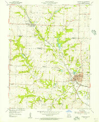
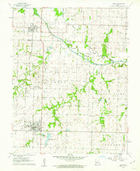
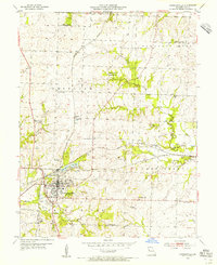 1954 Harrisonville1955 Print · USGSHarrisonville at the midpoint of the twentieth century is a busy rail hub where three major lines meet. Genealogists can trace early rural life through numerous one-room schoolhouses like Walnut Grove Sch and family burial sites like Orient Cem.2 unique versions available
 - 1954 Map of East Lynne, 1955 Print
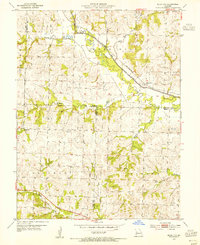
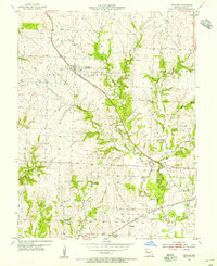
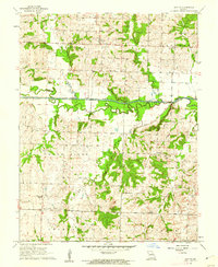
 1954 East Lynne1955 Print · USGSEastern Cass County is shown here in the mid-1950s, a time when three major railroads still defined the local economy and geography. Researchers can trace rural life through landmarks like Staley Mound Cem, Smith Sch, and the depot at Gunn City (Station).
 - 1954 Map of Quick City, 1955 Print
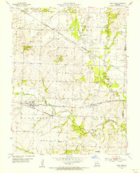
 1954 Quick City1955 Print · USGSMid-century Johnson County comes into focus as a landscape of small schools and family cemeteries along the ST LOUIS SAN FRANCISCO rail line. Genealogists can trace rural roots at Quick City or locate ancestral sites at Grant Cem and Forest Sch.
 - 1954 Map of Raymore, 1955 Print
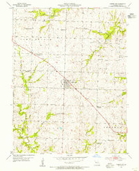
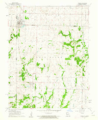
 1954 Raymore1955 Print · USGSMid-century Cass County, Missouri, is revealed here just as the rural agricultural landscape began to meet the expanding influence of the Kansas City region. Genealogists and local historians can trace family locations near Raymore, find the Raymore Cem, or follow the St Louis San Francisco tracks through Harrelson.3 unique versions available
 - 1954 Map of Kingsville, 1955 Print
 1954 Kingsville1955 Print · USGSRailroad development in western Johnson County reached its peak in the mid-fifties, centering on the junction of five different lines. Genealogists and rail historians can trace local family landmarks like Rose Hill Cem, Stout Sch, and the small settlement of Latour.2 unique versions available
 - 1954 Map of Strasburg, 1955 Print
 1954 Strasburg1955 Print · USGSMid-century Cass County comes to life in this survey of the Strasburg and Lonejack areas during the 1950s. Genealogists can locate several local burial grounds including Soldiers Cem and Sloan Cem, or trace the rail corridor of the Missouri Pacific.2 unique versions available
 - 1954 Map of Garden City, 1955 Print
 1954 Garden City1955 Print · USGSMid-century Cass County is captured here as a landscape of small-town commerce and shifting rural education. Genealogists can locate several family burial sites including Clearfork Cem and Byler Cem, or trace early schools like Schuyler Sch and Peach Grove Sch.
 - 1954 Map of Austin, 1955 Print
 1954 Austin1955 Print · USGSCentral Missouri farmland in the mid-1950s is captured here in detail. Genealogists can trace family landmarks like Vansandt Cem and the Mid-West Landing Field, or find several rural schools including Belle Plain Sch and Eightmile Sch.2 unique versions available
 - 1954 Map of Pleasant Hill, 1955 Print
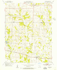
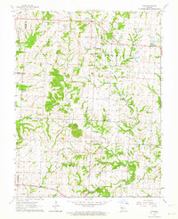
 1954 Pleasant Hill1955 Print · USGSThe Cass County rail junction at Pleasant Hill is shown in the mid-fifties at a moment of transition for its rural school system. Genealogists and local historians can locate several decommissioned sites like Crossroads Sch alongside active landmarks like Union Cem and Loch Leonard.2 unique versions available
 - 1954 Map of Peculiar, 1955 Print
 1954 Peculiar1955 Print · USGSPeculiar and its rural Cass County surroundings are seen here in the mid-fifties, structured by the crossing of major rail lines and local streams. Genealogists can trace family landmarks and school districts like Rockford Sch, Wills Cem, and the village of Prettyman.2 unique versions available
 - 1956 Map of Lawrence, 1967 Print
 1956 Lawrence1967 Print · USGSEastern Kansas and the Missouri border country are captured here during the mid-century transition to the interstate era. Genealogists and local historians can trace family-named terrain like Summers Mound and the footprint of Sunflower Ordnance Works near Baldwin City.4 unique versions available
 - 1961 Map of Lawrence
 1961 Lawrence1961 Print · USGSThe Kansas-Missouri borderland shows its mid-century transition from a rail-dependent agricultural region to a suburbanizing landscape. Genealogists can trace family footprints through numerous Cem sites and distinctive terrain landmarks like Graves Mound and Summers Mound.
 - 1961 Map of Drexel, 1962 Print
 1961 Drexel1962 Print · USGSThe Kansas-Missouri border comes alive in the early sixties as rural townships thrive along the rail lines. Genealogists and historians can trace family land between Drexel and the creeks of Morman Fork, or locate resting places at Sharon Cem and West Point Cem.2 unique versions available
 - 1961 Map of Main City, 1962 Print
 1961 Main City1962 Print · USGSThe borderlands of Cass and Bates counties are captured in the early sixties, showing a landscape defined by small settlements and rural schoolhouses. Genealogists can trace family footprints near Main City, Burdett, and the Fairview Ch.2 unique versions available
 - 1961 Map of Adrian, 1962 Print
 1961 Adrian1962 Print · USGSBates and Cass Counties are captured here in the early sixties, centered on the Missouri Pacific rail line and the meandering South Grand River. Genealogists and local historians can pinpoint the Crescent Hill Cem, Fairview Sch, and the Coleville Community Hall in this rural landscape.3 unique versions available
 - 1961 Map of Dayton, 1962 Print
 1961 Dayton1962 Print · USGSBates County rural life in the early sixties is preserved here, centered on the winding South Grand River. Researchers can locate numerous family burial grounds including Blackburn Cem and Peter Creek Cem, or the site of the Choctaw Sch.
 - 1962 Map of Elm, 1964 Print
 1962 Elm1964 Print · USGSNorthwestern Missouri farmland and the meandering South Fork Blackwater River define this rural landscape in the early sixties. Genealogists and local historians can locate several family burial grounds like Lunday Cem and Bluff Springs Cem, or trace the path of the Missouri Pacific RR.2 unique versions available
 - 1980 Map of Belton, 1981 Print
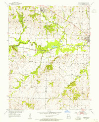
 1980 Belton1981 Print · USGSThe Missouri-Kansas borderlands in the 1980s are captured here during a period of significant military and suburban expansion. Genealogists and historians can trace the development of Belton and Grandview alongside the massive Richards-Gebaur Air Force Base.
Showing maps 1-25 of 31
Top cities of Cass County
- Belton historical maps
- Raymore historical maps
- Harrisonville historical maps
- Pleasant Hill historical maps
- Peculiar historical maps
- Garden City historical maps
See more
Frequently asked questions
- What are the different types of historical maps available for Cass County?
- What is the oldest map of Cass County?
- Where can I purchase historical maps of Cass County for my home or office?
- Where can I download high-res historical maps of Cass County?
- Are there historical topographic maps available for Cass County?
- Is there historical aerial imagery available for Cass County?
- Where are historical maps of Cass County sourced from?