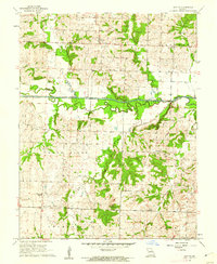
1961 Map of Dayton
USGS Topo · Published 1962About this map
The South Grand River meanders across the border of Bates and Cass counties, defining a landscape of agriculture and small rural clusters. Central to this 1961 survey is the Old Channel, which reveals the river's natural shifts over time, while the small settlement of Dayton sits to the north. For genealogists, the map is remarkably dense with family-named burial sites, including Blackburn Cem, Pulliam Cem, Earheart Cem, and France Cem.
Find a feature on this map
26 named features on this map. Tap any name to fly to it.
Don’t see what you’re looking for? This feature index may not catch every label — zoom into the map to look around manually.
Map Details
Editions of this 1961 Dayton Map
This is the sole edition of this map. No revisions or reprints were ever made.
Other maps of this area

1887 · Harrisonville
USGS Topo · 1:125,000

1887 · Butler
USGS Topo · 1:125,000

1892 · Harrisonville
USGS Topo · 1:125,000

1894 · Harrisonville
USGS Topo · 1:125,000

1894 · Butler
USGS Topo · 1:125,000

1947 · Lawrence
USGS Topo · 1:250,000

1950 · Lawrence
USGS Topo · 1:250,000

1953 · Johnstown
USGS Topo · 1:24,000
1953 · Creighton
USGS Topo · 1:24,000
1954 · Quick City
USGS Topo · 1:24,000