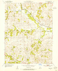
1954 Map of Quick City
USGS Topo · Published 1955About this map
Quick City stands as a rail-centered hub in the mid-1950s, positioned where the St Louis San Francisco railroad tracks parallel the winding path of Big Creek. This intersection of rail and water defines the local landscape, particularly where the stream follows an Old Channel through the townships of Rose Hill and Bogard. The map reveals a deeply rooted rural society characterized by a high density of family and community landmarks, including the Pemberton Cem and Grant Cem.
Find a feature on this map
26 named features on this map. Tap any name to fly to it.
Don’t see what you’re looking for? This feature index may not catch every label — zoom into the map to look around manually.
Map Details
Editions of this 1954 Quick City Map
This is the sole edition of this map. No revisions or reprints were ever made.
Other maps of this area

1885 · Warrensburg
USGS Topo · 1:125,000

1887 · Clinton
USGS Topo · 1:125,000

1887 · Harrisonville
USGS Topo · 1:125,000

1887 · Butler
USGS Topo · 1:125,000

1887 · Warrensburg
USGS Topo · 1:125,000

1892 · Harrisonville
USGS Topo · 1:125,000

1894 · Harrisonville
USGS Topo · 1:125,000

1894 · Butler
USGS Topo · 1:125,000

1894 · Warrensburg
USGS Topo · 1:125,000

1894 · Clinton
USGS Topo · 1:125,000