1950s Maps of Clever, Missouri
Explore 6 historic maps of Clever from the 1950s. These maps offer a rare glimpse into what life looked like during the 1950s — showing old roads, neighborhoods, homes, and landmarks that have changed or disappeared over time.
Whether you're researching your family's past, planning a metal detecting trip, or studying how Clever's landscape evolved across the 1950s, these high-resolution maps are a powerful tool for exploring the history of this region.
- Focus on a specific era: All maps on this page are from the 1950s, giving you a focused view of this time period.
- See what’s changed: Compare century-old streets, trails, and buildings to today's modern landscape using overlays and satellite layers.
- Research with precision: Use these maps for genealogy, historical research, land use analysis, or educational projects.
- View, download, or print: Maps are fully viewable online in high resolution, and can be downloaded or printed for your own records.
Start exploring Clever's history through authentic maps from the 1950s. This is your window into the past.
Clever, MO maps
(6)- 1954 Map of Harrison
 1954 Harrison1954 Print · USGSThe Ozarks and Boston Mountains meet during a period of massive river engineering in the mid-fifties. Researchers can trace the early shorelines of Bull Shoals Lake and Table Rock Reservoir or locate inland towns like Berryville and Harrison.
 - 1954 Map of Springfield
 1954 Springfield1954 Print · USGSThe Missouri Ozarks are captured here during the post-war era, showing the expansion of Springfield and the surrounding river valleys. Genealogists and historians can trace local landmarks like Mount Comfort Cemetery and the Fort Leonard Wood military grounds.6 unique versions available
 - 1955 Map of Hurley, 1957 Print
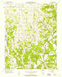 1955 Hurley1957 Print · USGSStone and Christian Counties were characterized by small farming hamlets and river-valley crossings in the mid-fifties. Genealogists can trace family names at Wright Chapel Cem or locate old community centers like Possum Trot, Lanetown, and Union City.2 unique versions available
 - 1958 Map of Springfield
 1958 Springfield1958 Print · USGSThe Missouri Ozarks are captured during the mid-century era of growth, centered on the bustling hub of Springfield. Genealogists and historians can trace family roots through numerous landmarks like Ebenezer Church, Stockton Cem, and the various county courthouses.
 - 1958 Map of Harrison, 1973 Print
 1958 Harrison1973 Print · USGSThe Ozark and Boston Mountains appear in this mid-century survey as the great White River impoundments were reshaping the region. Researchers can trace the rail lines of the St Louis-San Francisco Ry and locate early settlements like Berryville and Gainesville.
 - 1959 Map of Springfield
 1959 Springfield1959 Print · USGSThe Missouri Ozarks are captured here during a decade of postwar growth and increasing highway connectivity. Researchers can trace the legacy of the St Louis-San Francisco RR and locate early sites in Springfield, Lebanon, and Mountain Grove.
End of results
Showing maps 1-6 of 6
Top cities near Clever
- Springfield historical maps
- Nixa historical maps
- Ozark historical maps
- Republic historical maps
- Aurora historical maps
- Willard historical maps
See more
Frequently asked questions
- What are the different types of historical maps available for Clever?
- What is the oldest map of Clever?
- Where can I purchase historical maps of Clever for my home or office?
- Where can I download high-res historical maps of Clever?
- Are there historical topographic maps available for Clever?
- Is there historical aerial imagery available for Clever?
- Where are historical maps of Clever sourced from?