1960s Maps of Cooper County, Missouri
Explore 4 historic maps of Cooper County from the 1960s. These maps offer a rare glimpse into what life looked like during the 1960s — showing old roads, neighborhoods, homes, and landmarks that have changed or disappeared over time.
Whether you're researching your family's past, planning a metal detecting trip, or studying how Cooper County's landscape evolved across the 1960s, these high-resolution maps are a powerful tool for exploring the history of this region.
- Focus on a specific era: All maps on this page are from the 1960s, giving you a focused view of this time period.
- See what’s changed: Compare century-old streets, trails, and buildings to today's modern landscape using overlays and satellite layers.
- Research with precision: Use these maps for genealogy, historical research, land use analysis, or educational projects.
- View, download, or print: Maps are fully viewable online in high resolution, and can be downloaded or printed for your own records.
Start exploring Cooper County's history through authentic maps from the 1960s. This is your window into the past.
Cooper County, MO maps
(4)- 1960 Map of Moberly
 1960 Moberly1960 Print · USGSCentral Missouri comes alive in the mid-twentieth century as a bustling network of river towns and significant rail corridors. Genealogists and historians can trace the paths of the Wabash RR through Moberly or explore the riverfronts of Lexington and Brunswick.
 - 1960 Map of Otterville West, 1979 Print
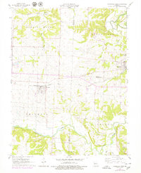 1960 Otterville West1979 Print · USGSWestern Pettis County at the start of the 1960s shows a landscape of small Missouri towns and established farmsteads along the Missouri Pacific railroad. Researchers can trace local heritage at Smithton Cem, Providence Ch, and the outlying Quarries.
 - 1961 Map of Otterville West, 1962 Print
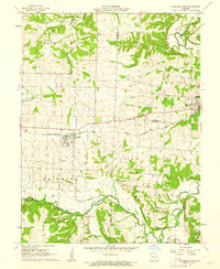 1961 Otterville West1962 Print · USGSSettled farmland and rail-side towns in Pettis and Cooper counties are captured here just before the mid-century. Genealogists and local researchers can trace the precise layout of Smithton, locate rural landmarks like Smithton Cemetery, and follow the Missouri Pacific rail line.
 - 1967 Map of Huntsdale, 1968 Print
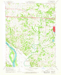 1967 Huntsdale1968 Print · USGSThe Missouri River bottomlands and the western outskirts of Columbia are captured here in the late sixties, showcasing a transition from river-rail economy to the interstate era. Genealogists can locate family sites at Mt Nebo Cemetery, Midway Heights School, and the settlement of McBaine.3 unique versions available
End of results
Showing maps 1-4 of 4
Top cities of Cooper County
- Boonville historical maps
- Pilot Grove historical maps
- Otterville historical maps
- Bunceton historical maps
- Windsor Place historical maps
- Prairie Home historical maps
See more
Frequently asked questions
- What are the different types of historical maps available for Cooper County?
- What is the oldest map of Cooper County?
- Where can I purchase historical maps of Cooper County for my home or office?
- Where can I download high-res historical maps of Cooper County?
- Are there historical topographic maps available for Cooper County?
- Is there historical aerial imagery available for Cooper County?
- Where are historical maps of Cooper County sourced from?