Old Maps of South Greenfield, Missouri for Academic Research
Study the evolution of South Greenfield with 16 high-resolution historic maps. Whether you're teaching, researching, or modeling changes in land use, these maps provide essential visual documentation of urban, environmental, and geographic change.
- Analyze long-term change: Track patterns in development, transportation, and natural features.
- Ideal for environmental or urban studies: Support academic projects with primary historical map data.
- Use in the classroom or lab: Educators and researchers rely on these maps to bring historical context to life.
These maps are a powerful tool for teaching, research, and visualizing how South Greenfield has changed over the decades.
South Greenfield, MO maps
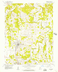
(16)- 1886 Map of Greenfield
 1886 Greenfield1886 Print · USGSSouthwest Missouri was undergoing a rail-driven transformation in the 1880s, as new lines connected established county seats to outlying farm towns. Genealogists can trace family roots through numerous small settlements like Paris Springs, Dadeville, and the thriving rail hub at Ash Grove.4 unique versions available
 - 1888 Map of Greenfield, 1898 Print
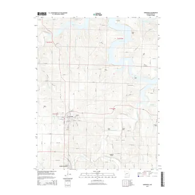
 1888 Greenfield1898 Print · USGSSouthwest Missouri thrived as a budding rail and agricultural hub in the 1880s. Local researchers can trace the early footprints of Greenfield and Mount Vernon, alongside smaller settlements like Paris Springs and Everton.
 - 1954 Map of Springfield
 1954 Springfield1954 Print · USGSThe Missouri Ozarks are captured here during the post-war era, showing the expansion of Springfield and the surrounding river valleys. Genealogists and historians can trace local landmarks like Mount Comfort Cemetery and the Fort Leonard Wood military grounds.6 unique versions available
 - 1956 Map of Greenfield, 1957 Print
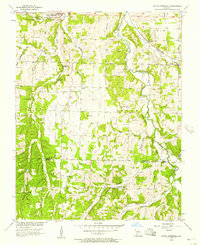
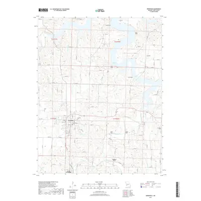
 1956 Greenfield1957 Print · USGSMid-century Dade County centers on the busy trade hub of Greenfield as the rail-driven economy of South Greenfield takes shape to the south. Genealogists can trace family landmarks like Wetzel Cem, Carr Chapel, and the historic crossing at Fiddlers Ford.3 unique versions available
 - 1956 Map of South Greenfield, 1957 Print
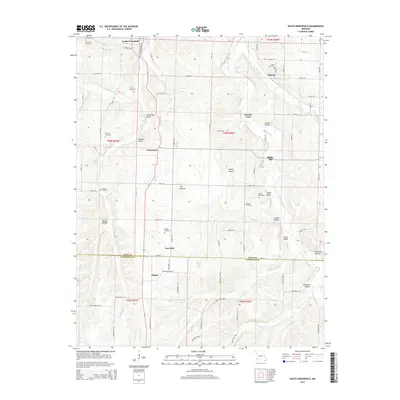
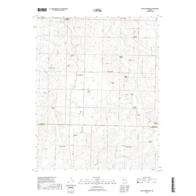
 1956 South Greenfield1957 Print · USGSThe rural borderlands of Dade and Lawrence counties are shown here in the mid-fifties, centered on the railroad town of South Greenfield. Researchers can trace old family burial grounds like Daughtrey Cem and Merrick Cem or locate local landmarks like Dilday Mill and Carrico Caves.
 - 1958 Map of Springfield
 1958 Springfield1958 Print · USGSThe Missouri Ozarks are captured during the mid-century era of growth, centered on the bustling hub of Springfield. Genealogists and historians can trace family roots through numerous landmarks like Ebenezer Church, Stockton Cem, and the various county courthouses.
 - 1959 Map of Springfield
 1959 Springfield1959 Print · USGSThe Missouri Ozarks are captured here during a decade of postwar growth and increasing highway connectivity. Researchers can trace the legacy of the St Louis-San Francisco RR and locate early sites in Springfield, Lebanon, and Mountain Grove.
 - 1982 Map of Springfield, 1983 Print
 1982 Springfield1983 Print · USGSSpringfield and the surrounding Ozark plateau are captured in the early eighties as the region balanced urban growth with its agricultural roots. Genealogists and researchers can trace the locations of White Chapel, the State Sanatorium, and older rail stops like Brookline.
 - 2011 Map of South Greenfield, 2011 Print
 2011 South Greenfield2011 Print · USGSCovers South Greenfield, including Pilgrim, Pennsboro, and other nearby areas
 - 2011 Map of Greenfield, 2011 Print
 2011 Greenfield2011 Print · USGSCovers South Greenfield, including Greenfield, Fiddlers Ford, and other nearby areas
 - 2015 Map of South Greenfield, 2015 Print
 2015 South Greenfield2015 Print · USGSCovers South Greenfield, including Pilgrim, Pennsboro, and other nearby areas
 - 2015 Map of Greenfield, 2015 Print
 2015 Greenfield2015 Print · USGSCovers South Greenfield, including Greenfield, Fiddlers Ford, and other nearby areas
 - 2017 Map of South Greenfield, 2017 Print
 2017 South Greenfield2017 Print · USGSCovers South Greenfield, including Pilgrim, Pennsboro, and other nearby areas
 - 2017 Map of Greenfield, 2017 Print
 2017 Greenfield2017 Print · USGSCovers South Greenfield, including Greenfield, Fiddlers Ford, and other nearby areas
 - 2021 Map of South Greenfield, 2021 Print
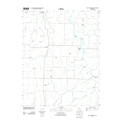
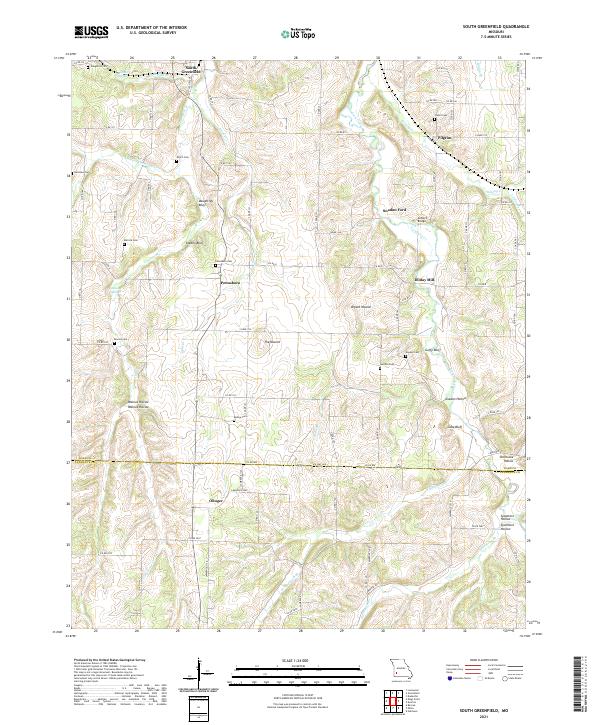 2021 South Greenfield2021 Print · USGSSouthwestern Missouri's rural interior comes into focus here at the start of the 2020s, documenting the creek-carved hillsides of Dade and Lawrence Counties. Researchers can locate local landmarks like Dilday Mill, Snadon Ford, and numerous family burial grounds including Friend Cem.
 - 2021 Map of Greenfield, 2021 Print
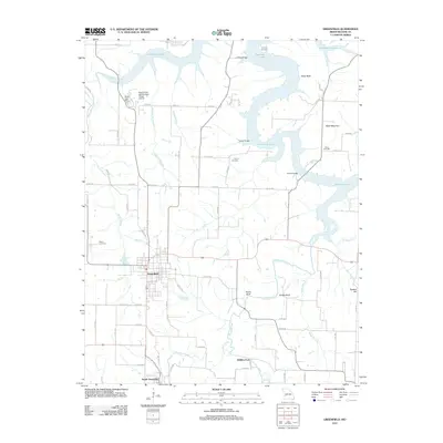
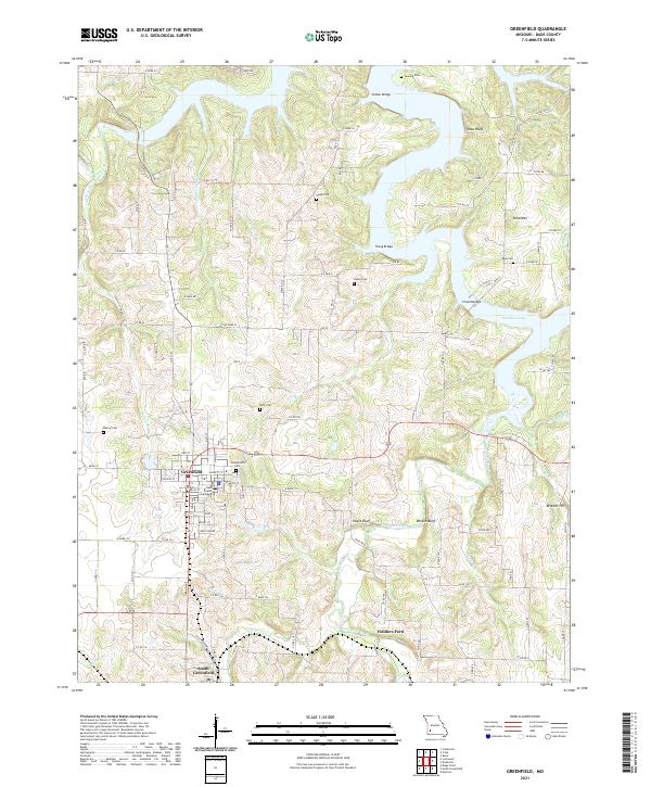 2021 Greenfield2021 Print · USGSGreenfield and Dade County come into focus in this contemporary study of southwest Missouri. Researchers can trace family history through local sites like the Dade County Courthouse, Fiddlers Ford, and the Rose Cem near Stockton Lake.
End of results
Showing maps 1-16 of 16
Top cities near South Greenfield
- Greenfield historical maps
- Lockwood historical maps
- Miller historical maps
- Everton historical maps
- Dadeville historical maps
- Pilgrim historical maps
See more
Frequently asked questions
- What are the different types of historical maps available for South Greenfield?
- What is the oldest map of South Greenfield?
- Where can I purchase historical maps of South Greenfield for my home or office?
- Where can I download high-res historical maps of South Greenfield?
- Are there historical topographic maps available for South Greenfield?
- Is there historical aerial imagery available for South Greenfield?
- Where are historical maps of South Greenfield sourced from?