Old Maps of Dallas Township, Missouri for Academic Research
Study the evolution of Dallas Township with 38 high-resolution historic maps. Whether you're teaching, researching, or modeling changes in land use, these maps provide essential visual documentation of urban, environmental, and geographic change.
- Analyze long-term change: Track patterns in development, transportation, and natural features.
- Ideal for environmental or urban studies: Support academic projects with primary historical map data.
- Use in the classroom or lab: Educators and researchers rely on these maps to bring historical context to life.
These maps are a powerful tool for teaching, research, and visualizing how Dallas Township has changed over the decades.
Dallas Township, MO maps
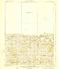
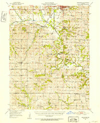
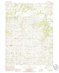
(38)- 1923 Map of Maysville, 1966 Print
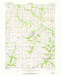 1923 Maysville1966 Print · USGSDeKalb County at the start of the twenties was a landscape of thriving rural school districts and bustling rail towns. Genealogists can locate family landmarks like Butler Cemetery or trace community life at Marvin Chapel and Fairmount School.
 - 1924 Map of Winston
 1924 Winston1924 Print · USGSDaviess and Caldwell counties are shown here in the 1920s, featuring a dense network of rural schools and multiple railroad junctions. Researchers can trace family history through landmarks like Roasting Ear School, Wamsley Church, and the town of Winston.3 unique versions available
 - 1925 Map of Pattonsburg
 1925 Pattonsburg1925 Print · USGSDaviess and Gentry counties are shown here in the mid-1920s as a thriving rail and river landscape. Researchers can trace the paths of the Wabash railroad through Pattonsburg or locate rural landmarks like Wesley Chapel and the Everly School.3 unique versions available
 - 1925 Map of Maysville
 1925 Maysville1925 Print · USGSDeKalb County is shown in the mid-1920s as a thriving patchwork of rural school districts and rail-connected towns. Genealogists and local historians can trace family roots through dozens of named landmarks like Hedge School, Marvin Chapel, and Amity Cemetery.2 unique versions available
 - 1925 Map of Darlington
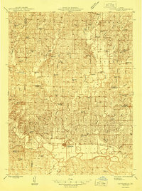
 1925 Darlington1925 Print · USGSGentry and DeKalb counties come alive in the mid-1920s, showing a landscape of small farmsteads and rural schoolhouses. Genealogists can trace family roots through landmarks like Mt Tabor Church, Ford City, and the uniquely named Rattlesnake School.3 unique versions available
 - 1944 Map of Pattonsburg, 1977 Print
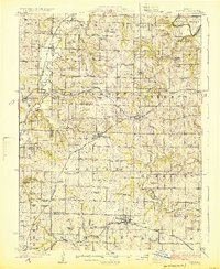
 1944 Pattonsburg1977 Print · USGSNorthwest Missouri in the 1940s is defined here by the winding Grand River and the busy WABASH rail line. Genealogists can locate family landmarks like Savage Cem, the Coffey P O and Sta, and rural centers such as Mitchellville.2 unique versions available
 - 1946 Map of Pattonsburg
 1946 Pattonsburg1946 Print · USGSNorthwest Missouri's river valleys and rail lines are captured here in the mid-1940s, showing a landscape defined by small-scale agriculture and close-knit rural communities. Genealogists can locate numerous local institutions like Virginia Ridge Sch, Pattonsburg, and the Crab Orchard Cem.
 - 1948 Map of Pattonsburg
 1948 Pattonsburg1948 Print · USGSDaviess and Gentry counties are shown here just after the war, featuring the winding Grand River and the Wabash rail line. Researchers can locate many former rural landmarks, including Rice Town Sch, Mooney Bridge, and Salem Coffey P O and Sta.2 unique versions available
 - 1950 Map of Kansas City
 1950 Kansas City1950 Print · USGSMid-century Kansas and Missouri are captured here during a period of industrial growth and shifting transportation. Genealogists and historians can trace rail lines like the Wabash RR or locate ancestral homes near the Potawatomi Indian Reservation and Horton.
 - 1950 Map of Darlington, 1952 Print
 1950 Darlington1952 Print · USGSNorthwest Missouri's agricultural heartland is documented here in the early postwar era, centering on the rail junctions and river valleys of Gentry County. Researchers can trace dozens of country schoolhouses like Buckley Sch and Red Star Sch, alongside community hubs such as Gentryville and Ford City.
 - 1954 Map of Kansas City
 1954 Kansas City1954 Print · USGSThe Missouri-Kansas borderlands flourished in the post-war era as river commerce and rail networks converged at the Missouri River. Genealogists and historians can trace the foundations of Kansas City and smaller rural hubs like Hiawatha or Sabetha.
 - 1955 Map of Nebraska City, 1967 Print
 1955 Nebraska City1967 Print · USGSThe four-state region surrounding the Missouri River valley appears here in the mid-1950s, a landscape of rail-dependent market towns and rural school districts. Genealogists can locate family landmarks like the Rock Bluff School, St Oswald Church, and the Clarinda State Hospital.3 unique versions available
 - 1956 Map of Kansas City, 1967 Print
 1956 Kansas City1967 Print · USGSThe Kansas-Missouri border region thrived during the mid-fifties, centered on the growing metropolitan cores and the busy river valleys. Researchers can trace the layout of significant government sites like Fort Leavenworth and the Lake City Army Ammunition Plant.4 unique versions available
 - 1957 Map of Nebraska City
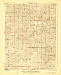
 1957 Nebraska City1957 Print · USGSThe four-state junction of Nebraska, Iowa, Missouri, and Kansas comes alive in this mid-fifties survey of the Missouri River valley. Genealogists and historians can trace the rail-and-road networks connecting Nebraska City, Maryville, and the Squaw Creek National Wildlife Refuge.
 - 1958 Map of Nebraska City
 1958 Nebraska City1958 Print · USGSThe Missouri River Valley and its fertile four-state borderlands are captured here during the mid-century expansion of the regional highway and rail networks. Genealogists can trace family roots through numerous rural landmarks like Moulton School, Shady Grove Church, and the Clarinda State Hospital.
 - 1960 Map of Kansas City
 1960 Kansas City1960 Print · USGSMid-century Kansas and Missouri meet at the river forks, showing a sprawling rail-and-river economy during the 1950s growth era. Genealogists and researchers can trace tribal lands like the Kickapoo Indian Reservation or follow the early interstate corridors through Saint Joseph and Independence.3 unique versions available
 - 1983 Map of Maysville, 1984 Print
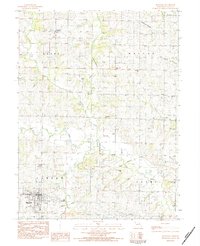 1983 Maysville1984 Print · USGSDeKalb County farmland is captured here in the early 1980s, centered on the county seat and the surrounding rural townships. Genealogists can trace family footprints across numerous rural burial sites like Norwegian Cem, Schambaugh-Cope Cem, and Oak Lawn Cem.
 - 1983 Map of Weatherby, 1984 Print
 1983 Weatherby1984 Print · USGSNorthwestern Missouri's rolling farm country comes to life in the 1980s, centering on the rural community of Weatherby and the DeKalb and Daviess county line. Researchers can trace family sites like Muddy Cemetery and the Old Railroad Grade winding through the hills.
 - 1984 Map of Pattonsburg, 1985 Print
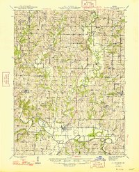
 1984 Pattonsburg1985 Print · USGSNorthwest Missouri's river-bottom landscapes and rural rail history come alive in this mid-eighties survey of the Daviess County region. Researchers can trace the path of the Old Railroad Grade and explore the winding banks of the Grand River near Pattonsburg.
 - 1985 Map of Berlin
 1985 Berlin1985 Print · USGSGentry and De Kalb Counties in the mid-1980s are defined by the winding course of the Grand River and its many wooded tributaries. Researchers can locate the small community of Berlin, the riverside Andy Denton Public Access, and the winding North Fork Lost Creek.
 - 1986 Map of Maryville
 1986 Maryville1986 Print · USGSNorthwest Missouri's agricultural heartland is documented here in the mid-1980s, from the campus at Northwest Missouri State University to the Grand River valley. Genealogists can trace family footprints across dozens of local burial grounds like Alanthus Grove Cem and Brooklyn Cem.2 unique versions available
 - 1986 Map of Saint Joseph
 1986 Saint Joseph1986 Print · USGSNorthwest Missouri thrived as a regional transportation and educational hub during the mid-eighties, centered on the historic river city of Saint Joseph. Researchers can locate specific local landmarks like Burlington Cemetery, Pigeon Hill Church, and the winding Pony Express Trail.2 unique versions available
 - 2011 Map of Berlin, 2011 Print
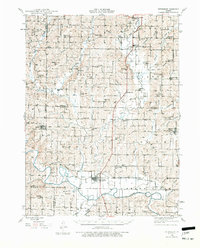
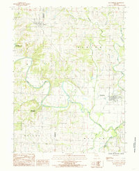
 2011 Berlin2011 Print · USGSCovers Dallas Township, including Berlin, Grant Township, and other nearby areas
 - 2011 Map of McFall, 2011 Print
 2011 McFall2011 Print · USGSCovers Dallas Township, including McFall, Old Pattonsburg, and other nearby areas
 - 2012 Map of Maysville, 2012 Print
 2012 Maysville2012 Print · USGSCovers Dallas Township, including Maysville, Grant Township, and other nearby areas
Showing maps 1-25 of 38
Top cities near Dallas Township
- Cameron historical maps
- Maysville historical maps
- Kidder historical maps
- Pattonsburg historical maps
- Winston historical maps
- Altamont historical maps
See more
Top neighborhoods of Dallas Township
Frequently asked questions
- What are the different types of historical maps available for Dallas Township?
- What is the oldest map of Dallas Township?
- Where can I purchase historical maps of Dallas Township for my home or office?
- Where can I download high-res historical maps of Dallas Township?
- Are there historical topographic maps available for Dallas Township?
- Is there historical aerial imagery available for Dallas Township?
- Where are historical maps of Dallas Township sourced from?