1970s Maps of Dunklin County, Missouri
Explore 8 historic maps of Dunklin County from the 1970s. These maps offer a rare glimpse into what life looked like during the 1970s — showing old roads, neighborhoods, homes, and landmarks that have changed or disappeared over time.
Whether you're researching your family's past, planning a metal detecting trip, or studying how Dunklin County's landscape evolved across the 1970s, these high-resolution maps are a powerful tool for exploring the history of this region.
- Focus on a specific era: All maps on this page are from the 1970s, giving you a focused view of this time period.
- See what’s changed: Compare century-old streets, trails, and buildings to today's modern landscape using overlays and satellite layers.
- Research with precision: Use these maps for genealogy, historical research, land use analysis, or educational projects.
- View, download, or print: Maps are fully viewable online in high resolution, and can be downloaded or printed for your own records.
Start exploring Dunklin County's history through authentic maps from the 1970s. This is your window into the past.
Dunklin County, MO maps
(8)- 1972 Map of Blytheville, 1974 Print
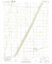
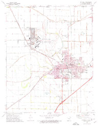 1972 Blytheville1974 Print · USGSBlytheville and the surrounding Delta farm country are captured here in the early seventies during the height of the Cold War. Genealogists and local historians can trace family locations near Mt Zion Cem, the massive Blytheville Air Force Base, and rural schools like Fairview Sch.2 unique versions available
 - 1976 Map of Blytheville
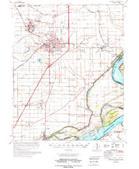 1976 Blytheville1976 Print · USGSBlytheville and the Mississippi River Delta are captured here in the mid-seventies, showing a landscape defined by military aviation and river commerce. Genealogists and researchers can locate family sites at Memorial Park Cem, trace the vanished streets of Yarbro, or explore the extensive Blytheville Air Force Base.
 - 1978 Map of Denton, 1979 Print
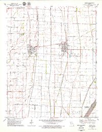
 1978 Denton1979 Print · USGSThe Missouri Bootheel landscape is captured here in the late seventies, showing a highly engineered agricultural plain at the Arkansas border. Genealogists and local historians can trace family sites like Macedonia Cem, St Matthews Ch, and the settlement at Hermondale.
 - 1978 Map of Malden, 1979 Print
 1978 Malden1979 Print · USGSThe Missouri Bootheel in the late seventies reveals a landscape of engineered drainage and rail-side growth. Genealogists and local historians can locate several family burial grounds like Macedonia Cem and trace the legacy of Townley and the Malden Municipal Airport.
 - 1978 Map of Bragg City, 1979 Print
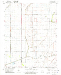
 1978 Bragg City1979 Print · USGSSoutheast Missouri’s Bootheel region in the late seventies reveals a landscape transformed by drainage and rail. Genealogists and local historians can trace the foundations of Bragg City and Peach Orchard alongside rural landmarks like Tatum Chapel and the St Louis-San Francisco line.
 - 1978 Map of Gideon, 1979 Print
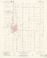
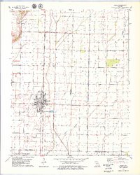
 1978 Gideon1979 Print · USGSIn the Missouri Bootheel during the late seventies, this area shows a landscape defined by an engineered drainage network and established rail lines. Researchers can locate family sites at Mt Gilead Cem, trace the St Louis Southwestern tracks, or explore the grid of Clarkton.
 - 1978 Map of Bernie, 1979 Print
 1978 Bernie1979 Print · USGSBernie and the surrounding Bootheel lowlands are captured in the late seventies, showing a landscape defined by industrial drainage and rail transport. Genealogists can locate family sites at Poplin Cem or trace the routes between Sugar Tree Ch and the ST LOUIS SOUTHWESTERN line.
 - 1978 Map of Deering, 1979 Print
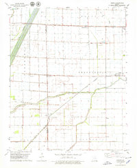 1978 Deering1979 Print · USGSThe Missouri Bootheel is shown in the late seventies as a landscape of precision drainage and rail-side settlements. Genealogists can locate family landmarks like Jones Cem, United Ch, and small rural communities such as Tinkerville and Oakville.
End of results
Showing maps 1-8 of 8
Top cities of Dunklin County
- Kennett historical maps
- Malden historical maps
- Campbell historical maps
- Senath historical maps
- Clarkton historical maps
- Cardwell historical maps
See more
Frequently asked questions
- What are the different types of historical maps available for Dunklin County?
- What is the oldest map of Dunklin County?
- Where can I purchase historical maps of Dunklin County for my home or office?
- Where can I download high-res historical maps of Dunklin County?
- Are there historical topographic maps available for Dunklin County?
- Is there historical aerial imagery available for Dunklin County?
- Where are historical maps of Dunklin County sourced from?