1980s Maps of Dunklin County, Missouri
Explore 24 historic maps of Dunklin County from the 1980s. These maps offer a rare glimpse into what life looked like during the 1980s — showing old roads, neighborhoods, homes, and landmarks that have changed or disappeared over time.
Whether you're researching your family's past, planning a metal detecting trip, or studying how Dunklin County's landscape evolved across the 1980s, these high-resolution maps are a powerful tool for exploring the history of this region.
- Focus on a specific era: All maps on this page are from the 1980s, giving you a focused view of this time period.
- See what’s changed: Compare century-old streets, trails, and buildings to today's modern landscape using overlays and satellite layers.
- Research with precision: Use these maps for genealogy, historical research, land use analysis, or educational projects.
- View, download, or print: Maps are fully viewable online in high resolution, and can be downloaded or printed for your own records.
Start exploring Dunklin County's history through authentic maps from the 1980s. This is your window into the past.
Dunklin County, MO maps
(24)- 1983 Map of Dyersburg
 1983 Dyersburg1983 Print · USGSSpanning the Mississippi River at the start of the 1980s, this area shows the vital river-and-rail connections between Tennessee and Missouri. Researchers can trace family sites at Mount Pisgah Cemetery or study the evolving shoreline near Caruthersville and Reelfoot Lake.
 - 1983 Map of Poplar Bluff
 1983 Poplar Bluff1983 Print · USGSSoutheast Missouri in the early 1980s reveals a landscape defined by the Ozark foothills and the complex drainage systems of the Bootheel. Researchers can trace the rail corridors of the Missouri Pacific RR through Poplar Bluff or locate rural sites like Wilhelmina Church and Lone Hill Lookout.
 - 1983 Map of Senath, 1984 Print
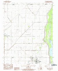
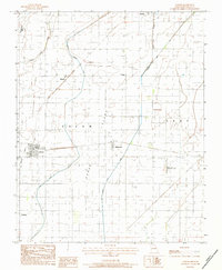
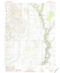
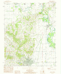
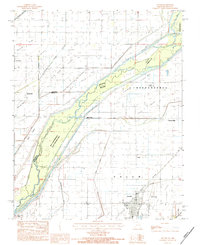 1983 Senath1984 Print · USGSDunklin County and the Arkansas borderlands come alive in this early 1980s survey of the river-braided lowlands. Researchers can trace rural livelihoods through landmarks like Mitchell Mill, the Burlington Northern rail line, and the wetlands of the Ben Cash Memorial State Wildlife Area.
 - 1983 Map of Kennett North, 1984 Print
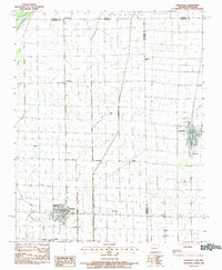
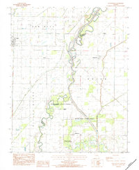
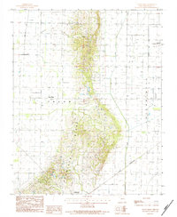
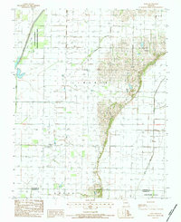
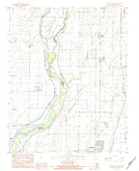 1983 Kennett North1984 Print · USGSDunklin County and the Arkansas borderlands are captured in the early eighties as a landscape of river islands and evolving rail lines. Genealogists and local historians can trace the foundations of Kennett and rural outposts like Frisbee and Nimmons.
 - 1983 Map of Hornersville, 1984 Print
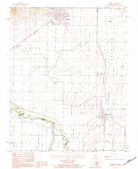
 1983 Hornersville1984 Print · USGSDunklin County in the early eighties shows a highly engineered agricultural landscape shaped by massive drainage projects. Trace the history of small settlements like Cotton Plant, Sunrise, and Rives alongside the St Louis Southwestern RR.
 - 1983 Map of Cardwell, 1984 Print
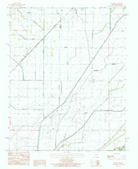
 1983 Cardwell1984 Print · USGSThe Missouri-Arkansas border along the St Francis River comes into sharp focus during the early eighties. Genealogists and local historians can trace family roots near Cardwell or locate vanished landmarks like Buck Donic and Bark Camp Island.
 - 1983 Map of Manila North, 1984 Print
 1983 Manila North1984 Print · USGSNorthern Mississippi County at the start of the eighties shows a landscape of reclaimed wetlands and established rural centers. Genealogists and historians can trace the foundations of Manila and Leachville or locate long-standing landmarks like Jolliff Store and Browns Chapel.
 - 1983 Map of Leachville, 1984 Print
 1983 Leachville1984 Print · USGSThe Arkansas-Missouri state line comes alive in the late seventies, showing a landscape defined by drainage ditches and rural junctions. Trace local roots through Leachville, Monette, and community landmarks like Happy Corner Ch.
 - 1983 Map of Dixie, 1984 Print
 1983 Dixie1984 Print · USGSNortheastern Arkansas in the late seventies and early eighties shows a landscape shaped by massive water management projects and river bottom agriculture. Researchers can trace rural communities like Schug and Dixie, along with remote landmarks like Burnt Hill Ch and Miller Cem near the St Francis River.
 - 1983 Map of Paragould East, 1984 Print
 1983 Paragould East1984 Print · USGSGreene County agriculture and the eastward expansion of Paragould are on full display in the early eighties. Genealogists and researchers can trace local landmarks like Morning Star, Cotton Belt, and the intricate fish ponds near Lake Side.2 unique versions available
 - 1983 Map of Arbyrd, 1984 Print
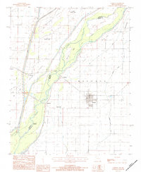
 1983 Arbyrd1984 Print · USGSThe Missouri Bootheel appears here in the early eighties as a landscape shaped by drainage and agriculture. Genealogists and local historians can trace the footprint of settlements like Arbyrd and Hollywood or locate the Old RR Sp and Hornersville Municipal Airport.
 - 1983 Map of Glennonville, 1984 Print
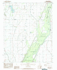
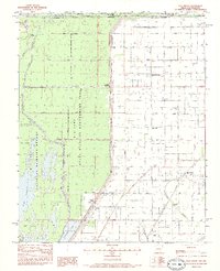
 1983 Glennonville1984 Print · USGSDunklin County agricultural and river life are preserved here in the early eighties, showcasing a landscape of drainage canals and small settlements. Researchers can trace the meandering St Francis River and locate historic community centers like Glennonville, Wilhelmina, and Qulin.
 - 1983 Map of Kennett South, 1984 Print
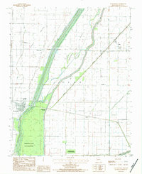
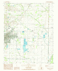
 1983 Kennett South1984 Print · USGSDunklin County and the Arkansas borderlands come into focus in this early 1980s survey of the Missouri Bootheel. Genealogists and local researchers can trace the rural communities of Caruth, Dillman, and Vincit alongside the drainage networks of The Floodway.
 - 1983 Map of Half Moon, 1984 Print
 1983 Half Moon1984 Print · USGSThe Missouri-Arkansas borderlands in the early 1980s show a landscape of intensive drainage and wildlife conservation. Genealogists and local historians can trace small settlements like Half Moon and Stark City, or locate family landmarks such as Wilkerson Cem and Simmons Bridge.
 - 1984 Map of Broseley
 1984 Broseley1984 Print · USGSSoutheast Missouri in the early eighties shows a landscape shaped by the St Francis River and extensive drainage projects. Genealogists and local historians can trace family locations near Broseley, Nyssa, and the high ground of Ash Hill.
 - 1984 Map of Valley Ridge
 1984 Valley Ridge1984 Print · USGSDunklin County is seen during the early eighties as agricultural and transit networks expanded across the Bootheel. Researchers can trace the path of the St Louis Southwestern railroad or locate local landmarks like Crowleys Ridge and Bethany.
 - 1984 Map of Campbell
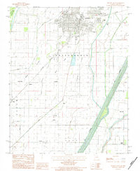
 1984 Campbell1984 Print · USGSDunklin County and the Missouri-Arkansas border are captured here in the mid-1980s, showcasing the agricultural heart of the Bootheel region. Genealogists and local historians can trace the rail corridors of the St Louis and Southwestern, or find old river crossings like Browns Ferry.
 - 1984 Map of Mounds
 1984 Mounds1984 Print · USGSNortheast Arkansas in the early eighties was a landscape of intricate drainage systems and rail-side settlements. Genealogists and collectors can trace the St Louis Southwestern RR through rural outposts like Mounds, Slavens, and Fritz.
 - 1984 Map of Piggott
 1984 Piggott1984 Print · USGSClay County, Arkansas, was a landscape of river-bend borders and rail lines in the early 1980s. Genealogists and historians can trace the paths of the St Louis Southwestern railroad and locate old river features like Bass Island and Chalk Bluff.
 - 1984 Map of Powe
 1984 Powe1984 Print · USGSSoutheast Missouri in the early eighties shows a transition from wetland conservation to productive farmland. Trace local roots in Powe and Pyletown or explore the drainage systems of Main Ditch and the Otter Slough State Wildlife Management Area.
 - 1984 Map of Paragould
 1984 Paragould1984 Print · USGSNortheast Arkansas and the Missouri Bootheel appear here in the mid-1980s as a landscape of ridge-top towns and engineered delta drainage. Genealogists and historians can locate rural landmarks like Oak Grove Church, trace the St Louis San Francisco RR, or explore the limits of Crowleys Ridge State Park.2 unique versions available
 - 1985 Map of Sikeston, 1986 Print
 1985 Sikeston1986 Print · USGSThe Missouri Bootheel and the four-state river convergence are captured in the mid-eighties as the modern agricultural and rail networks matured. Researchers can locate regional landmarks like the Towosahgy State Historic Site, Oak Grove Cem, and towns along the St Louis Southwestern Railroad.2 unique versions available
 - 1986 Map of Jonesboro
 1986 Jonesboro1986 Print · USGSNortheast Arkansas in the mid-eighties shows a landscape of intensive drainage and railroad junctions centered on the rise of Crowley's Ridge. Researchers can trace the rail corridors of the St Louis Southwestern Railway and explore the unique geography of Hatchie Coon Island and the Mississippi River floodplain.2 unique versions available
 - 1986 Map of Blytheville
 1986 Blytheville1986 Print · USGSThe Arkansas-Tennessee borderlands appear here in the mid-eighties, centered on the mighty Mississippi River and its shifting islands. Trace the footprints of Blytheville Air Force Base, old river towns like Golddust, and the extensive grounds of the Fort Pillow State Prison Farm.2 unique versions available
End of results
Showing maps 1-24 of 24
Top cities of Dunklin County
- Kennett historical maps
- Malden historical maps
- Campbell historical maps
- Senath historical maps
- Clarkton historical maps
- Cardwell historical maps
See more
Frequently asked questions
- What are the different types of historical maps available for Dunklin County?
- What is the oldest map of Dunklin County?
- Where can I purchase historical maps of Dunklin County for my home or office?
- Where can I download high-res historical maps of Dunklin County?
- Are there historical topographic maps available for Dunklin County?
- Is there historical aerial imagery available for Dunklin County?
- Where are historical maps of Dunklin County sourced from?