1960s Maps of Parkwood, Springfield
Explore 4 historic maps of Parkwood from the 1960s. These maps offer a rare glimpse into what life looked like during the 1960s — showing old roads, neighborhoods, homes, and landmarks that have changed or disappeared over time.
Whether you're researching your family's past, planning a metal detecting trip, or studying how Parkwood's landscape evolved across the 1960s, these high-resolution maps are a powerful tool for exploring the history of this region.
- Focus on a specific era: All maps on this page are from the 1960s, giving you a focused view of this time period.
- See what’s changed: Compare century-old streets, trails, and buildings to today's modern landscape using overlays and satellite layers.
- Research with precision: Use these maps for genealogy, historical research, land use analysis, or educational projects.
- View, download, or print: Maps are fully viewable online in high resolution, and can be downloaded or printed for your own records.
Start exploring Parkwood's history through authentic maps from the 1960s. This is your window into the past.
Parkwood, Springfield maps
(4)- 1960 Map of Springfield, 1961 Print
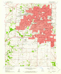 1960 Springfield1961 Print · USGSSpringfield and its surrounding Greene County townships appear in the early sixties during a season of post-war growth. Researchers can trace institutional roots at Southwest Missouri State College, explore the FEDERAL MEDICAL CENTER, or locate family sites near Hazelwood Cemetery and Bethany Ch.4 unique versions available
 - 1960 Map of Galloway, 1961 Print
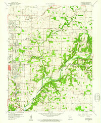 1960 Galloway1961 Print · USGSEastern Greene County at the dawn of the 1960s shows a mix of rural heritage and emerging city growth. Researchers can trace family roots through numerous landmarks like Kinser Chapel, the St Louis San Francisco railroad, and Bodenhamer Cem.4 unique versions available
 - 1961 Map of Ebenezer, 1962 Print
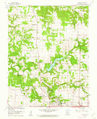 1961 Ebenezer1962 Print · USGSNorth of Springfield in the early sixties, the landscape transitions from growing suburbs to established prairie farms and river valleys. Researchers can trace family roots at Greenlawn Cemetery or locate landmarks like Fantastic Caverns and McDaniel Lake.3 unique versions available
 - 1961 Map of Bassville, 1962 Print
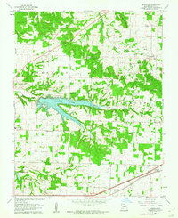 1961 Bassville1962 Print · USGSNortheast of Springfield in the early sixties, this area shows the recently established Fellows Lake and the rural crossroads of the day. Researchers can locate family landmarks like Salem Cem, Hickory Barren, and the old Pleasant View Sch.3 unique versions available
End of results
Showing maps 1-4 of 4
Frequently asked questions
- What are the different types of historical maps available for Parkwood?
- What is the oldest map of Parkwood?
- Where can I purchase historical maps of Parkwood for my home or office?
- Where can I download high-res historical maps of Parkwood?
- Are there historical topographic maps available for Parkwood?
- Is there historical aerial imagery available for Parkwood?
- Where are historical maps of Parkwood sourced from?