1940s Maps of Leota, Missouri
Explore 4 historic maps of Leota from the 1940s. These maps offer a rare glimpse into what life looked like during the 1940s — showing old roads, neighborhoods, homes, and landmarks that have changed or disappeared over time.
Whether you're researching your family's past, planning a metal detecting trip, or studying how Leota's landscape evolved across the 1940s, these high-resolution maps are a powerful tool for exploring the history of this region.
- Focus on a specific era: All maps on this page are from the 1940s, giving you a focused view of this time period.
- See what’s changed: Compare century-old streets, trails, and buildings to today's modern landscape using overlays and satellite layers.
- Research with precision: Use these maps for genealogy, historical research, land use analysis, or educational projects.
- View, download, or print: Maps are fully viewable online in high resolution, and can be downloaded or printed for your own records.
Start exploring Leota's history through authentic maps from the 1940s. This is your window into the past.
Leota, MO maps
(4)- 1944 Map of Cureall, 1962 Print
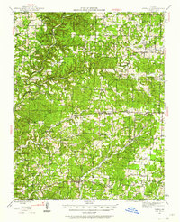 1944 Cureall1962 Print · USGSThe Missouri-Arkansas borderlands come alive in this mid-century survey of the Ozarks during a time when rural life centered on local river crossings and country schoolhouses. Trace family history through the numerous sites like Alice Mine, Breakup Mill, and Cureall Cem.2 unique versions available
 - 1945 Map of Harrison
 1945 Harrison1945 Print · USGSThe Ozark and Boston Mountains straddle the Missouri-Arkansas border during the mid-forties, showing a landscape of forest ridges and river valleys. Genealogists and historians can trace rail-connected towns like Monett and West Plains or early lake developments at Bull Shoals Res and Norfork Lake.
 - 1946 Map of Cureall
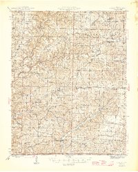 1946 Cureall1946 Print · USGSThe Missouri-Arkansas borderlands are captured here in the mid-forties, showing a rural landscape defined by ridge-top farms and deep river hollows. Genealogists can locate dozens of country schools and churches, including Hawkins Ridge School, Alice Mine, and Cold Springs Church.2 unique versions available
 - 1949 Map of Harrison
 1949 Harrison1949 Print · USGSThe Ozark highlands of northern Arkansas and southern Missouri are shown just after the war, when the White River still followed its original course. Genealogists and historians can trace rail lines like the Missouri & Arkansas RR and locate rural hubs like Harrison, Eureka Springs, and Mountain Home.
End of results
Showing maps 1-4 of 4
Top cities near Leota
Frequently asked questions
- What are the different types of historical maps available for Leota?
- What is the oldest map of Leota?
- Where can I purchase historical maps of Leota for my home or office?
- Where can I download high-res historical maps of Leota?
- Are there historical topographic maps available for Leota?
- Is there historical aerial imagery available for Leota?
- Where are historical maps of Leota sourced from?