Old Maps of West Plains, Missouri for Hiking & Exploration
Hike through history with 34 historic maps of West Plains. Explore old trails, ghost towns, and forgotten backroads — perfect for outdoor adventurers and local explorers.
- Rediscover forgotten places: Map out old mining camps, roads, and footpaths that no longer exist on modern maps.
- Layer with modern tools: Combine with LiDAR or satellite views to plan hikes through historical terrain.
- Made for exploration: Popular among hikers, overlanders, and local history lovers.
Use these maps to find adventure and explore the hidden past of West Plains.
West Plains, MO maps
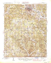
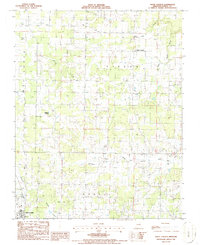
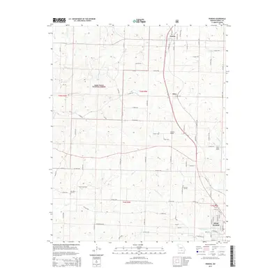
(34)- 1938 Map of West Plains, 1954 Print
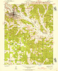 1938 West Plains1954 Print · USGSWest Plains was a bustling Missouri rail town in the late 1930s, centered in the Howell Valley. Genealogists can locate family landmarks such as the County Cem, rural schools like Renfrow Sch, and the St Louis San Francisco rail corridor.3 unique versions available
 - 1940 Map of West Plains
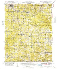
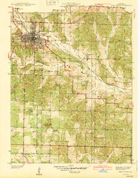 1940 West Plains1940 Print · USGSWest Plains was a bustling Ozark rail hub just before the mid-century, surrounded by a landscape of family farms and valley schools. Genealogists can locate specific local landmarks like County Home, Smith Chapel, and the St Louis San Francisco rail corridor.
 - 1944 Map of West Plains, 1957 Print
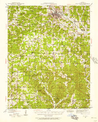 1944 West Plains1957 Print · USGSThe West Plains region at the close of the Second World War remains a landscape of rail-connected commerce and scattered rural school districts. Genealogists can locate family names at Saddle Cem, Neubarger Sch, or the rural community of Lanton.2 unique versions available
 - 1945 Map of Willow Springs, 1954 Print
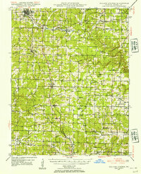 1945 Willow Springs1954 Print · USGSThis Howell County survey captured the Missouri Ozarks at mid-century, when the railroad still linked small farming towns. Researchers can trace rural school locations like College Hill Sch and cemeteries such as Lone Pine Cem and Rowe Cem.3 unique versions available
 - 1946 Map of West Plains
 1946 West Plains1946 Print · USGSHowell County's rolling uplands and rural communities are captured here in the mid-1940s, centered on the growing hub of West Plains. Researchers can trace dozens of vanished country school sites and family-linked landmarks like Pleasant Hill Ch, Mc Elmery Cem, and Moody.2 unique versions available
 - 1948 Map of Willow Springs
 1948 Willow Springs1948 Print · USGSHowell County's post-war landscape comes alive through this mid-century survey of the Ozark Plateau. Researchers can trace family history through dozens of rural landmarks, from Sky Haven Airport and Trask to the Simms Valley Sch and Walkers Chapel.
 - 1957 Map of Poplar Bluff, 1968 Print
 1957 Poplar Bluff1968 Print · USGSThe Missouri-Arkansas border region is captured here as the timber and rail industries shaped the Ozark foothills. Genealogists and historians can trace the Missouri Pacific Railroad through river towns like Pocahontas, Greenville, and Van Buren.3 unique versions available
 - 1959 Map of Poplar Bluff
 1959 Poplar Bluff1959 Print · USGSThe Missouri Ozarks and Arkansas borderlands meet in this late 1950s study of the region's diverse terrain and rail-fed towns. Researchers can trace the path of the Missouri Pacific Railroad through Poplar Bluff or locate smaller settlements like Birch Tree and Myrtle.
 - 1960 Map of Poplar Bluff
 1960 Poplar Bluff1960 Print · USGSSoutheast Missouri and Northeast Arkansas are captured here during the post-war era, showing the transition from the Ozark highlands to the Delta. Genealogists and historians can trace rail corridors like the St. Louis Southwestern RR and remote settlements such as Birch Tree and Warm Springs.
 - 1976 Map of West Plains NW, 1977 Print
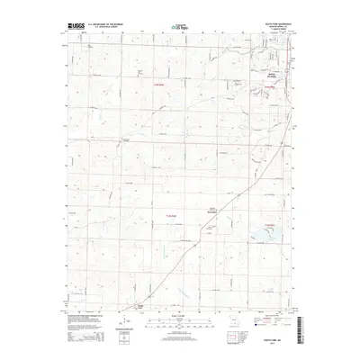
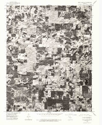 1976 West Plains NW1977 Print · USGSHowell County agriculture and timber tracts are seen in detail in the mid-1970s through this aerial survey. Local researchers can trace the rural landscape surrounding West Plains and the settlement of South Fork along the Spring River.
 - 1976 Map of West Plains, 1977 Print
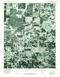
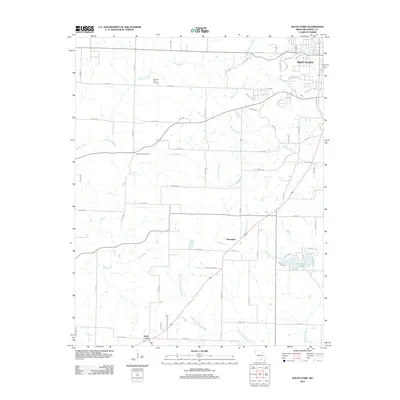
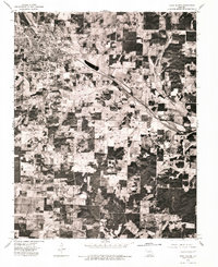 1976 West Plains1977 Print · USGSMid-seventies aerial photography captures the heart of the Ozarks as the community of West Plains expanded. Researchers can trace the layout of residential streets, agricultural field patterns, and the highway corridors that defined the town during this era.
 - 1976 Map of Willow Springs SW, 1977 Print
 1976 Willow Springs SW1977 Print · USGSHowell County, Missouri, is shown here in the mid-seventies through detailed aerial imagery of the Ozark highlands. Local historians can examine the layout of rural communities and transportation corridors at Pomona and Olden.
 - 1983 Map of West Plains, 1984 Print
 1983 West Plains1984 Print · USGSMissouri's Ozark plateau comes into view during the early 1980s, centered on the growing county seat of West Plains. Family historians can trace local landmarks like Parker Cem and Chapin Cem (Radio Cem) or locate rural school sites like Howell Valley Sch.
 - 1983 Map of South Fork, 1984 Print
 1983 South Fork1984 Print · USGSThe rural communities south of West Plains are documented here during the early eighties, showing a landscape defined by traditional Ozark farmsteads and creek valleys. Genealogists can locate family landmarks like Fairview Sch, Spring Creek Ch, and the small settlement of Homeland.
 - 1984 Map of West Plains
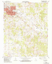
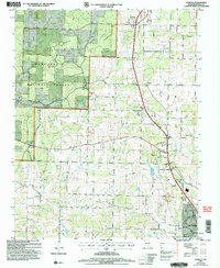
 1984 West Plains1984 Print · USGSThe Missouri Ozarks are mapped here in the mid-1980s, centered on the regional hub of West Plains and the river corridors of the Eleven Point River. Trace the old rail lines and timber towns of Willow Springs, Mountain View, and Birch Tree through the Mark Twain National Forest.2 unique versions available
 - 1986 Map of Pomona
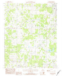
 1986 Pomona1986 Print · USGSHowell County's rolling Ozark landscape appears in transition during the mid-eighties as the borders of West Plains expand northward toward Pomona. Researchers can trace rural lineages through sites like Mt Zion Ch and New Liberty Ch or locate the local Drag Strip.
 - 1986 Map of White Church
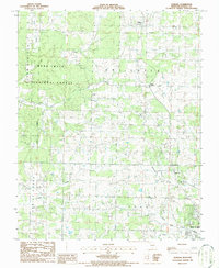
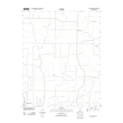
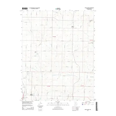
 1986 White Church1986 Print · USGSHowell County in the mid-eighties shows a landscape of quiet rural settlements and winding valley creek systems. Researchers can trace the layout of West Plains near the Fairground or locate the namesake White Church and nearby Cem.
 - 2004 Map of Pomona, 2006 Print
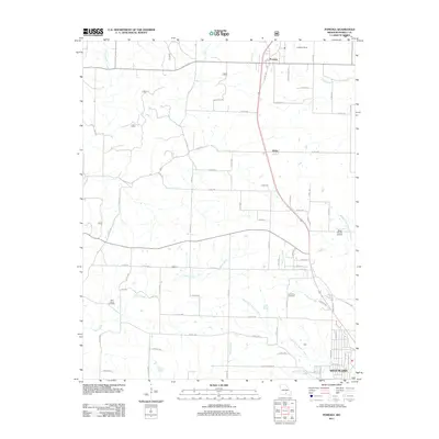
 2004 Pomona2006 Print · USGSHowell County at the turn of the millennium shows the enduring Ozark timberlands of the Mark Twain National Forest alongside a modernizing rural economy. Researchers can trace family sites at Olden and Pomona or find local landmarks like the Drive In Theater and Mt Zion Ch.
 - 2011 Map of Pomona, 2011 Print
 2011 Pomona2011 Print · USGSCovers West Plains, including Pomona, Olden, and other nearby areas
 - 2011 Map of West Plains, 2011 Print
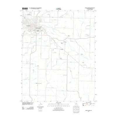 2011 West Plains2011 Print · USGSCovers West Plains, including Chapin, Cottbus, and other nearby areas
 - 2012 Map of South Fork, 2012 Print
 2012 South Fork2012 Print · USGSCovers West Plains, including South Fork, Homeland, and other nearby areas
 - 2012 Map of White Church, 2012 Print
 2012 White Church2012 Print · USGSCovers West Plains, including White Church, Howell County, and other nearby areas
 - 2015 Map of South Fork, 2015 Print
 2015 South Fork2015 Print · USGSCovers West Plains, including South Fork, Homeland, and other nearby areas
 - 2015 Map of White Church, 2015 Print
 2015 White Church2015 Print · USGSCovers West Plains, including White Church, Howell County, and other nearby areas
 - 2015 Map of Pomona, 2015 Print
 2015 Pomona2015 Print · USGSCovers West Plains, including Pomona, Olden, and other nearby areas
Showing maps 1-25 of 34
Top cities near West Plains
Top neighborhoods of West Plains
Frequently asked questions
- What are the different types of historical maps available for West Plains?
- What is the oldest map of West Plains?
- Where can I purchase historical maps of West Plains for my home or office?
- Where can I download high-res historical maps of West Plains?
- Are there historical topographic maps available for West Plains?
- Is there historical aerial imagery available for West Plains?
- Where are historical maps of West Plains sourced from?