1990s Maps of Jackson County, Missouri
Explore 23 historic maps of Jackson County from the 1990s. These maps offer a rare glimpse into what life looked like during the 1990s — showing old roads, neighborhoods, homes, and landmarks that have changed or disappeared over time.
Whether you're researching your family's past, planning a metal detecting trip, or studying how Jackson County's landscape evolved across the 1990s, these high-resolution maps are a powerful tool for exploring the history of this region.
- Focus on a specific era: All maps on this page are from the 1990s, giving you a focused view of this time period.
- See what’s changed: Compare century-old streets, trails, and buildings to today's modern landscape using overlays and satellite layers.
- Research with precision: Use these maps for genealogy, historical research, land use analysis, or educational projects.
- View, download, or print: Maps are fully viewable online in high resolution, and can be downloaded or printed for your own records.
Start exploring Jackson County's history through authentic maps from the 1990s. This is your window into the past.
Jackson County, MO maps
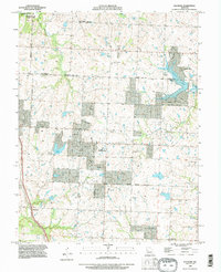
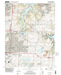
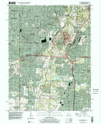
(23)- 1990 Map of Pleasant Hill, 1995 Print
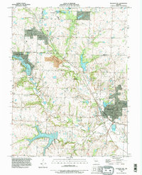 1990 Pleasant Hill1995 Print · USGSPleasant Hill and Greenwood are captured here at the start of the 1990s as these Missouri communities expanded across the county line. Researchers can locate Pleasant Hill Cemetery, the Landing Strip, and Gowdy.
 - 1990 Map of Missouri City, 1995 Print
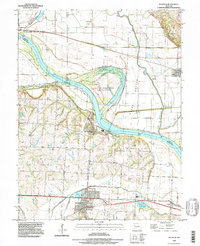
 1990 Missouri City1995 Print · USGSThe river-bend country of Clay and Jackson counties shows its industrial and rural character by the early 1990s. Genealogists can trace family names at Drake Cem and Rice Cem, while historians can locate Mine Tunnels near Nebo Hill.
 - 1990 Map of Oak Grove, 1995 Print
 1990 Oak Grove1995 Print · USGSJackson County in the early nineties shows a landscape of suburban expansion meeting deep-rooted rural history. Genealogists and researchers can trace local lineage through the Levasy Cem and Oakland Cem or locate the sprawling Lake City Army Ammunition Plant.
 - 1990 Map of Blue Springs, 1995 Print
 1990 Blue Springs1995 Print · USGSJackson County's eastern expansion is captured in the early nineties, showcasing the balance between massive federal facilities and suburban growth. Genealogists and historians can trace local landmarks like Lobb Cemetery, the Lake City Army Ammunition Plant, and Selsa.
 - 1990 Map of Lake Jacomo, 1995 Print
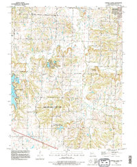
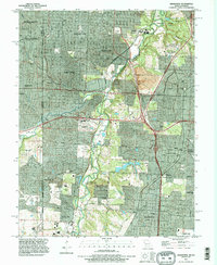
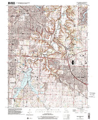
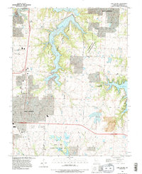 1990 Lake Jacomo1995 Print · USGSJackson County enters a period of significant suburban growth in the 1990s as recreation and aviation hubs expand. Trace the development of Lees Summit and Blue Springs alongside major water projects like Lake Jacomo and Lake Lotawana.
 - 1990 Map of Lees Summit, 1995 Print
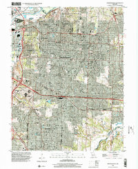
 1990 Lees Summit1995 Print · USGSThe rapid growth of the Kansas City metropolitan area is captured in the mid-nineties as major suburban centers expanded. Genealogists and local researchers can trace family plots at Floral Hills Cemetery or explore the unique campus of Unity Village and Longview Lake.
 - 1990 Map of Independence, 1995 Print
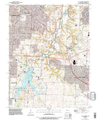
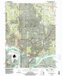
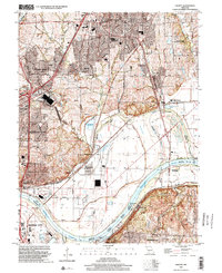
 1990 Independence1995 Print · USGSGreater Kansas City and Independence are shown in the final decade of the century, illustrating a landscape defined by heavy rail and major sporting venues. Genealogists can trace family plots across Mt Washington Cemetery or locate landmarks like the Truman Library and Drumm Institute.
 - 1990 Map of Raymore, 1996 Print
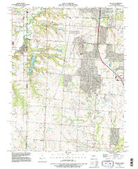
 1990 Raymore1996 Print · USGSThe borderlands of Jackson and Cass Counties are shown in the early nineties as residential growth begins to reshape the landscape. Trace local developments around Lake Winnebago and Raintree Lake, or locate family history sites near Raymore and Harrelson.
 - 1990 Map of Liberty, 1996 Print
 1990 Liberty1996 Print · USGSThe Missouri River corridor in the 1990s reveals a complex landscape of industrial centers and quiet hillside cemeteries. Trace the river-and-rail economy from Cement City to Birmingham, while identifying family landmarks like Pence Cem and New Hope Ch.
 - 1990 Map of Strasburg, 1996 Print
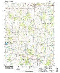 1990 Strasburg1996 Print · USGSThe borderlands of Jackson and Cass counties are captured here in the 1990s, centered on the grid of Strasburg and the rural reaches of Big Creek. Genealogists and local historians can locate Sloan Cem, Soldiers Cem, and water features like Baldwin Lake.
 - 1990 Map of Tarsney Lakes, 1996 Print
 1990 Tarsney Lakes1996 Print · USGSEastern Jackson County is shown here in the 1990s, where the winding Sni-A-Bar Creek meets small settlements and sprawling county parks. Genealogists can locate family-named landmarks like Purdee Chapel Cem or trace the early footprint of Tarsney Lakes.
 - 1990 Map of North Kansas City, 1996 Print
 1990 North Kansas City1996 Print · USGSAs North Kansas City and Gladstone expanded in the 1990s, this survey captured the shifting suburban landscape across the Clay County line. Trace family sites at Barry Cem and New Stark Cem, or the riverfront near Goose Island.
 - 1990 Map of Buckner, 1997 Print
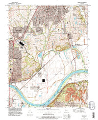
 1990 Buckner1997 Print · USGSThe Missouri River floodplain comes to life in the 1990s as it meanders between Clay, Ray, and Jackson counties. Local historians can trace family roots at Buckner Hill Cem or explore the riverfront geography of Sibley and the oxbow at Jackass Bend.
 - 1991 Map of Kansas City, 1995 Print
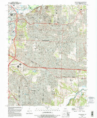
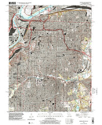
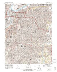 1991 Kansas City1995 Print · USGSGreater Kansas City in the 1990s showcases a dense network of historic neighborhoods, river crossings, and major cemeteries. Researchers can trace family history at Union Cemetery or Elmwood Cemetery and explore the industrial roots of Leeds.2 unique versions available
 - 1991 Map of Grandview, 1996 Print
 1991 Grandview1996 Print · USGSSouth Kansas City and the Missouri-Kansas border show extensive suburban growth in the early nineties. Genealogists can trace family plots at Green Lawn Cemetery or explore the old rail hubs of Dodson and Martin City.
 - 1991 Map of Belton, 1996 Print
 1991 Belton1996 Print · USGSThe Missouri-Kansas borderlands south of Kansas City are captured here in the early nineties as residential growth meets long-standing industrial sites. Researchers can trace family history through sites like Woodland Cem and the Richards-Gebaur Memorial Airport.
 - 1996 Map of Lake Jacomo, 2002 Print
 1996 Lake Jacomo2002 Print · USGSEastern Jackson County is shown during a period of rapid suburban growth in the late nineties. Researchers can trace development near Lees Summit and Blue Springs, or explore the many lakes within the James A Reed Memorial State Wildlife Area.
 - 1996 Map of Lees Summit, 2002 Print
 1996 Lees Summit2002 Print · USGSSuburban growth meets the Jackson County valley landscapes in the late nineties as Lees Summit and Kansas City expand. Genealogists and historians can trace family plots at Gantrell Cem and explore the sprawling grounds of Unity Village.
 - 1996 Map of Independence, 2002 Print
 1996 Independence2002 Print · USGSGreater Independence and East Kansas City are shown here in the mid-nineties as the urban landscape matured around major sports and rail hubs. Trace local history through the Harry S Truman Sports Complex, Mt Washington Cemetery, and the historic Drumm Institute.
 - 1996 Map of Liberty, 2002 Print
 1996 Liberty2002 Print · USGSLiberty and the Missouri River corridor are shown in detail during the mid-nineties as suburban growth met long-standing river industry. Researchers can locate numerous family burial sites like Pence Cem and Mann Cem or trace the river infrastructure near Birmingham.
 - 1996 Map of Grandview, 2002 Print
 1996 Grandview2002 Print · USGSGrandview and southern Kansas City are shown during a period of rapid suburban growth in the late 1990s. Researchers can trace the evolution of old settlements like Hickman Mills, locate family plots in Mt Moriah Cemetery, or follow the path of the Blue River.
 - 1996 Map of Kansas City, 2002 Print
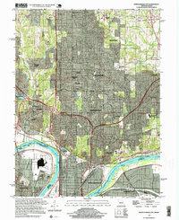
 1996 Kansas City2002 Print · USGSKansas City at the turn of the millennium shows a dense urban fabric intertwined with a remarkable legacy of parks and river industry. Genealogists and historians can locate legacy burial grounds like Union Cemetery or trace the early aviation footprint of the Downtown Airport.
 - 1997 Map of North Kansas City, 1999 Print
 1997 North Kansas City1999 Print · USGSClay County at the end of the millennium shows the dense suburban and industrial evolution of the Northland. Researchers can trace historic burial sites like Barry Cem and major landmarks including the Kansas City Downtown Airport and Chouteau Bridge.2 unique versions available
End of results
Showing maps 1-23 of 23
Top cities of Jackson County
- Independence historical maps
- Lee's Summit historical maps
- Blue Springs historical maps
- Raytown historical maps
- Grandview historical maps
- Grain Valley historical maps
See more
Frequently asked questions
- What are the different types of historical maps available for Jackson County?
- What is the oldest map of Jackson County?
- Where can I purchase historical maps of Jackson County for my home or office?
- Where can I download high-res historical maps of Jackson County?
- Are there historical topographic maps available for Jackson County?
- Is there historical aerial imagery available for Jackson County?
- Where are historical maps of Jackson County sourced from?