Old Maps of Jasper County, Missouri for Genealogy
Trace your family roots with 95 historic maps of Jasper County. These high-res maps reveal old neighborhoods, homesites, landmarks, and streets — helping you uncover where your ancestors lived and how the area evolved over time.
- Explore historic neighborhoods: Identify where your relatives may have lived in the 1800s or 1900s.
- Compare maps over time: Trace the changes in streets, buildings, and landmarks for multi-generational research.
- Perfect for genealogy & ancestry research: Used by family historians and researchers to map out lineage and migration.
These maps are an incredible resource for exploring your personal connection to Jasper County's past.
Jasper County, MO maps
(95)- 1886 Map of Joplin
 1886 Joplin1886 Print · USGSThe Missouri-Kansas borderlands were rapidly developing in the late nineteenth century as rail lines and river valleys shaped new settlements. Researchers can trace the early footprints of towns like Columbus and Pittsburg or locate vanished points like Georgia City and Litchfield.
 - 1886 Map of Carthage
 1886 Carthage1886 Print · USGSJasper and Barton Counties thrive during the mid-1880s as the railroad era transforms the Missouri landscape into a bustling corridor of trade and industry. Genealogists and historians can trace the early footprints of Carthage, the mills at Bowers Mill, and the early rail connections through Webb City and Oronogo.
 - 1894 Map of Joplin
 1894 Joplin1894 Print · USGSSoutheastern Kansas and southwestern Missouri met at a crossroads of industry and rail during the late nineteenth century. Genealogists can trace the early streets of Pittsburg and Joplin or find vanished rail stops like Stippville and Stilson.6 unique versions available
 - 1894 Map of Carthage
 1894 Carthage1894 Print · USGSSouthwest Missouri thrived as a rail and mining hub in the late nineteenth century. Genealogists can trace family roots through old settlements like Diamond City, Dudenville, and Bowers Mill during this period of growth.5 unique versions available
 - 1921 Map of Sarcoxie
 1921 Sarcoxie1921 Print · USGSJasper and Newton counties in the early 1920s reveal a flourishing agricultural landscape centered on the rail lines of the Pacific and Frisco. Genealogists and local historians can locate dozens of rural landmarks, from the Red Fox Mine to Union Chapel and Forest Mills.2 unique versions available
 - 1945 Map of Pittsburg
 1945 Pittsburg1945 Print · USGSSoutheast Kansas at the end of the war reveals a landscape dominated by the coal industry and rural community life. Researchers can trace the extensive rail networks of the St Louis San Francisco or locate old schoolhouses like Owsley Sch and Bird Sch.2 unique versions available
 - 1947 Map of Joplin, 1954 Print
 1947 Joplin1954 Print · USGSThe borderlands of Missouri, Kansas, and Oklahoma are shown here during the late 1940s, a period of heavy industrial and military activity. Researchers can trace the extensive Tri-State Mining District, the layout of Camp Crowder, and local landmarks like Mount Hope Cem.
 - 1947 Map of Pittsburg, 1978 Print
 1947 Pittsburg1978 Print · USGSSoutheast Kansas and the Missouri borderlands were defined by the coal industry in the late 1940s. Genealogists can trace family footprints through numerous township schools like Nelson Sch and the many Strip Mines surrounding Frontenac and Mindenmines.
 - 1949 Map of Joplin
 1949 Joplin1949 Print · USGSThe Kansas-Missouri borderlands thrive in the late 1940s, showing a robust network of railroad towns and river valleys. Researchers can trace historic rail lines like the Missouri Pacific RR and locate rural centers such as Chanute, Iola, and Fort Scott.
 - 1950 Map of Pittsburg
 1950 Pittsburg1950 Print · USGSThe coal country along the Kansas-Missouri border was defined by heavy industry and rail just after the war. Genealogists and historians can trace numerous rural schools and family burial sites, including Mindenmines Cem, Council Corner Sch, and the town of Litchfield.2 unique versions available
 - 1954 Map of Joplin, 1967 Print
 1954 Joplin1967 Print · USGSThe tri-state border region of Kansas, Missouri, and Oklahoma is captured here during a peak era of mid-century industrial and agricultural activity. Researchers can trace family history through dozens of rural cemeteries or locate landmarks like the Kansas Army Ammunition Plant and Pittsburg State University.3 unique versions available
 - 1958 Map of Joplin
 1958 Joplin1958 Print · USGSThe tri-state border region of Missouri, Kansas, and Oklahoma is shown during the late fifties, a time of heavy rail traffic and mining activity. Local historians can trace the industrial landscape through the Joplin & Pittsburg Ry or locate family sites like Zion Ch and Bender Mounds.
 - 1959 Map of Joplin
 1959 Joplin1959 Print · USGSThe Tri-State region’s mining and rail-driven economy is on full display in the late fifties. Genealogists can locate Lead and Zinc Mines near Joplin, family markers at Oak Hill Cem, and military history at Camp Clark.
 - 1962 Map of Jasper, 1963 Print
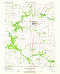 1962 Jasper1963 Print · USGSJasper and its surrounding townships are shown in the early 1960s as the rail-and-road network supported a thriving rural community. Genealogists can trace family roots through numerous local landmarks, including Stafford Cem, Salem Ch, and the settlement of Carytown.2 unique versions available
 - 1962 Map of Neck City, 1963 Print
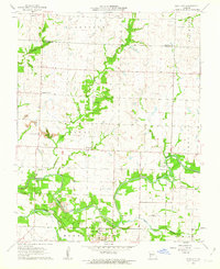 1962 Neck City1963 Print · USGSThe mining landscapes of Jasper County are clearly visible in the early sixties, centered around the industrial activity of Neck City. Researchers can trace the remnants of the Old Railroad Grade and locate family history at Gresham Cem and Preston.2 unique versions available
 - 1962 Map of Dudenville, 1963 Print
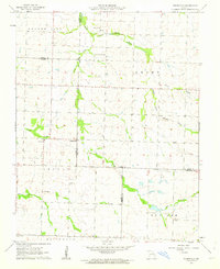 1962 Dudenville1963 Print · USGSSouthwest Missouri farmland and rural townships are captured here in the early 1960s at the junction of four counties. Genealogists and local historians can trace the foundations of Dudenville, the location of Unity Sch, and the grounds of Kistler Cem.2 unique versions available
 - 1962 Map of Maple Grove, 1964 Print
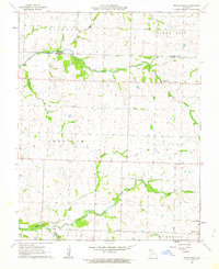 1962 Maple Grove1964 Print · USGSJasper County during the early 1960s was a patchwork of family farms and rural townships spanning the Barton County line. Genealogists and historians can locate legacy landmarks like Maple Grove, the Spring Hill Sch, and Mitchell Cem.
 - 1962 Map of Joplin West, 1964 Print
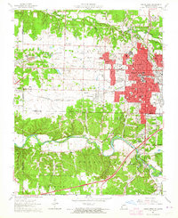 1962 Joplin West1964 Print · USGSJoplin and the Missouri-Kansas borderlands are shown here in the early sixties, still bearing the visible scars and structures of the region's mining boom. Genealogists and historians can trace local families through many sites including Fairview Cemetery, Peace Church, and the neighborhood of Chitwood.2 unique versions available
 - 1963 Map of Carthage, 1964 Print
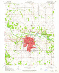 1963 Carthage1964 Print · USGSCarthage and its surrounding Jasper County townships are captured here in the early sixties as a bustling hub of rail, industry, and education. Researchers can trace family roots at Park Cemetery or locate old school sites like Lone Star Sch and Our Lady of the Ozarks College.2 unique versions available
 - 1963 Map of Webb City, 1964 Print
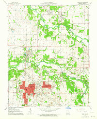 1963 Webb City1964 Print · USGSIn the early 1960s, this pocket of Jasper County shows the overlap of Missouri's mining heritage and mid-century growth. Researchers can trace historical lead-and-zinc sites like Oronogo alongside landmarks like Mark Twain School and Mt Hope Cemetery.2 unique versions available
 - 1963 Map of Joplin East, 1964 Print
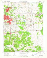 1963 Joplin East1964 Print · USGSJasper County in the early sixties shows the industrial transition of a major mining district. Trace the legacy of the lead belt through Tailings piles near Duenweg or find family landmarks like Underwood Sch and Harmony Grove Cem.3 unique versions available
 - 1963 Map of Carl Junction, 1964 Print
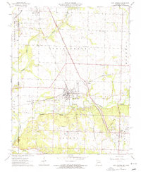 1963 Carl Junction1964 Print · USGSThe Joplin periphery during the early 1960s reveals a landscape shaped by mining and rail, from the Spring River to the growing suburbs. Researchers can locate vanished infrastructure like the Old Railroad Grade and trace family roots at Twin Grove Cem or Brick Sch.2 unique versions available
 - 1963 Map of Fidelity, 1964 Print
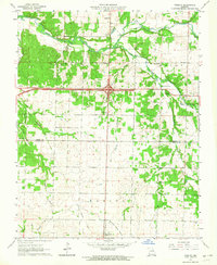 1963 Fidelity1964 Print · USGSJasper and Newton counties are captured here in the early sixties, showing the rural communities between Fidelity and Diamond. Local historians can trace family roots through several legacy sites, including Stone Cem, Fullerton Cem, and the Liberty Ch.2 unique versions available
 - 1971 Map of Avilla, 1973 Print
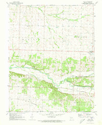 1971 Avilla1973 Print · USGSJasper County as it appeared in the early 1970s shows a landscape of river-valley agriculture and intersecting rail lines. Genealogists and local historians can trace legacy sites like Parent Mill Sch, Fasken Cem, and the village of Forest Mills.
 - 1971 Map of Sarcoxie, 1973 Print
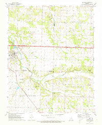 1971 Sarcoxie1973 Print · USGSSarcoxie and the surrounding townships in the early seventies sit at the intersection of three Missouri counties. Researchers can trace the St Louis - San Francisco rail line and locate rural landmarks like Cave Spring Cem, Clarkson Spring, and Bethany Ch.
Showing maps 1-25 of 95
Top cities of Jasper County
- Carthage historical maps
- Webb City historical maps
- Carl Junction historical maps
- Oronogo historical maps
- Carterville historical maps
- Duquesne historical maps
See more
Frequently asked questions
- What are the different types of historical maps available for Jasper County?
- What is the oldest map of Jasper County?
- Where can I purchase historical maps of Jasper County for my home or office?
- Where can I download high-res historical maps of Jasper County?
- Are there historical topographic maps available for Jasper County?
- Is there historical aerial imagery available for Jasper County?
- Where are historical maps of Jasper County sourced from?