1900s (20th Century) Maps of Garner, Missouri
Explore 7 historic maps of Garner from the 1900s (20th Century). These maps offer a rare glimpse into what life looked like during the 1900s — showing old roads, neighborhoods, homes, and landmarks that have changed or disappeared over time.
Whether you're researching your family's past, planning a metal detecting trip, or studying how Garner's landscape evolved across the 1900s, these high-resolution maps are a powerful tool for exploring the history of this region.
- Focus on a specific era: All maps on this page are from the 1900s, giving you a focused view of this time period.
- See what’s changed: Compare century-old streets, trails, and buildings to today's modern landscape using overlays and satellite layers.
- Research with precision: Use these maps for genealogy, historical research, land use analysis, or educational projects.
- View, download, or print: Maps are fully viewable online in high resolution, and can be downloaded or printed for your own records.
Start exploring Garner's history through authentic maps from the 1900s. This is your window into the past.
Garner, MO maps
(7)- 1949 Map of Bucklin NW, 1963 Print
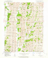 1949 Bucklin NW1963 Print · USGSLinn and Missouri counties are shown here just after the war, when rural life centered on a robust network of country schools and local churches. Researchers can trace family ties at Johnstown or find ancestral landmarks like Nester Chapel, Wyatt Cem, and Thodium Sch.2 unique versions available
 - 1950 Map of Bucklin NW
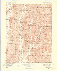 1950 Bucklin NW1950 Print · USGSMid-century Missouri farm life comes into focus in this detailed survey of Linn County's rural townships and creek valleys. Researchers can trace family history through a high density of country schools and churches like Hackler Sch, Nester Chapel, and Pulliam Cem.2 unique versions available
 - 1953 Map of Moberly
 1953 Moberly1953 Print · USGSMid-century north-central Missouri is documented here as a bustling intersection of river commerce and heavy rail. Researchers can trace historic family-named landmarks and transport hubs from the Missouri River corridor to the rail yards of Moberly, Chillicothe, and Macon.
 - 1954 Map of Moberly, 1969 Print
 1954 Moberly1969 Print · USGSMid-century Missouri is captured here during a period of transition for its river towns and rail hubs. Genealogists and historians can trace the paths of the Wabash railroad through Moberly or explore the riverside layout of Lexington and Brunswick.3 unique versions available
 - 1957 Map of Moberly
 1957 Moberly1957 Print · USGSNorth-central Missouri in the late nineteen-forties and fifties remains a landscape defined by its great rivers and a dense network of steam and diesel rail lines. Genealogists and historians can trace the paths of the Wabash RR and Santa Fe RR through historic junctions like Moberly, Brookfield, and Macon.
 - 1960 Map of Moberly
 1960 Moberly1960 Print · USGSCentral Missouri comes alive in the mid-twentieth century as a bustling network of river towns and significant rail corridors. Genealogists and historians can trace the paths of the Wabash RR through Moberly or explore the riverfronts of Lexington and Brunswick.
 - 1981 Map of Macon
 1981 Macon1981 Print · USGSNorthern Missouri's rail-and-river landscape is captured here in the early eighties, centered on the crossroads of Macon. Researchers can trace old cemetery sites like St Marys Cem, local landmarks such as College Mound, and the routes of the Burlington Northern railroad.
End of results
Showing maps 1-7 of 7
Top cities near Garner
- Brookfield historical maps
- Milan historical maps
- Bucklin historical maps
- Laclede historical maps
- Linneus historical maps
- Browning historical maps
See more
Frequently asked questions
- What are the different types of historical maps available for Garner?
- What is the oldest map of Garner?
- Where can I purchase historical maps of Garner for my home or office?
- Where can I download high-res historical maps of Garner?
- Are there historical topographic maps available for Garner?
- Is there historical aerial imagery available for Garner?
- Where are historical maps of Garner sourced from?