2000s (21st Century) Maps of Jewett, Missouri
Explore 5 historic maps of Jewett from the 2000s (21st Century). These maps offer a rare glimpse into what life looked like during the 2000s — showing old roads, neighborhoods, homes, and landmarks that have changed or disappeared over time.
Whether you're researching your family's past, planning a metal detecting trip, or studying how Jewett's landscape evolved across the 2000s, these high-resolution maps are a powerful tool for exploring the history of this region.
- Focus on a specific era: All maps on this page are from the 2000s, giving you a focused view of this time period.
- See what’s changed: Compare century-old streets, trails, and buildings to today's modern landscape using overlays and satellite layers.
- Research with precision: Use these maps for genealogy, historical research, land use analysis, or educational projects.
- View, download, or print: Maps are fully viewable online in high resolution, and can be downloaded or printed for your own records.
Start exploring Jewett's history through authentic maps from the 2000s. This is your window into the past.
Jewett, MO maps
(5)- 2000 Map of Des Arc NE, 2003 Print
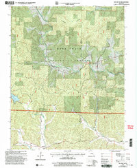 2000 Des Arc NE2003 Print · USGSIron and Madison counties are shown here as the new millennium began, dominated by the heavily timbered tracts of the Mark Twain National Forest. Genealogists and hikers can trace the Ozark Trail past rural landmarks like Liberty United Cem, Minimum, and the remote Black Mtn Ch.
 - 2011 Map of Des Arc NE, 2011 Print
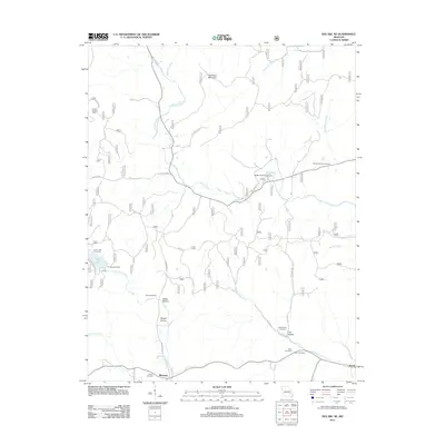 2011 Des Arc NE2011 Print · USGSCovers Jewett, including Minimum, Madison County, and other nearby areas
 - 2015 Map of Des Arc NE, 2015 Print
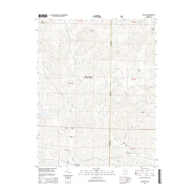 2015 Des Arc NE2015 Print · USGSCovers Jewett, including Minimum, Madison County, and other nearby areas
 - 2017 Map of Des Arc NE, 2017 Print
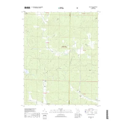 2017 Des Arc NE2017 Print · USGSCovers Jewett, including Minimum, Madison County, and other nearby areas
 - 2021 Map of Des Arc NE, 2021 Print
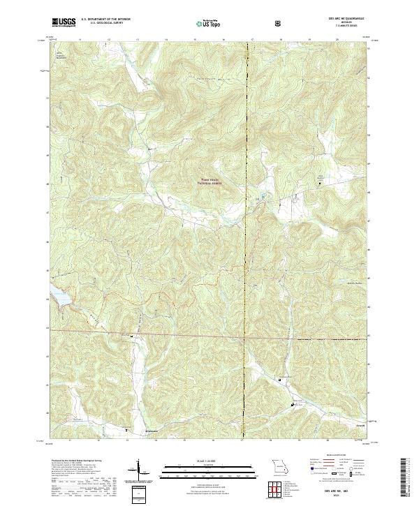 2021 Des Arc NE2021 Print · USGSIron and Madison Counties are captured here in the early 2020s, showcasing a landscape of high ridges and secluded hollows. Genealogists can locate several remote burying grounds like Kelley Cem and Davis Cem, while following the waters of Marble Creek.
End of results
Showing maps 1-5 of 5
Top cities near Jewett
- Fredericktown historical maps
- Piedmont historical maps
- Ironton historical maps
- Arcadia historical maps
- Junction City historical maps
- Annapolis historical maps
See more
Frequently asked questions
- What are the different types of historical maps available for Jewett?
- What is the oldest map of Jewett?
- Where can I purchase historical maps of Jewett for my home or office?
- Where can I download high-res historical maps of Jewett?
- Are there historical topographic maps available for Jewett?
- Is there historical aerial imagery available for Jewett?
- Where are historical maps of Jewett sourced from?