Old Maps of Hannibal, Missouri for Genealogy
Trace your family roots with 26 historic maps of Hannibal. These high-res maps reveal old neighborhoods, homesites, landmarks, and streets — helping you uncover where your ancestors lived and how the area evolved over time.
- Explore historic neighborhoods: Identify where your relatives may have lived in the 1800s or 1900s.
- Compare maps over time: Trace the changes in streets, buildings, and landmarks for multi-generational research.
- Perfect for genealogy & ancestry research: Used by family historians and researchers to map out lineage and migration.
These maps are an incredible resource for exploring your personal connection to Hannibal's past.
Hannibal, MO maps
(26)- 1925 Map of Quincy
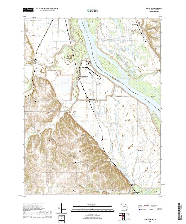
 1925 Quincy1925 Print · USGSQuincy and its Mississippi River hinterlands are captured in the mid-1920s, showing a landscape defined by river navigation and rail transport. Genealogists can locate dozens of country schools and churches, from St Ludgerus School to Zion Church and the Soldiers Home.2 unique versions available
 - 1932 Map of Hannibal
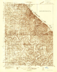
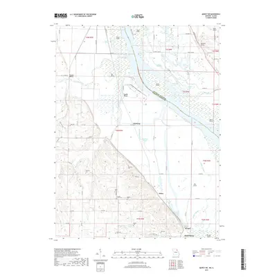
 1932 Hannibal1932 Print · USGSAlong the Mississippi River in the early 1930s, this survey captures the riverfront from Hannibal across to the Illinois bottomlands. Researchers can trace the river rail crossings of the WABASH and locate rural landmarks like Bird Slough Sch and the CHENALE ECARTE CLUB.4 unique versions available
 - 1936 Map of Hannibal
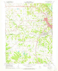
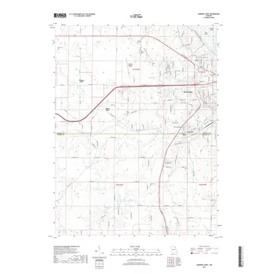
 1936 Hannibal1936 Print · USGSMid-century Hannibal and New London are shown during a transitional era of river commerce and early aviation. Researchers can trace the paths of the Burlington railroad or find ancestral landmarks like Withers Mill and Mt Olivet Cem.2 unique versions available
 - 1944 Map of Quincy, 1954 Print
 1944 Quincy1954 Print · USGSQuincy and the Mississippi River valley are captured in the 1940s, showing a landscape defined by rail lines and rural parish schools. Researchers can trace the riverfront at Marion City, the grounds of the Soldiers Home, and historic sites like Zion Church.5 unique versions available
 - 1945 Map of Hannibal
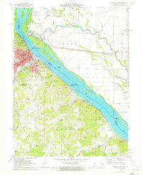
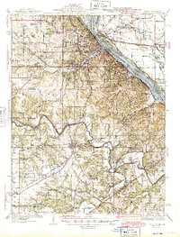 1945 Hannibal1945 Print · USGSMid-century Hannibal is captured here as a bustling Mississippi river port and railroad crossroads just after the war. Local historians can trace family roots through dozens of rural landmarks like Mt Zion Cem, Withers Mill, and Ocean Wave Sch.2 unique versions available
 - 1945 Map of Quincy
 1945 Quincy1945 Print · USGSQuincy and its Mississippi River crossings are captured here in the mid-1940s during a period of transition for its riverfront and rail lines. Genealogists can trace family roots at local landmarks like the Soldiers Home, Melrose Chapel, and numerous rural schoolhouses such as Hickory Grove School.2 unique versions available
 - 1948 Map of Quincy
 1948 Quincy1948 Print · USGSThe Mississippi and Illinois River valleys are captured at a post-war crossroads as rail and river travel met the expanding highway system. Genealogists can trace family settlements from Quincy to Hannibal and smaller towns like Vandalia and Jerseyville.2 unique versions available
 - 1956 Map of Quincy, 1967 Print
 1956 Quincy1967 Print · USGSThe river and rail corridors of the Illinois-Missouri border are documented here during the mid-1950s. Researchers can trace historic river landings and regional transit hubs from Quincy and Hannibal to smaller settlements like Meredosia and Roodhouse.3 unique versions available
 - 1971 Map of Quincy SW, 1973 Print
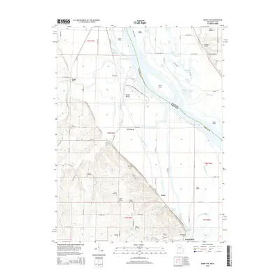
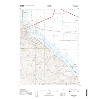
 1971 Quincy SW1973 Print · USGSMarion County's riverfront landscape is captured here in the early seventies, showing a complex network of levees and sloughs along the Mississippi. Genealogists and local historians can locate numerous family burial grounds including Pennewell Cem, Kaiser Cem, and Thrasher Chapel Cem.
 - 1971 Map of Hannibal West, 1973 Print
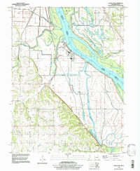
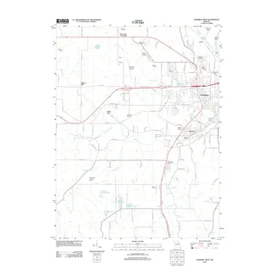
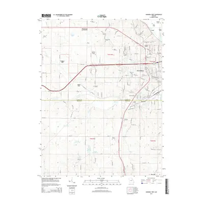
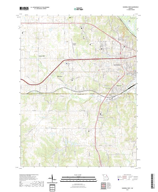
 1971 Hannibal West1973 Print · USGSThe western edges of the Mississippi River bluffs in the early 1970s reveal a landscape of established seminaries and new shopping centers. Genealogists can trace family roots through Barkley Cem, Withers Mill, and Hydesburg Ch.2 unique versions available
 - 1971 Map of Hannibal East, 1973 Print
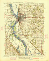
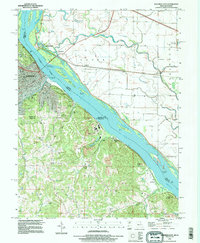
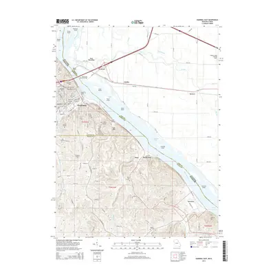
 1971 Hannibal East1973 Print · USGSThe Missouri riverfront at Hannibal was a bustling hub of rail and river commerce in the early 1970s. Genealogists and historians can locate legacy sites like Mark Twain Cave, Antioch Ch, and the numerous quarries that defined the local economy.
 - 1986 Map of Quincy
 1986 Quincy1986 Print · USGSThe tri-state border region along the Mississippi River comes into focus during the mid-1980s. Researchers can trace the legacy of river towns and rail hubs like Quincy and Monroe City or locate landmarks such as Mount Olive Cem.2 unique versions available
 - 1993 Map of Hannibal East, 1996 Print
 1993 Hannibal East1996 Print · USGSThe Mississippi River corridor near Hannibal comes to life in this mid-nineties survey of the Missouri-Illinois border. Genealogists and historians can trace Riverside Cem, the Mark Twain Cave, and old river settlements like Saverton and Monkey Run.
 - 1996 Map of Quincy SW, 1998 Print
 1996 Quincy SW1998 Print · USGSMarion County and the Illinois borderlands appear in the late nineties as a network of river-bound islands and upland cemeteries. Trace family roots at Thrasher Chapel or along the bluffs at Kaiser Cem and Cobb Cem.
 - 2012 Map of Hannibal West, 2012 Print
 2012 Hannibal West2012 Print · USGSCovers Hannibal, including Uva, Oakwood, and other nearby areas
 - 2012 Map of Quincy SW, 2012 Print
 2012 Quincy SW2012 Print · USGSCovers Hannibal, including Mungers, Huiskamp, and other nearby areas
 - 2012 Map of Hannibal East, 2012 Print
 2012 Hannibal East2012 Print · USGSCovers Hannibal, including Aladdin, Spencer, and other nearby areas
 - 2014 Map of Hannibal West, 2014 Print
 2014 Hannibal West2014 Print · USGSCovers Hannibal, including Uva, Oakwood, and other nearby areas
 - 2014 Map of Hannibal East, 2014 Print
 2014 Hannibal East2014 Print · USGSCovers Hannibal, including Aladdin, Spencer, and other nearby areas
 - 2015 Map of Quincy SW, 2015 Print
 2015 Quincy SW2015 Print · USGSCovers Hannibal, including Mungers, Huiskamp, and other nearby areas
 - 2017 Map of Hannibal West, 2017 Print
 2017 Hannibal West2017 Print · USGSCovers Hannibal, including Uva, Oakwood, and other nearby areas
 - 2017 Map of Quincy SW, 2017 Print
 2017 Quincy SW2017 Print · USGSCovers Hannibal, including Mungers, Huiskamp, and other nearby areas
 - 2017 Map of Hannibal East, 2017 Print
 2017 Hannibal East2017 Print · USGSCovers Hannibal, including Aladdin, Spencer, and other nearby areas
 - 2021 Map of Quincy SW, 2021 Print
 2021 Quincy SW2021 Print · USGSThe riverfront north of Hannibal is captured here during a modern era of detailed surveying, revealing the complex sloughs and islands of the Mississippi River. Genealogists can locate several family burial sites including Pennewell Cem and Kaiser Cem near settlements like Huiskamp and South River.
 - 2021 Map of Hannibal West, 2021 Print
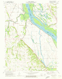
 2021 Hannibal West2021 Print · USGSThe western fringes of Hannibal come into focus in the early 2020s, documenting the area's modern campus and airport infrastructure. Researchers can trace family history at Grand View Burial Park or locate the rural communities of Withers Mill and White Bear.
Showing maps 1-25 of 26
Top cities near Hannibal
- Quincy historical maps
- Palmyra historical maps
- Payson historical maps
- New London historical maps
- Burton historical maps
- Fall Creek historical maps
See more
Top neighborhoods of Hannibal
Frequently asked questions
- What are the different types of historical maps available for Hannibal?
- What is the oldest map of Hannibal?
- Where can I purchase historical maps of Hannibal for my home or office?
- Where can I download high-res historical maps of Hannibal?
- Are there historical topographic maps available for Hannibal?
- Is there historical aerial imagery available for Hannibal?
- Where are historical maps of Hannibal sourced from?