1980s Maps of Rocky Comfort, Missouri
Explore 2 historic maps of Rocky Comfort from the 1980s. These maps offer a rare glimpse into what life looked like during the 1980s — showing old roads, neighborhoods, homes, and landmarks that have changed or disappeared over time.
Whether you're researching your family's past, planning a metal detecting trip, or studying how Rocky Comfort's landscape evolved across the 1980s, these high-resolution maps are a powerful tool for exploring the history of this region.
- Focus on a specific era: All maps on this page are from the 1980s, giving you a focused view of this time period.
- See what’s changed: Compare century-old streets, trails, and buildings to today's modern landscape using overlays and satellite layers.
- Research with precision: Use these maps for genealogy, historical research, land use analysis, or educational projects.
- View, download, or print: Maps are fully viewable online in high resolution, and can be downloaded or printed for your own records.
Start exploring Rocky Comfort's history through authentic maps from the 1980s. This is your window into the past.
Rocky Comfort, MO maps
(2)- 1982 Map of Rocky Comfort
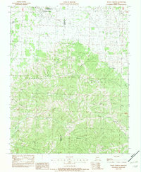 1982 Rocky Comfort1982 Print · USGSThe northern Ozarks in the early eighties are mapped here in detail, centered on the Newton and McDonald County border. Researchers can trace family-named hollows and sites like Rocky Comfort, Ridgley, and Christian Spring.
 - 1986 Map of Neosho
 1986 Neosho1986 Print · USGSThe tri-state border region comes alive in the mid-eighties as a landscape of mining heritage and river valleys. Researchers can trace the rail lines of the Kansas City Southern Ry and locate rural landmarks like Gibson Cem and Peoria.2 unique versions available
End of results
Showing maps 1-2 of 2
Top cities near Rocky Comfort
- Monett historical maps
- Cassville historical maps
- Granby historical maps
- Pierce City historical maps
- Purdy historical maps
- Seligman historical maps
See more
Frequently asked questions
- What are the different types of historical maps available for Rocky Comfort?
- What is the oldest map of Rocky Comfort?
- Where can I purchase historical maps of Rocky Comfort for my home or office?
- Where can I download high-res historical maps of Rocky Comfort?
- Are there historical topographic maps available for Rocky Comfort?
- Is there historical aerial imagery available for Rocky Comfort?
- Where are historical maps of Rocky Comfort sourced from?