1900s (20th Century) Maps of Miller County, Missouri
Explore 46 historic maps of Miller County from the 1900s (20th Century). These maps offer a rare glimpse into what life looked like during the 1900s — showing old roads, neighborhoods, homes, and landmarks that have changed or disappeared over time.
Whether you're researching your family's past, planning a metal detecting trip, or studying how Miller County's landscape evolved across the 1900s, these high-resolution maps are a powerful tool for exploring the history of this region.
- Focus on a specific era: All maps on this page are from the 1900s, giving you a focused view of this time period.
- See what’s changed: Compare century-old streets, trails, and buildings to today's modern landscape using overlays and satellite layers.
- Research with precision: Use these maps for genealogy, historical research, land use analysis, or educational projects.
- View, download, or print: Maps are fully viewable online in high resolution, and can be downloaded or printed for your own records.
Start exploring Miller County's history through authentic maps from the 1900s. This is your window into the past.
Miller County, MO maps
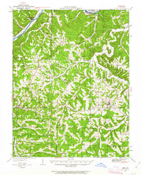
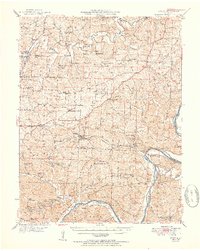
(46)- 1904 Map of Eldon
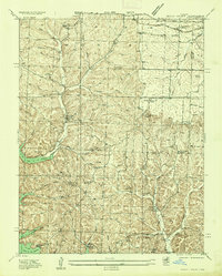
 1904 Eldon1904 Print · USGSMiller and Morgan counties thrived at the turn of the century as the new railroad network connected agricultural hills to outside markets. Genealogists can trace family roots through early settlements like Barnett Sta. and Olean or locate the historic Simpson Coalmine.
 - 1932 Map of Versailles No 4
 1932 Versailles No 41932 Print · USGSThe Missouri Ozarks are captured here in the early 1930s, showing the early transformation of the landscape following the creation of Lake of the Ozarks. Researchers can trace the roots of Osage Beach or locate rural landmarks like Popplewell Cem and Watson Sch.
 - 1933 Map of Iberia, 1963 Print
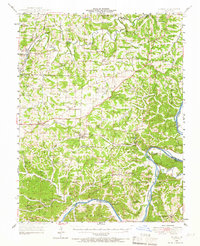
 1933 Iberia1963 Print · USGSThe Osage River hills during the early 1930s reveal a landscape of isolated farmsteads and rural schoolhouses. Genealogists can trace family roots through numerous sites like Ramsey Cem, Gott Ch, and vanished school districts like Stumpf Sch.2 unique versions available
 - 1934 Map of Toronto
 1934 Toronto1934 Print · USGSMissouri's lake country was in its early years of transformation during the 1930s as new shorelines met established rural communities. Genealogists can locate family landmarks like Auglaize Cem or trace rural education at Snider School and Jefferies School.
 - 1934 Map of Lake Ozark
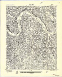
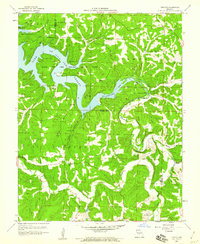
 1934 Lake Ozark1934 Print · USGSThe new reservoir era in Central Missouri comes to life in this survey, showing the shoreline just after the completion of Bagnell Dam. Researchers can trace the early developments at Lakeview Beach and locate rural landmarks like Harpers Chapel and Zebra PO.3 unique versions available
 - 1934 Map of Bagnell
 1934 Bagnell1934 Print · USGSThe Lake of the Ozarks region is captured here during the transformative mid-1930s, just after the completion of the massive Bagnell Dam. Researchers can trace rural life through the locations of the Fitzgerald Cem, Bennett Ch, and early river crossings like the Ferry near Wilcox Bend.
 - 1935 Map of Rocky Mount
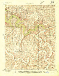
 1935 Rocky Mount1935 Print · USGSThe Morgan and Miller County borderlands are shown here in the mid-1930s as the northern arms of the Lake of the Ozarks began to shape the terrain. Researchers can locate rural landmarks like the Stover Coal Bank, the Rocky Mount PO, and several family cemeteries.
 - 1935 Map of Eldon
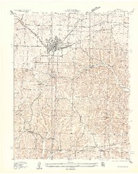 1935 Eldon1935 Print · USGSMiller County's rail and ridge lands are captured here in the mid-1930s as Eldon grew around the Chicago Rock Island and Pacific tracks. Researchers can trace the footprint of early rural education at Franklin School or locate family plots at Salem Cem and Vaughn Cem.2 unique versions available
 - 1937 Map of Iberia
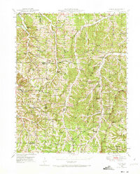
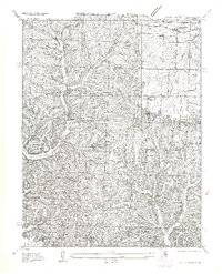
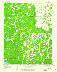
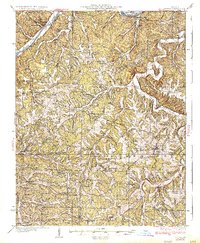 1937 Iberia1937 Print · USGSIberia and the surrounding Miller County hills are captured here in the mid-1930s, showing a landscape of small farms and crossroads communities. Genealogists can trace family footprints at Ramsey Cem, Twelve Corners Ch, and dozens of rural school sites like Barton Sch.2 unique versions available
 - 1947 Map of Jefferson City, 1949 Print
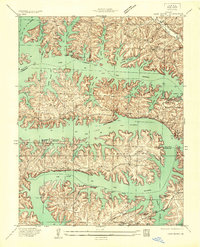
 1947 Jefferson City1949 Print · USGSCentral Missouri and the northern Ozarks come into focus in this late 1940s survey of the river-and-rail landscape. Genealogists and historians can trace the growth of Jefferson City and Sedalia or locate family roots near Bagnell Dam and the Lake of the Ozarks.
 - 1948 Map of Meta, 1963 Print
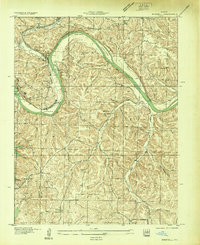
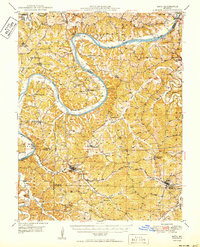
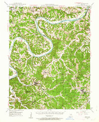 1948 Meta1963 Print · USGSThe Osage River valley in the late 1940s shows a landscape of river ferries and emerging rail hubs. Researchers can trace family sites like St Cecilia Cem & Ch, early river infrastructure at the US Lock & Dam, and rural centers such as Koeltztown.
 - 1948 Map of Eugene, 1966 Print
 1948 Eugene1966 Print · USGSCentral Missouri rural life is captured here in the years following the war, centered on the rail corridor through Eugene. Researchers can trace family sites and community landmarks like Marys Home, Rush Chapel, and the river bluffs along the Osage River.2 unique versions available
 - 1948 Map of Tavern, 1973 Print
 1948 Tavern1973 Print · USGSMaries County life in the late 1940s was centered on the river valleys and a network of rural schools. Genealogists can trace family landmarks like Old Van Cleve, the Barnhart Cem, and numerous schoolhouses including Camp Ground Sch.2 unique versions available
 - 1950 Map of Meta
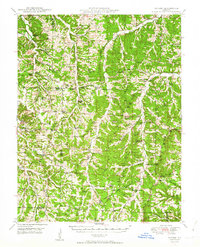
 1950 Meta1950 Print · USGSMid-century life in the Missouri river hills centers on the winding Osage River and the small parish towns of the interior. Genealogists can trace family roots through several rural schools and burial grounds, including St Cecelia Cem and the Bodie Ferry (Aban'd).
 - 1950 Map of Tavern
 1950 Tavern1950 Print · USGSMaries County and the surrounding Missouri countryside appear here in the late 1940s, showing a landscape defined by river bends and rural schoolhouses. Researchers can locate family landmarks like Ricker Ch, Brinktown Sch, and Barnhart Cem.3 unique versions available
 - 1951 Map of Eugene
 1951 Eugene1951 Print · USGSMid-century life in central Missouri centered on the Chicago Rock Island and Pacific rail corridor and the deep valleys of the Osage River. Researchers can locate dozens of historic rural landmarks, from the McCann Bridge Cem to small communities like Marys Home and Etterville.2 unique versions available
 - 1954 Map of Jefferson City
 1954 Jefferson City1954 Print · USGSCentral Missouri in the early postwar years showcases a landscape defined by the winding Lake of the Ozarks and the state capital at Jefferson City. Researchers can trace the mid-century rail networks of the Missouri Pacific RR and locate rural communities like Tuscumbia, St Elizabeth, and St Anthony.2 unique versions available
 - 1955 Map of Jefferson City, 1967 Print
 1955 Jefferson City1967 Print · USGSCentral Missouri in the mid-fifties is defined by the winding Missouri River and the expanding reach of Lake of the Ozarks. Researchers can trace the rail corridors of the Missouri Pacific or locate the early footprint of Whiteman AFB and Jefferson City.4 unique versions available
 - 1957 Map of Rocky Mount
 1957 Rocky Mount1957 Print · USGSCentral Missouri hill country meets the rising waters of the lake in the mid-1930s. Genealogists and historians can locate old landmarks like Barnett Sta, the Stover Coal Bank, and small country burial grounds such as Dooley Cem.
 - 1957 Map of Bagnell
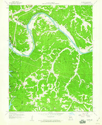
 1957 Bagnell1957 Print · USGSMiller County was undergoing a massive transformation in the early 1930s following the construction of the Bagnell Dam. Researchers can trace the original river course around Wilcox Bend and locate family landmarks like Fitzgerald Cem and Fletcher Ch.
 - 1958 Map of Jefferson City
 1958 Jefferson City1958 Print · USGSCentral Missouri in the late fifties shows a region transforming through the growth of Whiteman Air Force Base and the Lake of the Ozarks. Researchers can trace rail lines like the Missouri Pacific or find family roots at Enloe Cemetery and Mount Pleasant Cem.
 - 1959 Map of Jefferson City
 1959 Jefferson City1959 Print · USGSCentral Missouri is captured during the mid-fifties as the river economy and rail networks like the Missouri Pacific met the rise of the automobile. Local researchers can trace family landmarks and rural infrastructure from the Lake of the Ozarks up to Providence Cemetery and Knob Noster State Park.
 - 1959 Map of Bagnell, 1960 Print
 1959 Bagnell1960 Print · USGSThe Lake of the Ozarks region is captured here in the late fifties, showing the engineering of Bagnell Dam and the early growth of Osage Beach. Researchers can trace local genealogy through Brockman Cem and Harmony Ch or explore the river terrain around Brockmans Island.3 unique versions available
 - 1959 Map of Rocky Mount, 1960 Print
 1959 Rocky Mount1960 Print · USGSThe northern reaches of the Lake of the Ozarks are captured here in the late fifties as the reservoir reshaped the Morgan County landscape. Genealogists and researchers can trace family landmarks like the Taylor Cem, Union Ch, and the defunct Stover Mine.2 unique versions available
 - 1959 Map of Toronto, 1960 Print
 1959 Toronto1960 Print · USGSMid-century Camden County is seen here along the branching waters of the Grandglaize Arm during the expansion of the state park system. Researchers can pinpoint long-standing community centers like Toronto, Freedom Sch, and the Kaiser Lookout Tower.3 unique versions available
Showing maps 1-25 of 46
Top cities of Miller County
- Eldon historical maps
- Lake Ozark historical maps
- Iberia historical maps
- Tuscumbia historical maps
- Olean historical maps
- Brumley historical maps
See more
Frequently asked questions
- What are the different types of historical maps available for Miller County?
- What is the oldest map of Miller County?
- Where can I purchase historical maps of Miller County for my home or office?
- Where can I download high-res historical maps of Miller County?
- Are there historical topographic maps available for Miller County?
- Is there historical aerial imagery available for Miller County?
- Where are historical maps of Miller County sourced from?