Old Maps of Montgomery County, Missouri
Explore 120 old maps of Montgomery County, spanning from 1890 to today. These high-resolution historic maps reveal how streets, neighborhoods, landmarks, and natural features evolved over time — perfect for genealogy, metal detecting, research, and local history exploration.
What you can do with these maps:
- See how Montgomery County changed over time: Compare historical maps to modern-day views to trace roads, homesites, rail lines & more.
- View detailed metadata: Each map includes creators, publishers, year, scale, and archive source.
- Overlay maps with satellite & LiDAR: Visualize the past alongside modern tools to explore terrain & human change.
- Trusted historical sources: Maps sourced from the USGS, Library of Congress, and other archives.
- Access maps your way: View online, download high-res files, or order prints for personal or research use.
Start exploring old maps of Montgomery County to uncover forgotten places, hidden landmarks, and the deep history beneath your feet.
Montgomery County, MO maps
(120)- 1890 Map of Louisiana
 1890 Louisiana1890 Print · USGSUpper Missouri and Illinois river country in the 1890s is captured here at the height of the steam-rail era. Genealogists can trace family roots through old rural outposts like New Harmony, Prairieville, and the transit hub at Bowling Green.5 unique versions available
 - 1890 Map of Mexico
 1890 Mexico1890 Print · USGSMid-Missouri was a bustling junction of rail and river in the late 1880s, where iron rails began to reshape the old prairie. Genealogists can trace family roots in early settlements like Mexico, Laddonia, and the rural community at Shamrock P.O..5 unique versions available
 - 1890 Map of Hermann
 1890 Hermann1890 Print · USGSMid-Missouri river life and rail commerce define this late-century landscape during a period of steady expansion. Genealogists and historians can trace family roots through old post offices like Hopewell Academy P.O. and Swiss P.O. or the early street grids of Hermann and Warrenton.5 unique versions available
 - 1890 Map of Fulton
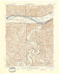
 1890 Fulton1890 Print · USGSMid-Missouri river life and railroad expansion come into focus in this late nineteenth-century survey. Genealogists and historians can trace old township lines and early river towns like Chamois, Danville, and the bustling county seat at Fulton.5 unique versions available
 - 1935 Map of Morrison
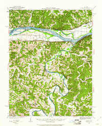
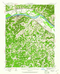
 1935 Morrison1935 Print · USGSThe confluence of the Missouri and Gasconade rivers comes to life in the mid-1930s, showing a world of river-town commerce and rural homesteads. Trace ancestral roots at Townley Cem, find old river crossings like Feiglers Ferry, or locate the Mint Hill PO.
 - 1936 Map of Hermann
 1936 Hermann1936 Print · USGSThe riverfront at Hermann and the surrounding hill country are captured here in the mid-1930s. Genealogists can trace family roots through an extensive network of rural landmarks, from the Swiss Sch and St Josephs Ch to the small settlement of Detmold.
 - 1940 Map of Montgomery City, 1965 Print
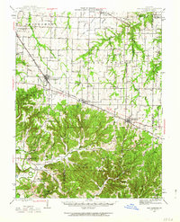
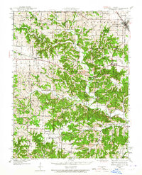 1940 Montgomery City1965 Print · USGSThe Montgomery County interior at the start of the 1940s reveals a landscape of railroad towns and scattered prairie farmsteads. Genealogists can trace family roots through numerous sites like Tate Cem, St Patricks Ch, and the Loutre Valley Sch.2 unique versions available
 - 1942 Map of Montgomery City
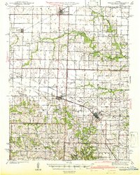
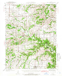
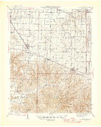
 1942 Montgomery City1942 Print · USGSMontgomery County and the edge of Callaway County are captured here in the early 1940s, showing a landscape defined by the Loutre River and the Wabash RR. Researchers can locate dozens of rural landmarks, from family-named plots like Worland Cem to country schoolhouses like Verbena Dale Sch and Sunny Hill Sch.2 unique versions available
 - 1942 Map of Wellsville
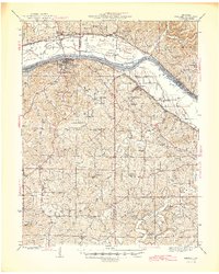
 1942 Wellsville1942 Print · USGSMid-Missouri's rail-and-river landscape is meticulously detailed here just before the war, showcasing the busy corridors of the Alton and Wabash lines. Researchers can trace rural life through dozens of local landmarks like Chapel Grove Sch, the Laclede Christy Mine, and Shamrock.2 unique versions available
 - 1942 Map of Morrison, 1961 Print
 1942 Morrison1961 Print · USGSThe river valleys of mid-Missouri are captured here in the 1940s, highlighting the vital rail and ferry networks of the era. Genealogists can locate family landmarks such as Wittenbach Cem, rural schools like Mud Creek Sch, and the historic Starkenburg community.2 unique versions available
 - 1942 Map of Hermann, 1961 Print
 1942 Hermann1961 Print · USGSMid-Missouri river life and rail commerce are documented here during the early 1940s as the river winds past thriving valley towns. Researchers can trace historic farmsteads, family burial grounds like Meyers Cem, and numerous rural schoolhouses such as Peace Hill Sch and Swiss Sch.2 unique versions available
 - 1942 Map of New Florence, 1963 Print
 1942 New Florence1963 Print · USGSMontgomery County in the early 1940s reveals a landscape of dispersed farmsteads and rail-dependent towns like New Florence and High Hill. You can trace rural education through vanished schoolhouses like Orange Blossom Sch or locate family sites near Wright Cem.2 unique versions available
 - 1942 Map of Bellflower, 1966 Print
 1942 Bellflower1966 Print · USGSEastern Missouri farm country is captured here during the early years of the war, revealing a landscape defined by the Cuivre River and the Chicago Burlington and Quincy rail line. Genealogists can locate family-named landmarks and rural hubs like Middletown, Smyrna Ch, and the Prairie Flower Sch.
 - 1945 Map of Bellflower
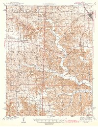
 1945 Bellflower1945 Print · USGSThe rural borderlands of Montgomery, Audrain, and Pike counties are captured here in the mid-1940s as a network of tightly-knit farming communities. Genealogists can trace family footprints through dozens of local landmarks, including Payne Cem, Smyrna Ch, and the many namesake schoolhouses like Mudd Sch.2 unique versions available
 - 1945 Map of Hermann
 1945 Hermann1945 Print · USGSThe Missouri River valley near Hermann and Berger is shown here in the mid-1940s, documenting a landscape of river-and-rail transport. Genealogists can trace family names through rural landmarks like St Johns Ch, Roth Cem, and Frene Sch.2 unique versions available
 - 1945 Map of Morrison
 1945 Morrison1945 Print · USGSThe river valleys of central Missouri were still deeply tied to the water in the mid-1940s, as shown by this survey of the Missouri and Gasconade confluence. Genealogists can trace family roots through numerous country schools like Best Sch and river crossings such as Brown Shanty Ferry.2 unique versions available
 - 1946 Map of New Florence
 1946 New Florence1946 Print · USGSMid-century Montgomery and Warren counties are captured here just as the rural school system and steam-era rail lines remained central to life. Genealogists can locate family landmarks like Wright Cem and dozens of vanished schoolhouses including Crabapple Sch and Me Kittrick Sch.2 unique versions available
 - 1948 Map of Quincy
 1948 Quincy1948 Print · USGSThe Mississippi and Illinois River valleys are captured at a post-war crossroads as rail and river travel met the expanding highway system. Genealogists can trace family settlements from Quincy to Hannibal and smaller towns like Vandalia and Jerseyville.2 unique versions available
 - 1949 Map of Saint Louis
 1949 Saint Louis1949 Print · USGSGreater St. Louis and its surrounding river valleys are captured here just after the war, showing the metropolitan core and the rural Ozark fringe. Researchers can trace the sprawling rail network of the Wabash RR or locate landmarks like Meramec Caverns Airport and Scott Air Force Base.2 unique versions available
 - 1956 Map of Quincy, 1967 Print
 1956 Quincy1967 Print · USGSThe river and rail corridors of the Illinois-Missouri border are documented here during the mid-1950s. Researchers can trace historic river landings and regional transit hubs from Quincy and Hannibal to smaller settlements like Meredosia and Roodhouse.3 unique versions available
 - 1962 Map of St. Louis
 1962 St. Louis1962 Print · USGSThe mid-century gateway to the west shows the metropolitan expansion of St Louis alongside its critical river confluences. Genealogists and historians can trace the rail corridors of the Missouri Pacific RR and settlements from Fulton to De Soto.
 - 1963 Map of St. Louis, 1970 Print
 1963 St. Louis1970 Print · USGSSt. Louis and its surrounding river valleys are captured here during the peak of mid-century suburban expansion and industrial activity. Trace the historic rail routes of the Norfolk and Western Ry or locate the St Louis Ordnance Plant and early stretches of US Highway 66.4 unique versions available
 - 1966 Map of St. Louis
 1966 St. Louis1966 Print · USGSThe St. Louis metropolitan area and its surrounding river valleys are captured here during the mid-sixties era of suburban growth and industrial strength. Genealogists and historians can trace the foundations of local communities through sites like Old Pioneer Cem, Parks College, and the Jefferson Barracks Military Reservation.
 - 1973 Map of Pinnacle Lake, 1975 Print
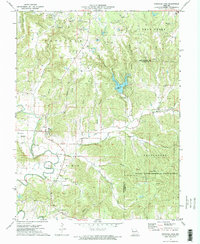 1973 Pinnacle Lake1975 Print · USGSMontgomery County in the early 1970s reveals a landscape defined by the clay mining industry and the waters of Pinnacle Lake. Genealogists and historians can trace numerous rural family burial sites including Snethen Cem and Loutre Island Cem.2 unique versions available
 - 1973 Map of New Florence, 1975 Print
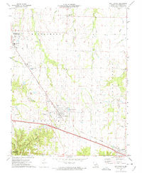 1973 New Florence1975 Print · USGSThe mid-Missouri countryside near New Florence is captured here in the early seventies during a period of industrial and rural transition. Local researchers can locate specific claypits, family-linked sites like Mt Pleasant Cem, and the path of the Norfolk and Western railroad.
Showing maps 1-25 of 120
Top cities of Montgomery County
- Montgomery City historical maps
- Wellsville historical maps
- New Florence historical maps
- Jonesburg historical maps
- Bellflower historical maps
- High Hill historical maps
See more
Frequently asked questions
- What are the different types of historical maps available for Montgomery County?
- What is the oldest map of Montgomery County?
- Where can I purchase historical maps of Montgomery County for my home or office?
- Where can I download high-res historical maps of Montgomery County?
- Are there historical topographic maps available for Montgomery County?
- Is there historical aerial imagery available for Montgomery County?
- Where are historical maps of Montgomery County sourced from?