2020s Maps of Montgomery County, Missouri
Explore 19 historic maps of Montgomery County from the 2020s. These maps offer a rare glimpse into what life looked like during the 2020s — showing old roads, neighborhoods, homes, and landmarks that have changed or disappeared over time.
Whether you're researching your family's past, planning a metal detecting trip, or studying how Montgomery County's landscape evolved across the 2020s, these high-resolution maps are a powerful tool for exploring the history of this region.
- Focus on a specific era: All maps on this page are from the 2020s, giving you a focused view of this time period.
- See what’s changed: Compare century-old streets, trails, and buildings to today's modern landscape using overlays and satellite layers.
- Research with precision: Use these maps for genealogy, historical research, land use analysis, or educational projects.
- View, download, or print: Maps are fully viewable online in high resolution, and can be downloaded or printed for your own records.
Start exploring Montgomery County's history through authentic maps from the 2020s. This is your window into the past.
Montgomery County, MO maps
(19)- 2021 Map of Gasconade, 2021 Print
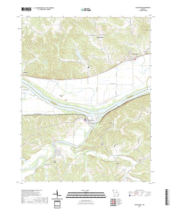 2021 Gasconade2021 Print · USGSGasconade and the Missouri River confluence are captured here in the early twenty-first century. Genealogists can locate several family burial sites like Saint Marcus Cem and Lucas Cem, or trace the winding path of the Katy Trl.
 - 2021 Map of Laddonia, 2021 Print
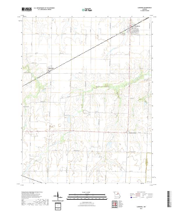 2021 Laddonia2021 Print · USGSAudrain County agriculture and rural life are captured here during the early 2020s. Researchers can trace local property access and terrain features from the streets of Laddonia to the banks of the W Fork Cuivre River and Moms Slough.
 - 2021 Map of New Hartford, 2021 Print
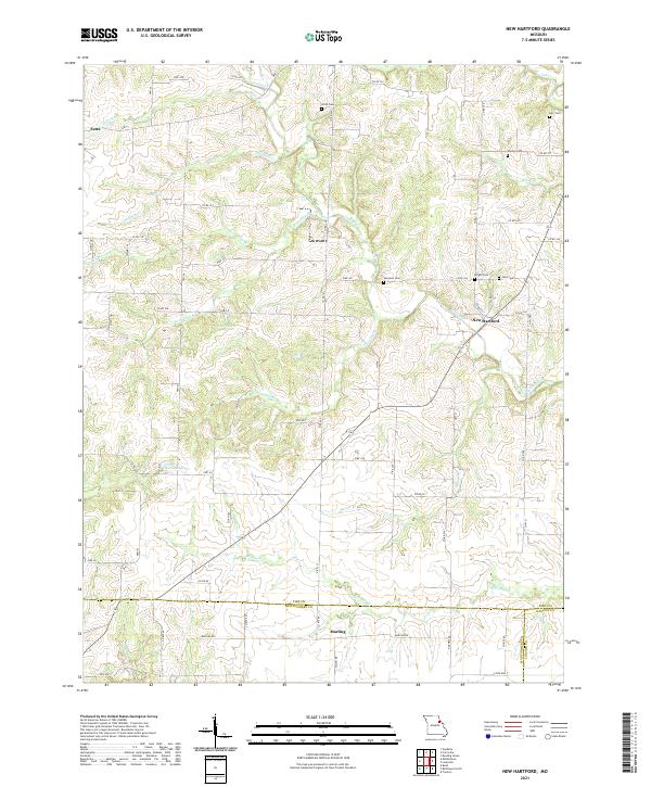 2021 New Hartford2021 Print · USGSNear the intersection of three Missouri counties in the early twenty-first century, this landscape remains a deeply rural agricultural patchwork. Genealogists and historians can locate numerous small family burial sites like Willis Cem and Wright Cem along with the settlements of New Hartford and Marling.
 - 2021 Map of Middletown, 2021 Print
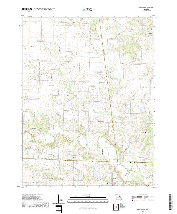 2021 Middletown2021 Print · USGSMiddletown and its surrounding tri-county farm country are captured here in the early twenty-first century. Researchers can trace family-named sites and rural landmarks like Payne Cem, Rudd School Cem, and the small community of Gazette.
 - 2021 Map of Martinsburg, 2021 Print
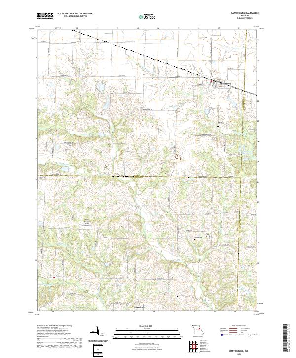 2021 Martinsburg2021 Print · USGSThe rural landscape of north-central Missouri is documented here at the meeting point of three counties. Local researchers can trace the drainages of the Loutre River or locate family history sites like Martinsburg Cem, Chatman Cem, and the small settlement of Shamrock.
 - 2021 Map of Morrison, 2021 Print
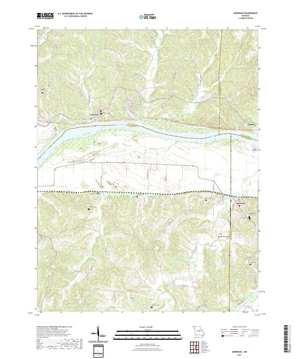 2021 Morrison2021 Print · USGSMorrison and the Missouri River bottoms appear in this modern survey of the Gasconade and Callaway county borders. Genealogists can trace numerous local burial sites like Assumption Catholic Cem and Ferguson Cem near the banks of Baileys Cr.
 - 2021 Map of Hermann, 2021 Print
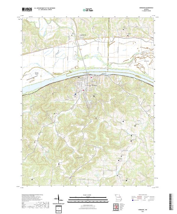 2021 Hermann2021 Print · USGSMissouri's Rhineland comes to life in this detailed view of Hermann and the Missouri River valley during the early twenty-first century. Genealogists and local historians can trace family roots through an exceptional number of burial sites, including Halle Talbot Cem, Poeschel Cem, and Loutre Island Church Cem.
 - 2021 Map of Americus, 2021 Print
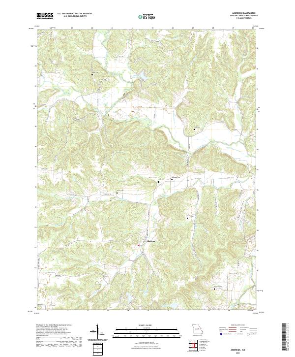 2021 Americus2021 Print · USGSAmericus and the surrounding Missouri countryside appear here in the early 2020s, showing a landscape shaped by the Loutre River and deep-rooted rural communities. Family history researchers can locate numerous burial grounds such as Bush Cem, Hunter Cem, and the high ground of Graveyard Hill.
 - 2021 Map of Bellflower South, 2021 Print
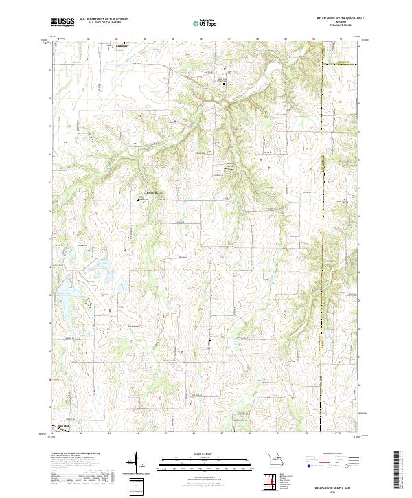 2021 Bellflower South2021 Print · USGSEastern Montgomery County is shown in detail during the early 2020s, highlighting the rural communities and county lines. Local historians can trace family roots through the Bellflower Cem, Prices Branch Cem, and the small settlement at High Hill.
 - 2021 Map of Pinnacle Lake, 2021 Print
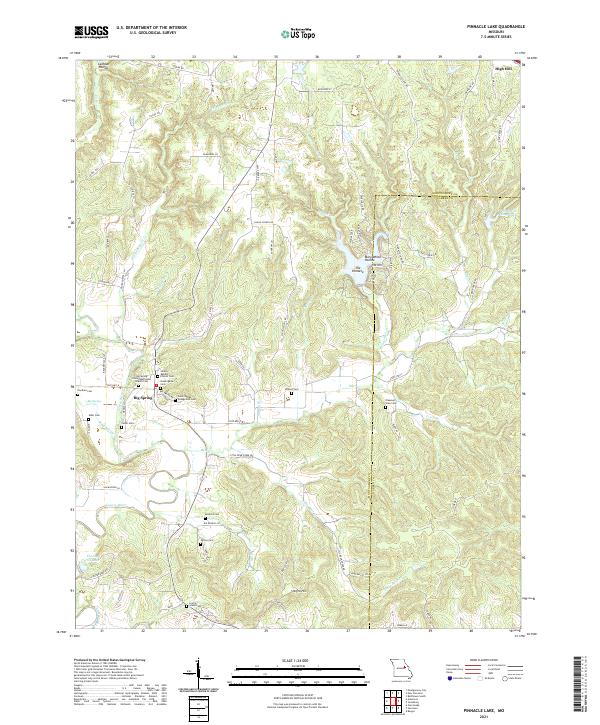 2021 Pinnacle Lake2021 Print · USGSThe rural landscape of Montgomery County is captured here in the early 2020s, showing a region defined by its deep-rooted family history and winding river valleys. Genealogists can locate several historic burial sites and congregations, including the Niedergerke Cem, Snethen Cem, and the Big Spring United Methodist Church.
 - 2021 Map of Wellsville, 2021 Print
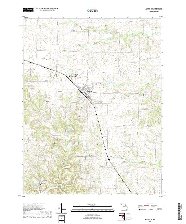 2021 Wellsville2021 Print · USGSWellsville and its rural Montgomery County surroundings are detailed here in the early 2020s, showcasing a landscape of family farms and small waterways. Researchers can locate numerous local burial sites like Peery Cem and Sunrise Memorial Gardens or trace the drainage of Scratchers Br and Coal Br.
 - 2021 Map of New Florence, 2021 Print
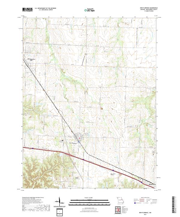 2021 New Florence2021 Print · USGSMontgomery County at the start of the 2020s shows a landscape of rail-side towns and rural hollows. Genealogists and local historians can trace family plots at New Florence Cem, follow the Norfolk Southern tracks, or locate Wilkins Airport.
 - 2021 Map of Buell, 2021 Print
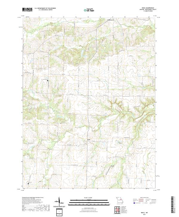 2021 Buell2021 Print · USGSNortheast Montgomery County is shown here in the early 2020s as a region defined by its numerous creek systems and small rural settlements. Researchers can locate several burial grounds like Hopewell Cem and Mcquoid Cem, alongside landmarks such as Middletown Lake.
 - 2021 Map of Jonesburg, 2021 Print
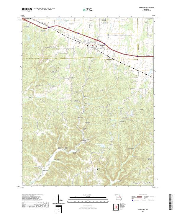 2021 Jonesburg2021 Print · USGSThe Missouri towns of Jonesburg and High Hill are captured here in the early twenty-first century along the historic Booneslick Rd corridor. Genealogists and local historians can locate Wright Cem, Ray Cem, and the many family-named landmarks like Henley Hollow.
 - 2021 Map of Williamsburg, 2021 Print
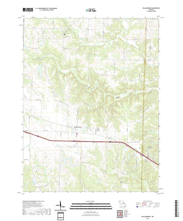 2021 Williamsburg2021 Print · USGSCallaway and Montgomery counties are captured in this modern survey of the Missouri countryside. Researchers can trace family history through sites like Augusta Cemetery or locate landmarks such as Flying V Ranch Airport and the Loutre River.
 - 2021 Map of Montgomery City, 2021 Print
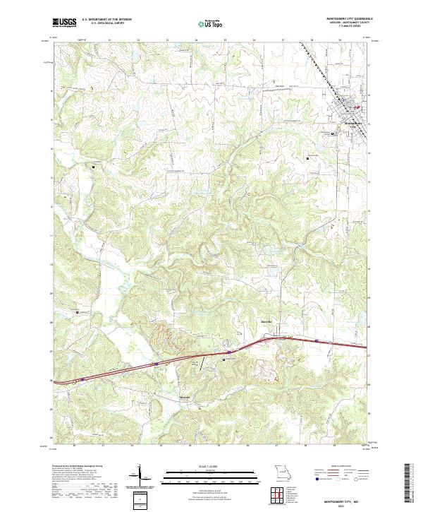 2021 Montgomery City2021 Print · USGSThe Montgomery County seat and surrounding rural townships are shown here as they appeared in the early 2020s. Genealogists and local historians can trace burial sites at Montgomery City Cem or Worland Cem and locate landmarks like the Sky-Vu Airport.
 - 2021 Map of Readsville, 2021 Print
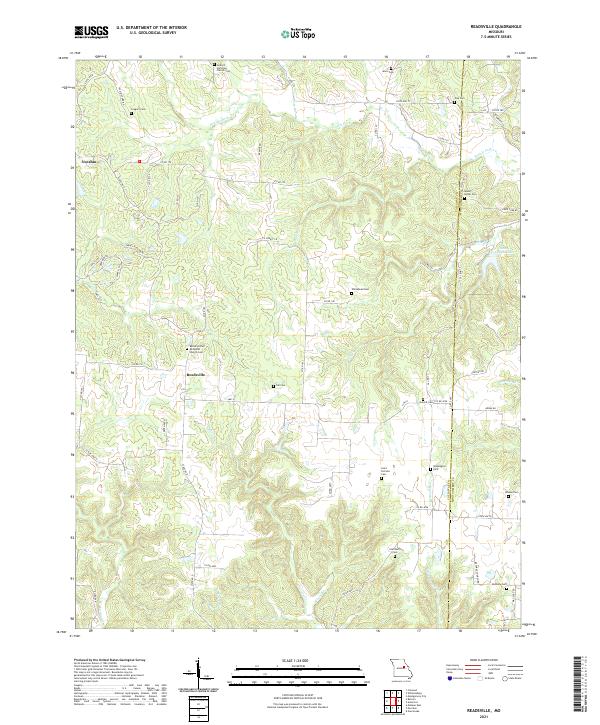 2021 Readsville2021 Print · USGSThe rural landscapes of Callaway County are documented here during the early twenty-first century, showing the enduring structure of its townships. Genealogists can locate numerous burial sites such as Mount Horeb Cem, Tate Cem, and Atterberry Cem among the hills.
 - 2021 Map of Vandalia Lake, 2021 Print
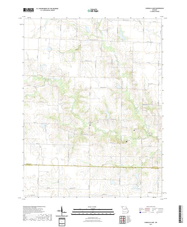 2021 Vandalia Lake2021 Print · USGSAudrain and Montgomery counties are shown in recent years, revealing a rural landscape defined by the W Fork Cuivre River. Genealogists can locate community landmarks like New Providence Cem, Fike Cem, and Elmer Foree Lake.
 - 2021 Map of Bellflower North, 2021 Print
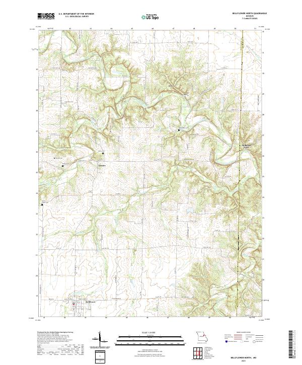 2021 Bellflower North2021 Print · USGSThe rural Montgomery County landscape south of the Cuivre River appears in detail just after the turn of the twenty-first century. Genealogists and local historians can trace family connections at Macedonia Cem, Union Chapel Cem, and the river crossing at Stillhouse Ford.
End of results
Showing maps 1-19 of 19
Top cities of Montgomery County
- Montgomery City historical maps
- Wellsville historical maps
- New Florence historical maps
- Jonesburg historical maps
- Bellflower historical maps
- High Hill historical maps
See more
Frequently asked questions
- What are the different types of historical maps available for Montgomery County?
- What is the oldest map of Montgomery County?
- Where can I purchase historical maps of Montgomery County for my home or office?
- Where can I download high-res historical maps of Montgomery County?
- Are there historical topographic maps available for Montgomery County?
- Is there historical aerial imagery available for Montgomery County?
- Where are historical maps of Montgomery County sourced from?