Old Maps of Montgomery City, Missouri
Explore 21 old maps of Montgomery City, spanning from 1890 to today. These high-resolution historic maps reveal how streets, neighborhoods, landmarks, and natural features evolved over time — perfect for genealogy, metal detecting, research, and local history exploration.
What you can do with these maps:
- See how Montgomery City changed over time: Compare historical maps to modern-day views to trace roads, homesites, rail lines & more.
- View detailed metadata: Each map includes creators, publishers, year, scale, and archive source.
- Overlay maps with satellite & LiDAR: Visualize the past alongside modern tools to explore terrain & human change.
- Trusted historical sources: Maps sourced from the USGS, Library of Congress, and other archives.
- Access maps your way: View online, download high-res files, or order prints for personal or research use.
Start exploring old maps of Montgomery City to uncover forgotten places, hidden landmarks, and the deep history beneath your feet.
Montgomery City, MO maps
(21)- 1890 Map of Hermann
 1890 Hermann1890 Print · USGSMid-Missouri river life and rail commerce define this late-century landscape during a period of steady expansion. Genealogists and historians can trace family roots through old post offices like Hopewell Academy P.O. and Swiss P.O. or the early street grids of Hermann and Warrenton.5 unique versions available
 - 1890 Map of Fulton
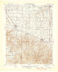
 1890 Fulton1890 Print · USGSMid-Missouri river life and railroad expansion come into focus in this late nineteenth-century survey. Genealogists and historians can trace old township lines and early river towns like Chamois, Danville, and the bustling county seat at Fulton.5 unique versions available
 - 1940 Map of Montgomery City, 1965 Print
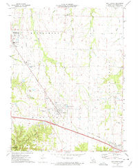
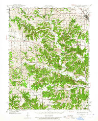 1940 Montgomery City1965 Print · USGSThe Montgomery County interior at the start of the 1940s reveals a landscape of railroad towns and scattered prairie farmsteads. Genealogists can trace family roots through numerous sites like Tate Cem, St Patricks Ch, and the Loutre Valley Sch.2 unique versions available
 - 1942 Map of Montgomery City
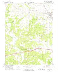
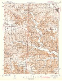 1942 Montgomery City1942 Print · USGSMontgomery County and the edge of Callaway County are captured here in the early 1940s, showing a landscape defined by the Loutre River and the Wabash RR. Researchers can locate dozens of rural landmarks, from family-named plots like Worland Cem to country schoolhouses like Verbena Dale Sch and Sunny Hill Sch.2 unique versions available
 - 1942 Map of New Florence, 1963 Print
 1942 New Florence1963 Print · USGSMontgomery County in the early 1940s reveals a landscape of dispersed farmsteads and rail-dependent towns like New Florence and High Hill. You can trace rural education through vanished schoolhouses like Orange Blossom Sch or locate family sites near Wright Cem.2 unique versions available
 - 1946 Map of New Florence
 1946 New Florence1946 Print · USGSMid-century Montgomery and Warren counties are captured here just as the rural school system and steam-era rail lines remained central to life. Genealogists can locate family landmarks like Wright Cem and dozens of vanished schoolhouses including Crabapple Sch and Me Kittrick Sch.2 unique versions available
 - 1949 Map of Saint Louis
 1949 Saint Louis1949 Print · USGSGreater St. Louis and its surrounding river valleys are captured here just after the war, showing the metropolitan core and the rural Ozark fringe. Researchers can trace the sprawling rail network of the Wabash RR or locate landmarks like Meramec Caverns Airport and Scott Air Force Base.2 unique versions available
 - 1962 Map of St. Louis
 1962 St. Louis1962 Print · USGSThe mid-century gateway to the west shows the metropolitan expansion of St Louis alongside its critical river confluences. Genealogists and historians can trace the rail corridors of the Missouri Pacific RR and settlements from Fulton to De Soto.
 - 1963 Map of St. Louis, 1970 Print
 1963 St. Louis1970 Print · USGSSt. Louis and its surrounding river valleys are captured here during the peak of mid-century suburban expansion and industrial activity. Trace the historic rail routes of the Norfolk and Western Ry or locate the St Louis Ordnance Plant and early stretches of US Highway 66.4 unique versions available
 - 1966 Map of St. Louis
 1966 St. Louis1966 Print · USGSThe St. Louis metropolitan area and its surrounding river valleys are captured here during the mid-sixties era of suburban growth and industrial strength. Genealogists and historians can trace the foundations of local communities through sites like Old Pioneer Cem, Parks College, and the Jefferson Barracks Military Reservation.
 - 1973 Map of New Florence, 1975 Print
 1973 New Florence1975 Print · USGSThe mid-Missouri countryside near New Florence is captured here in the early seventies during a period of industrial and rural transition. Local researchers can locate specific claypits, family-linked sites like Mt Pleasant Cem, and the path of the Norfolk and Western railroad.
 - 1973 Map of Montgomery City, 1975 Print
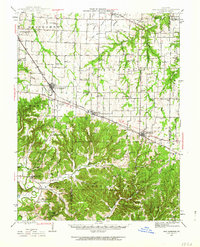
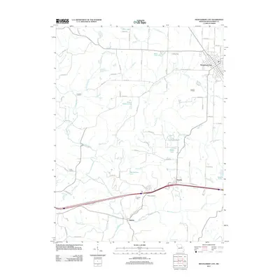
 1973 Montgomery City1975 Print · USGSMontgomery County was transitioning into a modern corridor in the 1970s as the new interstate bypassed the older settlements of Danville and Mineola. Researchers can trace the rail heritage of Montgomery Station or locate family burial grounds like Gregory Cem and Conley Cem.2 unique versions available
 - 1985 Map of Fulton
 1985 Fulton1985 Print · USGSMid-Missouri was a hub of river commerce and rail travel in the mid-1980s, where towns like Fulton and Hermann anchored the river valley. Researchers can trace historic river islands like Rush Island or follow the path of the Missouri - Kansas - Texas Railroad.2 unique versions available
 - 2012 Map of Montgomery City, 2012 Print
 2012 Montgomery City2012 Print · USGSCovers Montgomery City, including Danville, Mineola, and other nearby areas
 - 2012 Map of New Florence, 2012 Print
 2012 New Florence2012 Print · USGSCovers Montgomery City, including New Florence, High Hill, and other nearby areas
 - 2015 Map of Montgomery City, 2015 Print
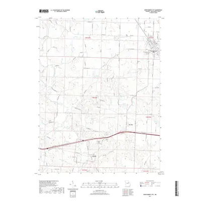
 2015 Montgomery City2015 Print · USGSCovers Montgomery City, including Danville, Mineola, and other nearby areas
 - 2015 Map of New Florence, 2015 Print
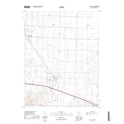
 2015 New Florence2015 Print · USGSCovers Montgomery City, including New Florence, High Hill, and other nearby areas
 - 2017 Map of New Florence, 2017 Print
 2017 New Florence2017 Print · USGSCovers Montgomery City, including New Florence, High Hill, and other nearby areas
 - 2017 Map of Montgomery City, 2017 Print
 2017 Montgomery City2017 Print · USGSCovers Montgomery City, including Danville, Mineola, and other nearby areas
 - 2021 Map of New Florence, 2021 Print
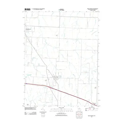
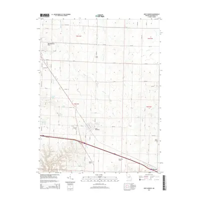
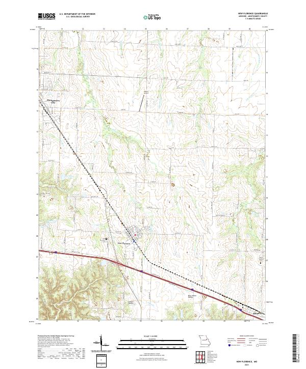 2021 New Florence2021 Print · USGSMontgomery County at the start of the 2020s shows a landscape of rail-side towns and rural hollows. Genealogists and local historians can trace family plots at New Florence Cem, follow the Norfolk Southern tracks, or locate Wilkins Airport.
 - 2021 Map of Montgomery City, 2021 Print
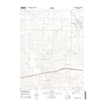
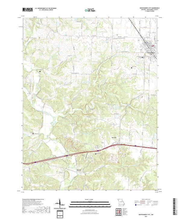 2021 Montgomery City2021 Print · USGSThe Montgomery County seat and surrounding rural townships are shown here as they appeared in the early 2020s. Genealogists and local historians can trace burial sites at Montgomery City Cem or Worland Cem and locate landmarks like the Sky-Vu Airport.
End of results
Showing maps 1-21 of 21
Top cities near Montgomery City
- Wellsville historical maps
- New Florence historical maps
- Jonesburg historical maps
- Bellflower historical maps
- Martinsburg historical maps
- High Hill historical maps
See more
Frequently asked questions
- What are the different types of historical maps available for Montgomery City?
- What is the oldest map of Montgomery City?
- Where can I purchase historical maps of Montgomery City for my home or office?
- Where can I download high-res historical maps of Montgomery City?
- Are there historical topographic maps available for Montgomery City?
- Is there historical aerial imagery available for Montgomery City?
- Where are historical maps of Montgomery City sourced from?