2020s Maps of Montgomery City, Missouri
Explore 2 historic maps of Montgomery City from the 2020s. These maps offer a rare glimpse into what life looked like during the 2020s — showing old roads, neighborhoods, homes, and landmarks that have changed or disappeared over time.
Whether you're researching your family's past, planning a metal detecting trip, or studying how Montgomery City's landscape evolved across the 2020s, these high-resolution maps are a powerful tool for exploring the history of this region.
- Focus on a specific era: All maps on this page are from the 2020s, giving you a focused view of this time period.
- See what’s changed: Compare century-old streets, trails, and buildings to today's modern landscape using overlays and satellite layers.
- Research with precision: Use these maps for genealogy, historical research, land use analysis, or educational projects.
- View, download, or print: Maps are fully viewable online in high resolution, and can be downloaded or printed for your own records.
Start exploring Montgomery City's history through authentic maps from the 2020s. This is your window into the past.
Montgomery City, MO maps
(2)- 2021 Map of New Florence, 2021 Print
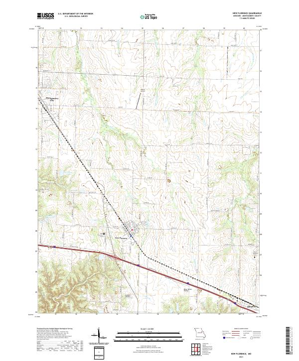 2021 New Florence2021 Print · USGSMontgomery County at the start of the 2020s shows a landscape of rail-side towns and rural hollows. Genealogists and local historians can trace family plots at New Florence Cem, follow the Norfolk Southern tracks, or locate Wilkins Airport.
 - 2021 Map of Montgomery City, 2021 Print
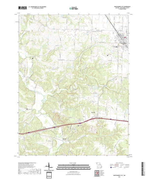 2021 Montgomery City2021 Print · USGSThe Montgomery County seat and surrounding rural townships are shown here as they appeared in the early 2020s. Genealogists and local historians can trace burial sites at Montgomery City Cem or Worland Cem and locate landmarks like the Sky-Vu Airport.
End of results
Showing maps 1-2 of 2
Top cities near Montgomery City
- Wellsville historical maps
- New Florence historical maps
- Jonesburg historical maps
- Bellflower historical maps
- Martinsburg historical maps
- High Hill historical maps
See more
Frequently asked questions
- What are the different types of historical maps available for Montgomery City?
- What is the oldest map of Montgomery City?
- Where can I purchase historical maps of Montgomery City for my home or office?
- Where can I download high-res historical maps of Montgomery City?
- Are there historical topographic maps available for Montgomery City?
- Is there historical aerial imagery available for Montgomery City?
- Where are historical maps of Montgomery City sourced from?