Old Maps of Riverview, Missouri for Metal Detecting
Plan your next treasure hunt with 16 historic maps of Riverview. Find old homesites, ghost towns, trails, and gathering spots that may be lost to time — perfect for identifying promising metal detecting locations.
- Locate forgotten sites: Uncover places like long-lost settlements, abandoned rail lines, or gathering spots.
- Plan better hunts: Use map overlays combined with LiDAR or satellite views to narrow in on historically rich areas.
- Made for detectorists: Thousands of hobbyists use these maps to discover relics, coins, and hidden history.
Use these historic maps to boost your research and find new opportunities beneath the surface of Riverview.
Riverview, MO maps
(16)- 1887 Map of Warsaw
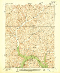
 1887 Warsaw1887 Print · USGSBenton County was a land of river junctions and railheads in the late 1880s. Local historians can trace the early footprints of Warsaw, the winding Missouri Pacific Railroad, and riverside settlements like Fairfield and Duroc.
 - 1894 Map of Warsaw
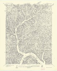
 1894 Warsaw1894 Print · USGSBenton County and its neighbors are shown here in the mid-1880s, centered on the river junctions that shaped early Missouri commerce. Genealogists can trace family roots through old rural centers like Fairfield, Boylers Mills, and Cross Timbers before the river valleys were transformed.4 unique versions available
 - 1935 Map of Boylers Mill
 1935 Boylers Mill1935 Print · USGSThe Morgan and Benton county lines meet here in the 1930s, showing the early impact of the newly formed Lake of the Ozarks. Genealogists can trace family landmarks like the Shiloh Church, Boylers Mill, and several rural one-room schoolhouses.
 - 1947 Map of Jefferson City, 1949 Print
 1947 Jefferson City1949 Print · USGSCentral Missouri and the northern Ozarks come into focus in this late 1940s survey of the river-and-rail landscape. Genealogists and historians can trace the growth of Jefferson City and Sedalia or locate family roots near Bagnell Dam and the Lake of the Ozarks.
 - 1954 Map of Jefferson City
 1954 Jefferson City1954 Print · USGSCentral Missouri in the early postwar years showcases a landscape defined by the winding Lake of the Ozarks and the state capital at Jefferson City. Researchers can trace the mid-century rail networks of the Missouri Pacific RR and locate rural communities like Tuscumbia, St Elizabeth, and St Anthony.2 unique versions available
 - 1955 Map of Jefferson City, 1967 Print
 1955 Jefferson City1967 Print · USGSCentral Missouri in the mid-fifties is defined by the winding Missouri River and the expanding reach of Lake of the Ozarks. Researchers can trace the rail corridors of the Missouri Pacific or locate the early footprint of Whiteman AFB and Jefferson City.4 unique versions available
 - 1957 Map of Boylers Mill
 1957 Boylers Mill1957 Print · USGSIn the mid-thirties, this part of the Missouri Ozarks centered on the waters of the newly formed lake and the valleys of Boylers Mill. Genealogists can locate family landmarks like Big Buffalo School, Shiloh Church, and the site of Zachada Ferry.
 - 1958 Map of Jefferson City
 1958 Jefferson City1958 Print · USGSCentral Missouri in the late fifties shows a region transforming through the growth of Whiteman Air Force Base and the Lake of the Ozarks. Researchers can trace rail lines like the Missouri Pacific or find family roots at Enloe Cemetery and Mount Pleasant Cem.
 - 1959 Map of Jefferson City
 1959 Jefferson City1959 Print · USGSCentral Missouri is captured during the mid-fifties as the river economy and rail networks like the Missouri Pacific met the rise of the automobile. Local researchers can trace family landmarks and rural infrastructure from the Lake of the Ozarks up to Providence Cemetery and Knob Noster State Park.
 - 1959 Map of Boylers Mill, 1960 Print
 1959 Boylers Mill1960 Print · USGSThe Morgan and Benton County line in the late fifties shows the intersection of traditional Ozark creek valleys and the expanding Lake of the Ozarks. Genealogists and local historians can trace rural landmarks like Boylers Mill, Big Buffalo Sch, and Mt Calvary Ch.2 unique versions available
 - 1983 Map of Boylers Mill
 1983 Boylers Mill1983 Print · USGSThe northern reaches of the Lake of the Ozarks meet the Missouri Ozarks in the early 1980s, documenting a landscape of steep hollows and family cemeteries. Locate local landmarks like Boylers Mill, the Mt Hulda Lookout Tower, and Shiloh Cem.
 - 1983 Map of Harry S Truman Reservoir, 1984 Print
 1983 Harry S Truman Reservoir1984 Print · USGSBenton and Henry counties center on the vast Harry S Truman Reservoir in the early 1980s as the landscape adapted to its new shoreline. Genealogists and historians can trace old river crossings like Bledsoe Ferry, local landmarks like Mt Zion Ch, and unique settlements such as Tightwad.
 - 2011 Map of Boylers Mill, 2011 Print
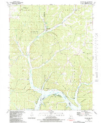
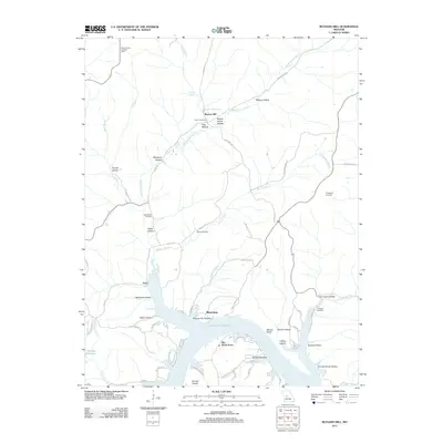 2011 Boylers Mill2011 Print · USGSCovers Riverview, including Zora, Boylers Mill, and other nearby areas
 - 2014 Map of Boylers Mill, 2014 Print
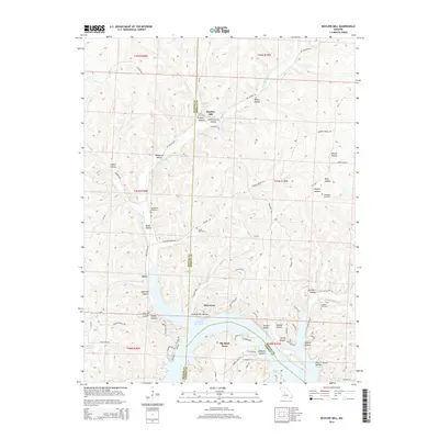 2014 Boylers Mill2014 Print · USGSCovers Riverview, including Zora, Boylers Mill, and other nearby areas
 - 2017 Map of Boylers Mill, 2017 Print
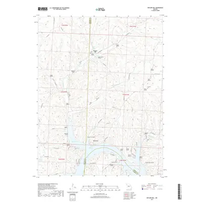 2017 Boylers Mill2017 Print · USGSCovers Riverview, including Zora, Boylers Mill, and other nearby areas
 - 2021 Map of Boylers Mill, 2021 Print
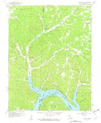
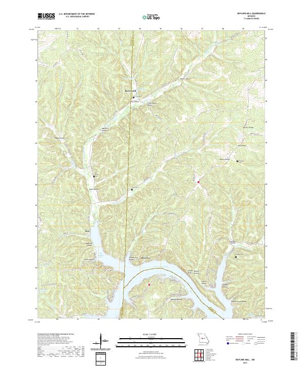 2021 Boylers Mill2021 Print · USGSThe northern reaches of the Lake of the Ozarks come into focus in this contemporary study of the Morgan and Benton County line. Local historians can trace family-named sites like Boylers Mill, Attners Bluffs, and Franklin Cem across a landscape of deep hollows.
End of results
Showing maps 1-16 of 16
Top cities near Riverview
- Versailles historical maps
- Cole Camp historical maps
- Stover historical maps
- Laurie historical maps
- Climax Springs historical maps
Frequently asked questions
- What are the different types of historical maps available for Riverview?
- What is the oldest map of Riverview?
- Where can I purchase historical maps of Riverview for my home or office?
- Where can I download high-res historical maps of Riverview?
- Are there historical topographic maps available for Riverview?
- Is there historical aerial imagery available for Riverview?
- Where are historical maps of Riverview sourced from?