Old Maps of Ray County, Missouri for Hiking & Exploration
Hike through history with 104 historic maps of Ray County. Explore old trails, ghost towns, and forgotten backroads — perfect for outdoor adventurers and local explorers.
- Rediscover forgotten places: Map out old mining camps, roads, and footpaths that no longer exist on modern maps.
- Layer with modern tools: Combine with LiDAR or satellite views to plan hikes through historical terrain.
- Made for exploration: Popular among hikers, overlanders, and local history lovers.
Use these maps to find adventure and explore the hidden past of Ray County.
Ray County, MO maps
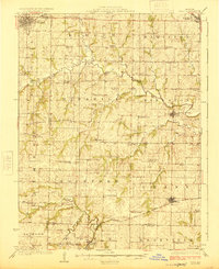
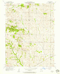
(104)- 1889 Map of Lexington
 1889 Lexington1889 Print · USGSLafayette and Ray Counties are captured here during the late nineteenth-century rail boom. Researchers can trace the development of river towns and rail junctions like Lexington, Lexington Junction, and the riverside landing at Miles Point.6 unique versions available
 - 1894 Map of Independence
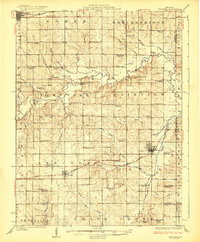
 1894 Independence1894 Print · USGSThe river valley and rail corridors of western Missouri are captured in detail during the late nineteenth century. Researchers can trace the early layouts of Liberty and Independence alongside lost river features like Liberty Landing and Cooley Lake.5 unique versions available
 - 1924 Map of Polo
 1924 Polo1924 Print · USGSCaldwell County rural life in the early twenties is centered around a dense network of school districts and small rail towns. Genealogists can trace family roots through dozens of local landmarks like Kendall Church, Yankee Ridge School, and the Stoner Bridge.2 unique versions available
 - 1924 Map of Braymer
 1924 Braymer1924 Print · USGSNorthwest Missouri's agricultural heartland is documented here in the early twenties, showing a landscape defined by the railroad and a dense grid of rural schoolhouses. Genealogists can locate specific family landmarks like Brown Jug School, Hopewell Church, and the Gould Farm Bridge.3 unique versions available
 - 1935 Map of Buckner
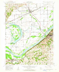
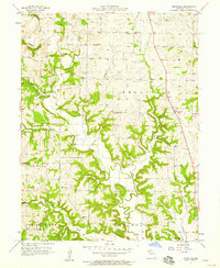
 1935 Buckner1935 Print · USGSThe Missouri River bottoms and Fort Osage bluffs are captured here in the mid-1930s during a period of heavy rail and river activity. Genealogists and historians can trace the locations of numerous rural landmarks like Union Ch, Egypt Sch, and the Hossenflow Duck Camp.2 unique versions available
 - 1949 Map of Lexington East, 1963 Print
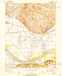
 1949 Lexington East1963 Print · USGSLafayette County enters the post-war era as a hub of river commerce and rural education. Researchers can trace historic coal operations at various Mine Dumps or locate local landmarks like Wentworth Military Academy and the Slusher Sch.3 unique versions available
 - 1949 Map of Lexington West, 1963 Print
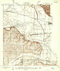
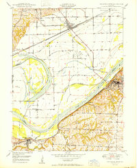
 1949 Lexington West1963 Print · USGSThe Missouri River floodplain in the late 1940s reveals a complex network of rail lines and riverfront industry between Ray and Lafayette counties. Researchers can trace the river's influence through features like the Sunshine Lake oxbow, the Henrietta rail junction, and the Myrick riverfront.3 unique versions available
 - 1950 Map of Lexington East
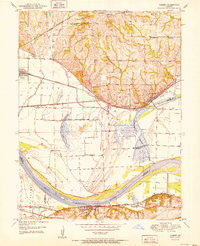
 1950 Lexington East1950 Print · USGSMid-century Lafayette County comes alive through this survey of the river valley and its surrounding uplands. Genealogists and historians can trace local family roots at Forest Grove Cem, Slusher Cem, and several rural schoolhouses like Burns Sch.
 - 1950 Map of Kansas City
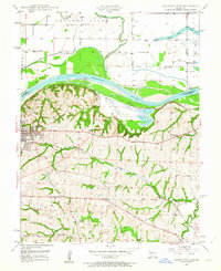
 1950 Kansas City1950 Print · USGSMid-century Kansas and Missouri are captured here during a period of industrial growth and shifting transportation. Genealogists and historians can trace rail lines like the Wabash RR or locate ancestral homes near the Potawatomi Indian Reservation and Horton.
 - 1950 Map of Camden, 1955 Print
 1950 Camden1955 Print · USGSThe Missouri River bottomlands in the early 1950s show a landscape shaped by three major railroads and a complex levee system. Genealogists and local historians can trace family roots at New Hope Church, Lillard School, and the Cravens Cemetery.4 unique versions available
 - 1950 Map of Lexington West, 1965 Print
 1950 Lexington West1965 Print · USGSThe Missouri River bluffs at the turn of the 1950s reveal a landscape of coal mining and river navigation along the Ray and Lafayette county lines. Researchers can trace family history through sites like Lexington Battle Ground, Sunshine Sch, and Foster Cem.
 - 1951 Map of Camden
 1951 Camden1951 Print · USGSThe Missouri River floodplain comes alive in this mid-century survey of the Ray and Lafayette county border. Genealogists and local historians can trace rural family sites like Lewis Cem and South Point Cem or locate the old Lillard Sch.2 unique versions available
 - 1953 Map of Moberly
 1953 Moberly1953 Print · USGSMid-century north-central Missouri is documented here as a bustling intersection of river commerce and heavy rail. Researchers can trace historic family-named landmarks and transport hubs from the Missouri River corridor to the rail yards of Moberly, Chillicothe, and Macon.
 - 1954 Map of Kansas City
 1954 Kansas City1954 Print · USGSThe Missouri-Kansas borderlands flourished in the post-war era as river commerce and rail networks converged at the Missouri River. Genealogists and historians can trace the foundations of Kansas City and smaller rural hubs like Hiawatha or Sabetha.
 - 1954 Map of Moberly, 1969 Print
 1954 Moberly1969 Print · USGSMid-century Missouri is captured here during a period of transition for its river towns and rail hubs. Genealogists and historians can trace the paths of the Wabash railroad through Moberly or explore the riverside layout of Lexington and Brunswick.3 unique versions available
 - 1956 Map of Kansas City, 1967 Print
 1956 Kansas City1967 Print · USGSThe Kansas-Missouri border region thrived during the mid-fifties, centered on the growing metropolitan cores and the busy river valleys. Researchers can trace the layout of significant government sites like Fort Leavenworth and the Lake City Army Ammunition Plant.4 unique versions available
 - 1957 Map of Moberly
 1957 Moberly1957 Print · USGSNorth-central Missouri in the late nineteen-forties and fifties remains a landscape defined by its great rivers and a dense network of steam and diesel rail lines. Genealogists and historians can trace the paths of the Wabash RR and Santa Fe RR through historic junctions like Moberly, Brookfield, and Macon.
 - 1957 Map of Stet, 1958 Print
 1957 Stet1958 Print · USGSRay and Carroll counties maintained a strong agricultural identity in the late fifties, centered on the community of Stet. Researchers can trace old family sites and rural institutions like Log Cabin Station, Penniston Cem, and the rail lines of the Chicago Burlington and Quincy.2 unique versions available
 - 1957 Map of Knoxville, 1958 Print
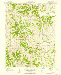
 1957 Knoxville1958 Print · USGSRay County's rural heartland is captured here in the late fifties, showing a landscape shaped by the Crooked River drainage system. Genealogists and local historians can trace family roots through sites like Sandals Cem, Bethlehem Ch, and the old Crenshaw Sch.2 unique versions available
 - 1957 Map of Lawson, 1958 Print
 1957 Lawson1958 Print · USGSMid-century Lawson and Vibbard sit at the junction of two major rail lines as they cut through the tri-county corner of Clay, Clinton, and Ray. Family historians can locate rural landmarks like Canaan Hill Ch, Franklin Sch, and the Elmira Camp near the Crooked River.2 unique versions available
 - 1957 Map of Millville, 1958 Print
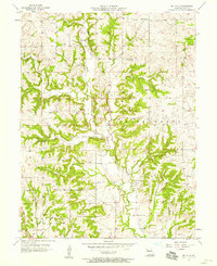 1957 Millville1958 Print · USGSRay County in the late fifties is captured here as a landscape of rural townships and family homesteads. Researchers can trace ancestral locations through several family-named burial grounds like Silar Cem and Smith Cem, alongside the community hub of Millville.2 unique versions available
 - 1957 Map of Hardin, 1958 Print
 1957 Hardin1958 Print · USGSThe river bottoms and prairie uplands of Ray and Carroll counties are captured here during the late 1950s. Genealogists and researchers can trace the rail-driven landscape through Hardin and locate rural landmarks like Lavelock Cemetery and Central School.2 unique versions available
 - 1957 Map of Excelsior Springs, 1958 Print
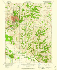 1957 Excelsior Springs1958 Print · USGSThe resort city of Excelsior Springs and the surrounding Clay County farmland are shown here in the mid-fifties. Researchers can locate numerous local landmarks including Crown Hill Cem, rural sites like Miltondale, and the Excelsior Institute medical facilities.2 unique versions available
 - 1957 Map of Richmond, 1958 Print
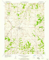
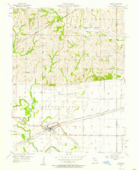
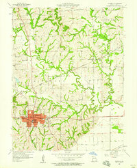 1957 Richmond1958 Print · USGSRay County in the late fifties is captured here at a peak of rail-line activity and rural settlement. Genealogists and local historians can trace family ties through numerous landmarks like Hickory Grove Ch, Watkins Cem, and Patton Sch.2 unique versions available
 - 1957 Map of Rayville, 1958 Print
 1957 Rayville1958 Print · USGSRay County's agricultural heartland is documented here in the late fifties, during a time when rural life revolved around local schools, churches, and two major rail lines. Genealogists can locate family landmarks like Hamilton Cem, Todds Chapel, and the Vanderpool Sch.2 unique versions available
Showing maps 1-25 of 104
Top cities of Ray County
- Richmond historical maps
- Orrick historical maps
- Hardin historical maps
- Henrietta historical maps
- Crystal Lakes historical maps
- Camden historical maps
See more
Frequently asked questions
- What are the different types of historical maps available for Ray County?
- What is the oldest map of Ray County?
- Where can I purchase historical maps of Ray County for my home or office?
- Where can I download high-res historical maps of Ray County?
- Are there historical topographic maps available for Ray County?
- Is there historical aerial imagery available for Ray County?
- Where are historical maps of Ray County sourced from?