Old Maps of Ellington, Missouri for Genealogy
Trace your family roots with 24 historic maps of Ellington. These high-res maps reveal old neighborhoods, homesites, landmarks, and streets — helping you uncover where your ancestors lived and how the area evolved over time.
- Explore historic neighborhoods: Identify where your relatives may have lived in the 1800s or 1900s.
- Compare maps over time: Trace the changes in streets, buildings, and landmarks for multi-generational research.
- Perfect for genealogy & ancestry research: Used by family historians and researchers to map out lineage and migration.
These maps are an incredible resource for exploring your personal connection to Ellington's past.
Ellington, MO maps
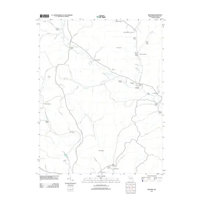
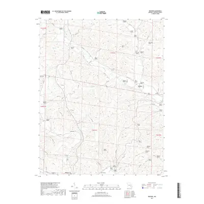
(24)- 1943 Map of Ellington, 1956 Print
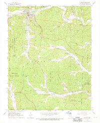
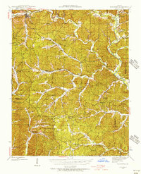 1943 Ellington1956 Print · USGSThe Reynolds County timberlands and river valleys are captured here in the 1940s as the local landscape faced significant change. Genealogists can trace family footprints through numerous rural landmarks like Pine Valley Cem, Garwood, and Carter Mill Sch.
 - 1943 Map of Lesterville, 1957 Print
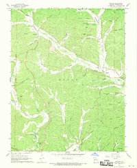
 1943 Lesterville1957 Print · USGSThe Black River forks meet in Reynolds County during the 1940s, revealing a landscape of remote hollows and hilltop schools. Genealogists can trace family names at Dobbins Cem and historic school sites like Harrison Valley Sch or Mayberry Sch.2 unique versions available
 - 1945 Map of Ellington
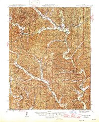
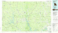
 1945 Ellington1945 Print · USGSThe Missouri Ozarks are captured here during the mid-forties, showing the deep-valley settlements of Reynolds and Carter counties. Genealogists can locate family landmarks such as Newton Cem, Doe Run Ch, and the Upper Doe Run Sch.2 unique versions available
 - 1946 Map of Lesterville
 1946 Lesterville1946 Print · USGSReynolds County settlements at the end of the Second World War reveal a landscape of tight-knit valley communities and upland forests. Genealogists can trace family names through landmarks like Shy Cem, Dobbins Mill, and rural schoolhouses such as Skyline Sch.2 unique versions available
 - 1949 Map of Rolla, 1950 Print
 1949 Rolla1950 Print · USGSThe Missouri Ozarks are captured here just after the war, showing a landscape of deep river valleys and emerging reservoir projects. Genealogists and historians can trace the mining towns of Bonne Terre and Potosi or follow the early route of U.S. Highway 66.
 - 1953 Map of Rolla
 1953 Rolla1953 Print · USGSSoutheast Missouri’s mining towns and timberlands are seen here at the start of the 1950s. Genealogists and historians can trace the rail-and-river economy through local hubs like Fredericktown and the lead-mining heritage of Potosi and Desloge.
 - 1954 Map of Rolla, 1970 Print
 1954 Rolla1970 Print · USGSThe Missouri Ozarks and the historic Lead Belt are captured in the late sixties, showing a landscape of deep river hollows and industrial mines. Researchers can trace the routes of the Missouri Pacific RR to extraction sites like the Iron Mountain Mine or Pea Ridge Mine.2 unique versions available
 - 1958 Map of Rolla
 1958 Rolla1958 Print · USGSThe Missouri Ozarks and the lead-rich hills of the southeast are captured here in the late fifties as timber and mining shaped the local economy. Researchers can locate family landmarks like the Rolla Cemetery or trace old rail lines including the Missouri-Illinois RR and St Louis-San Francisco RR.
 - 1959 Map of Rolla
 1959 Rolla1959 Print · USGSMid-century Missouri is defined here by the deep forests of the Ozarks and the industrial peaks of the St Francois Mountains. Genealogists and historians can trace the development of towns like Potosi and Fredericktown or locate rural landmarks like Dry Fork Church and the Phelps County Courthouse.
 - 1960 Map of Rolla
 1960 Rolla1960 Print · USGSThe Ozark Highlands in the mid-twentieth century reveal a landscape of deep timber and heavy industry. Researchers can trace the rail-and-mine economy through the St Louis-San Francisco RR and the Iron Mountain Mine, alongside the growth of Fort Leonard Wood.
 - 1966 Map of Rolla
 1966 Rolla1966 Print · USGSThe Missouri Ozarks are revealed here in the mid-1960s, showing the intersection of heavy industry and sprawling national forests. Trace the development of the Lead Belt near Flat River or locate family roots in vanished hamlets like Enough and Howes Mill.
 - 1968 Map of Ellington, 1969 Print
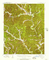
 1968 Ellington1969 Print · USGSEllington and the surrounding Reynolds County highlands are captured here in the late sixties, showing a landscape of deep-woods forestry and quiet rural settlements. Genealogists can locate numerous burial sites like Imboden Cem and Pratt Cem, or trace the Old Grade Railroad and the Deer Run Lookout Tower.3 unique versions available
 - 1968 Map of Redford, 1970 Print
 1968 Redford1970 Print · USGSReynolds County’s Ozark terrain is captured here in the late sixties, showing the valley communities along Sinking Creek. Genealogists and historians can locate family burial sites at Old Redford Cem and Ratliff Cem or trace rural landmarks like Pleasant Hill Ch.2 unique versions available
 - 1971 Map of Rolla
 1971 Rolla1971 Print · USGSThe Missouri Ozarks are captured here during the early seventies, showing a landscape of deep river valleys and industrial mining towns. Researchers can trace historic lead mining operations at St Joseph Mines and locate rural landmarks like Viburnum and the Galveston Trail.
 - 1986 Map of Piedmont
 1986 Piedmont1986 Print · USGSThe Missouri Ozarks are captured here in the mid-eighties as a region of dense state forests and critical river management. Genealogists and historians can trace family-named features and rural settlements like Piedmont, Lesterville, and the Yokum School.2 unique versions available
 - 1989 Map of Rolla
 1989 Rolla1989 Print · USGSThe Missouri Ozarks are captured in the late eighties as a landscape of national forests and historic mining towns. Researchers can trace the rail lines of the Missouri Pacific RR or locate landmarks like Taum Sauk Mtn and Elephant Rocks State Park.
 - 2011 Map of Ellington, 2011 Print
 2011 Ellington2011 Print · USGSCovers Ellington, including Chitwood, Ruble, and other nearby areas
 - 2011 Map of Redford, 2011 Print
 2011 Redford2011 Print · USGSCovers Ellington, including Redford, Reynolds County, and other nearby areas
 - 2015 Map of Ellington, 2015 Print
 2015 Ellington2015 Print · USGSCovers Ellington, including Chitwood, Ruble, and other nearby areas
 - 2015 Map of Redford, 2015 Print
 2015 Redford2015 Print · USGSCovers Ellington, including Redford, Reynolds County, and other nearby areas
 - 2017 Map of Ellington, 2017 Print
 2017 Ellington2017 Print · USGSCovers Ellington, including Chitwood, Ruble, and other nearby areas
 - 2017 Map of Redford, 2017 Print
 2017 Redford2017 Print · USGSCovers Ellington, including Redford, Reynolds County, and other nearby areas
 - 2021 Map of Redford, 2021 Print
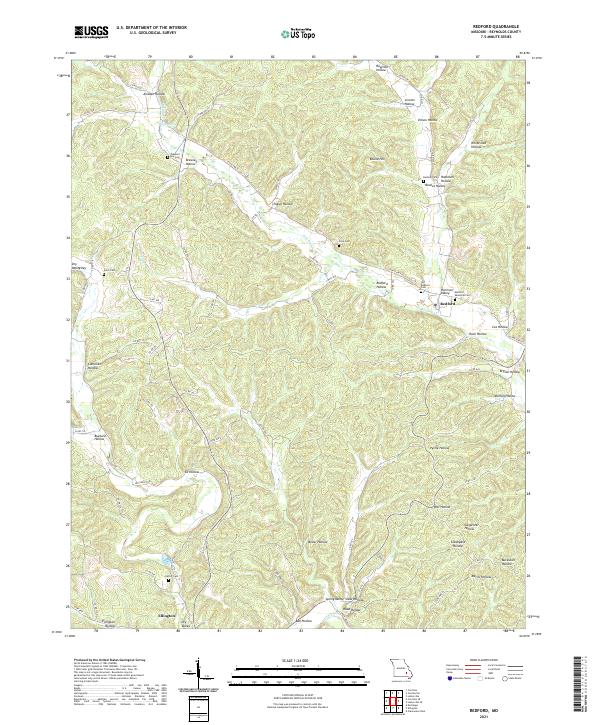 2021 Redford2021 Print · USGSReynolds County, Missouri, is shown here in the early twenty-first century, mapping the deep-hollow topography around the town of Redford. Genealogists and local historians can trace family burial sites like Durham Cem and Pleasant Hill Cem while following the winding paths of Sinking Cr.
 - 2021 Map of Ellington, 2021 Print
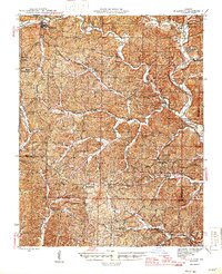
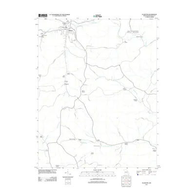
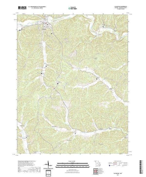 2021 Ellington2021 Print · USGSThe hills surrounding Ellington are captured here in the early twenty-first century, showing a landscape defined by its deep hollows and rural cemeteries. Researchers can locate numerous family burial grounds like Chitwood Cem and Dickson Cem or trace the routes through Darr Valley and Oakley Hollow.
End of results
Showing maps 1-24 of 24
Top cities near Ellington
Frequently asked questions
- What are the different types of historical maps available for Ellington?
- What is the oldest map of Ellington?
- Where can I purchase historical maps of Ellington for my home or office?
- Where can I download high-res historical maps of Ellington?
- Are there historical topographic maps available for Ellington?
- Is there historical aerial imagery available for Ellington?
- Where are historical maps of Ellington sourced from?