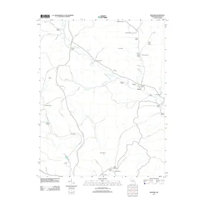
2011 Map of Redford
USGS Topo · Published 2011About this map
Sinking Creek winds through this section of the Ozarks, serving as the primary drainage for a landscape defined by deep hollows and narrow ridges. The settlement of Redford is situated along the creek's eastern banks, where it intersects with Harrison Valley Rd and Old Hwy 21. This 2011 survey reveals a high concentration of family cemeteries, such as the Pyles Cemetery and Durham Cemetery, which are often located on the high ground overlooking the creek valleys. These sites, including the Old Redford Cemetery and Ratliff Cemetery, provide significant data for genealogists tracing early families in Reynolds County. The terrain is further punctuated by natural water sources like Pyrtle Spring and Ball Spring, which have historically influenced the location of homes and livestock operations within the sheltered depressions of Amsden Hollow and Boiler Hollow.
Find a feature on this map
76 named features on this map. Tap any name to fly to it.
Don’t see what you’re looking for? This feature index may not catch every label — zoom into the map to look around manually.
Map Details
Editions of this 2011 Redford Map
This is the sole edition of this map. No revisions or reprints were ever made.
Other maps of this area

1928 · Cardareva
USGS Topo · 1:62,500

1943 · Ellington
USGS Topo · 1:62,500

1943 · Lesterville
USGS Topo · 1:62,500

1944 · Corridon
USGS Topo · 1:62,500

1945 · Ellington
USGS Topo · 1:62,500

1946 · Lesterville
USGS Topo · 1:62,500

1947 · Corridon
USGS Topo · 1:62,500

1949 · Rolla
USGS Topo · 1:250,000

1949 · Cardareva
USGS Topo · 1:62,500

1953 · Rolla
USGS Topo · 1:250,000