Old Maps of Tucker, Missouri for Metal Detecting
Plan your next treasure hunt with 12 historic maps of Tucker. Find old homesites, ghost towns, trails, and gathering spots that may be lost to time — perfect for identifying promising metal detecting locations.
- Locate forgotten sites: Uncover places like long-lost settlements, abandoned rail lines, or gathering spots.
- Plan better hunts: Use map overlays combined with LiDAR or satellite views to narrow in on historically rich areas.
- Made for detectorists: Thousands of hobbyists use these maps to discover relics, coins, and hidden history.
Use these historic maps to boost your research and find new opportunities beneath the surface of Tucker.
Tucker, MO maps
(12)- 1944 Map of Grandin, 1962 Print
 1944 Grandin1962 Print · USGSDeep in the Ozarks during the 1940s, this area shows a landscape of ridge-top schools and river-bottom homesteads. Genealogists can trace family sites like McDowell Place or search for roots near Shiloh Cem and the Old Iron Mines.
 - 1946 Map of Grandin
 1946 Grandin1946 Print · USGSThe Ozark hills of Carter and Ripley Counties are captured here in the mid-1940s, highlighting the area's timber and mining heritage. Researchers can locate vanished landmarks like Crossroads Sch, trace the Old Iron Mines, or find family plots at Shiloh Cem.2 unique versions available
 - 1957 Map of Poplar Bluff, 1968 Print
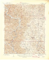
 1957 Poplar Bluff1968 Print · USGSThe Missouri-Arkansas border region is captured here as the timber and rail industries shaped the Ozark foothills. Genealogists and historians can trace the Missouri Pacific Railroad through river towns like Pocahontas, Greenville, and Van Buren.3 unique versions available
 - 1959 Map of Poplar Bluff
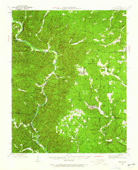
 1959 Poplar Bluff1959 Print · USGSThe Missouri Ozarks and Arkansas borderlands meet in this late 1950s study of the region's diverse terrain and rail-fed towns. Researchers can trace the path of the Missouri Pacific Railroad through Poplar Bluff or locate smaller settlements like Birch Tree and Myrtle.
 - 1960 Map of Poplar Bluff
 1960 Poplar Bluff1960 Print · USGSSoutheast Missouri and Northeast Arkansas are captured here during the post-war era, showing the transition from the Ozark highlands to the Delta. Genealogists and historians can trace rail corridors like the St. Louis Southwestern RR and remote settlements such as Birch Tree and Warm Springs.
 - 1968 Map of Grandin SW, 1969 Print
 1968 Grandin SW1969 Print · USGSRipley and Carter counties are captured in the late sixties as the federal government solidified forest and river protections. Researchers can find family-named landmarks and rural outposts including Good Hope Ch, Hofstader Cem, and the Panther Lookout Tower.2 unique versions available
 - 1983 Map of Poplar Bluff
 1983 Poplar Bluff1983 Print · USGSSoutheast Missouri in the early 1980s reveals a landscape defined by the Ozark foothills and the complex drainage systems of the Bootheel. Researchers can trace the rail corridors of the Missouri Pacific RR through Poplar Bluff or locate rural sites like Wilhelmina Church and Lone Hill Lookout.
 - 1997 Map of Grandin SW, 2000 Print
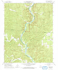
 1997 Grandin SW2000 Print · USGSThe Missouri Ozarks are captured here during the late 1990s as the river corridor transitioned into a federally protected scenic waterway. Genealogists can trace family roots at Ponder Cemetery or Good Hope Church along the Current River.
 - 2011 Map of Grandin SW, 2011 Print
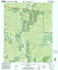
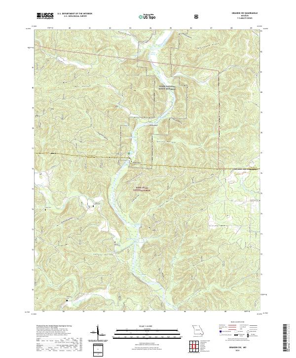
 2011 Grandin SW2011 Print · USGSCovers Tucker, including Carter County, Ripley County, and other nearby areas
 - 2015 Map of Grandin SW, 2015 Print
 2015 Grandin SW2015 Print · USGSCovers Tucker, including Carter County, Ripley County, and other nearby areas
 - 2017 Map of Grandin SW, 2017 Print
 2017 Grandin SW2017 Print · USGSCovers Tucker, including Carter County, Ripley County, and other nearby areas
 - 2021 Map of Grandin SW, 2021 Print
 2021 Grandin SW2021 Print · USGSRipley and Carter Counties come alive in this modern survey of the Ozark river country. Researchers can trace family history at Hannas Graveyard or explore the river-carved terrain around Kelley Bluff and the Bay Nothing Recreation Area.
End of results
Showing maps 1-12 of 12
Top cities near Tucker
Frequently asked questions
- What are the different types of historical maps available for Tucker?
- What is the oldest map of Tucker?
- Where can I purchase historical maps of Tucker for my home or office?
- Where can I download high-res historical maps of Tucker?
- Are there historical topographic maps available for Tucker?
- Is there historical aerial imagery available for Tucker?
- Where are historical maps of Tucker sourced from?